Groton in New London County, Connecticut — The American Northeast (New England)
The Battle of Groton Heights
Stabilization and Preservation of Fort Griswold
— Phase 1 —
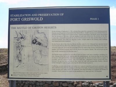
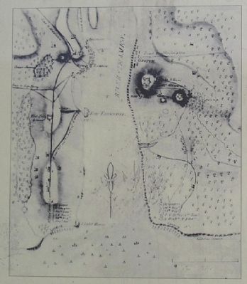
On the morning of September 6, 1781, a British fleet under the command of former American general Benedict Arnold appeared at the mouth of the Thames River. Arnold’s mission was to destroy American privateers in New London and to capture military supplies stored there. The British troops were divided into two divisions of 800 men, with one landing on each side of the river. The division on the New London side, commanded personally by Arnold, marched upriver to the town, quickly taking in succession Fort Trumbull, Town Hill Fort, and New London. Despite orders to the contrary, many buildings were burned and homes plundered.
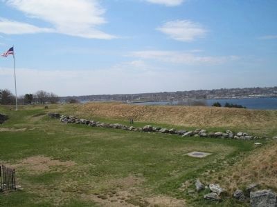
On the Groton side of the river, the British division under Lt. Col. Edmund Eyre marched toward Fort Griswold. Shortly after noon, with their troops in position to the north of the fort, Lt. Col. Eyre’s emissaries repeatedly demanded the surrender of the fort under a flag of truce. Fort Griswold’s commander, Col. William Ledyard, faced with the threat of no quarter, replied, “We will not give up the fort, let the consequences be what they may.”
The British troops assaulted but were driven back two times with heavy casualties, including Col. Eyre. During a brief lull in the fighting after the second assault, the American flag was shot from its halyard. Although instantly remounted on a pike pole, the British took this event as a signal of surrender, and they advanced again, only to be fired upon. Infuriated at being resisted after they believed the garrison had surrendered, they scaled the wall with renewed fury. Finally, a British soldier managed to open the gate, allowing the British troops to pour in.
Conflicting accounts indicate that even while Col. Ledyard ordered the garrison to surrender, some men continued firing from the barracks. In the heat of the battle, the British troops rampaged. When finally brought back under control, 88 Americans were dead including Col. Ledyard and another 35 wounded. Arnold reported his losses for the expedition at 51 dead and over 130 wounded.
Topics. This historical marker is listed in these topic lists: Notable Events • War, US Revolutionary. A significant historical date for this entry is September 6, 1947.
Location. 41° 21.267′ N, 72° 4.799′ W. Marker is in Groton, Connecticut, in New London County. Marker is on Monument Street, on the left when traveling west. Touch for map. Marker is in this post office area: Groton CT 06340, United States of America. Touch for directions.
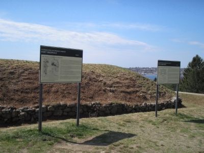
Other nearby markers. At least 8 other markers are within walking distance of this marker. The Construction of Fort Griswold (here, next to this marker); Defenders of Fort Griswold • Sept • 6th 1781 • (within shouting distance of this marker); Col. William Ledyard (within shouting distance of this marker);
Spanish Flagship Gun (within shouting distance of this marker); Groton Battle Monument (within shouting distance of this marker); Death of Major William Montgomery (within shouting distance of this marker); Covered Way (about 300 feet away, measured in a direct line); Civil War Memorial (about 400 feet away). Touch for a list and map of all markers in Groton.
More about this marker. The left side of the map contains a “Map of the British attack on New London and Fort Griswold by Captain Daniel Lyman of the Prince of Wales American Volunteers. (William L. Clements Library, University of Michigan)”
Also see . . . Battle of Groton Heights. Friends of Fort Griswold website. (Submitted on May 16, 2009, by Bill Coughlin of Woodland Park, New Jersey.)
Credits. This page was last revised on February 10, 2023. It was originally submitted on May 16, 2009, by Bill Coughlin of Woodland Park, New Jersey. This page has been viewed 2,237 times since then and 30 times this year. Photos: 1, 2, 3, 4, 5, 6. submitted on May 16, 2009, by Bill Coughlin of Woodland Park, New Jersey.
