South of Broad in Charleston in Charleston County, South Carolina — The American South (South Atlantic)
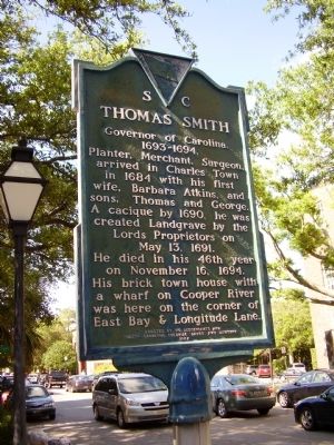
Thomas Smith
Governor of Carolina
— 1693 - 1694 —
Planter, Merchant, Surgeon, arrived in Charles Town in 1684 with his first wife, Barbara Atkins, and sons, Thomas and George. A cacique by 1690, he was created Landgrave by the Lords Proprietors on May 13, 1691. He died in his 46th year on November 16, 1694. His brick town house with a wharf on Cooper River was here on the corner of East Bay & Longitude Lane.
Erected 1967 by His Descendants and South Carolina Colonial Dames XVII Century. (Marker Number 10-3.)
Topics and series. This historical marker is listed in these topic lists: Colonial Era • Government & Politics • Settlements & Settlers. In addition, it is included in the The Colonial Dames XVII Century, National Society series list. A significant historical month for this entry is May 1935.
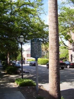
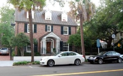
Location. 32° 46.477′ N, 79° 55.637′ W. Marker is in Charleston, South Carolina, in Charleston County. It is in South of Broad. Marker is at the intersection of East Bay Street and Longitude Lane, on the left when traveling north on East Bay Street. Touch for map. Marker is at or near this postal address: 63 East Bay Street, Charleston SC 29401, United States of America. Touch for directions.
Other nearby markers. At least 10 other markers are within walking distance of this marker. The John Fabre Jr. House (within shouting distance of this marker); 8-10 Tradd Street (within shouting distance of this marker); 90 East Bay Street Ancrum Wharf Building (within shouting distance of this marker); Casper Christian Schutt House (about 300 feet away, measured in a direct line); 23 Tradd Street (about 400 feet away); In Search of the Walled City (about 400 feet away); Section of parapet, or upper portion of the wall (about 400 feet away); The Walled City of Charles Town (about 400 feet away); Col. Othneil Beale's House (about 400 feet away); 26 Tradd Street (about 400 feet away). Touch for a list and map of all markers in Charleston.
Also see . . .
1. Thomas Smith. Thomas Smith (1648–1694) was the governor of colonial South Carolina from 1693 to 1694, a planter, a merchant and a surgeon. (Submitted on September 27, 2011, by Brian Scott of Anderson, South Carolina.)
2. Cacique. Cacique (female form: Cacica) is a title derived from the Taíno word for the pre-Columbian chiefs or leaders of tribes in the Bahamas, Greater Antilles, and the northern Lesser Antilles. (Submitted on September 27, 2011, by Brian Scott of Anderson, South Carolina.)
3. Cassiques. Cassiques (junior) and Landgraves (senior) were intended to be a fresh new system of titles of specifically American lesser nobility, created for hereditary representatives in a proposed upper house of a bicameral Carolina assembly. (Submitted on September 27, 2011, by Brian Scott of Anderson, South Carolina.)
4. Lords Proprietor > Carolina. There were eight Lords Proprietor of the Province of Carolina (by 1729, when seven of their descendants, all but the heir of Carteret, sold their shares to the Crown, it was split into two provinces: North and South Carolina). (Submitted on September 27, 2011, by Brian Scott of Anderson, South Carolina.)
Credits. This page was last revised on March 18, 2024. It was originally submitted on May 17, 2009, by Stanley and Terrie Howard of Greer, South Carolina. This page has been viewed 3,312 times since then and 61 times this year. Photos: 1, 2. submitted on May 17, 2009, by Stanley and Terrie Howard of Greer, South Carolina. 3. submitted on September 27, 2011, by Brian Scott of Anderson, South Carolina. 4. submitted on May 17, 2009, by Stanley and Terrie Howard of Greer, South Carolina. • Kevin W. was the editor who published this page.


