Sullivans Island in Charleston County, South Carolina — The American South (South Atlantic)
Battle of Fort Sullivan
[Side A]
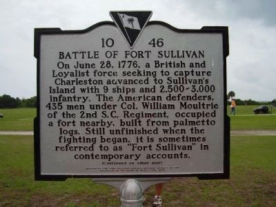
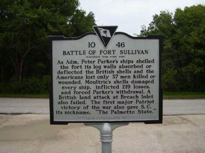
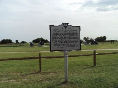
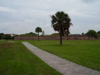
On June 28, 1776, a British and Loyalist force seeking to capture Charleston advanced to Sullivan's Island with 9 ships and 2,500-3,000 infantry. The American defenders, 435 men under Col. William Moultrie of the 2nd S.C. Regiment, occupied a fort nearby, built from plametto logs. Still unfinished when the fighting began, it is sometimes referred to as "Fort Sullivan" in contemporary accounts.
[Side B]
Erected 2005 by Fort Sullivan Chapter, National Society of the Daughters of the American Revolution. (Marker Number 10-46.)
Topics and series. This historical marker is listed in these topic lists: Forts and Castles • War, US Revolutionary. In addition, it is included in the Daughters of the American Revolution series list. A significant historical month for this entry is June 1868.
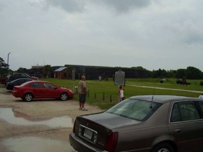
Location. 32° 45.55′ N, 79° 51.398′ W. Marker is on Sullivans Island, South Carolina, in Charleston County. Marker is on Poe Avenue near Palmetto Street, on the right when traveling east. Marker is located at Fort Moultrie. Touch for map. Marker is at or near this postal address: 1304 Poe Avenue, Sullivans Island SC 29482, United States of America. Touch for directions.
Other nearby markers. At least 8 other markers are within walking distance of this marker. CS H.L. Hunley (here, next to this marker); This is Sullivan's Island (a few steps from this marker); 10-Inch Columbiad, Rifled and Banded (within shouting distance of this marker); 10-Inch Columbiad (Rodman) (within shouting distance of this marker); 7-Inch Brooke Rifle, Triple Banded (within shouting distance of this marker); 8-inch Parrott (200 Pounder) (within shouting distance of this marker); 10-Inch Confederate Columbiad (within shouting distance of this marker); 13-Inch Seacoast Mortar (within shouting distance of this marker). Touch for a list and map of all markers in Sullivans Island.
Also see . . .
1. The Battle of Fort Sullivan. Includes additional links for more detailed information on the battle, its background, and aftermath. (Submitted on May 20, 2009, by Syd Whittle of Mesa, Arizona.)
2. The Battle of Fort Sullivan. The square-shaped Fort Sullivan made up of only the completed seaward wall, with walls made from Palmetto logs 16 feed wide and filled with sand, which rose 10 feed above the wooden platforms for the artillery. A hastly erected plaisde of thick planks helped guard the powder magazine and unfinished northern walls. A assortment of 31 hard-to-get cannon rangeing from 9- and 12-pounders as well as a few English 18-pounders and French 26-pounders dotted the front and rear walls. (Submitted on May 20, 2009, by Syd Whittle of Mesa, Arizona.)
Credits. This page was last revised on June 16, 2016. It was originally submitted on May 18, 2009, by Stanley and Terrie Howard of Greer, South Carolina. This page has been viewed 1,620 times since then and 31 times this year. Photos: 1, 2. submitted on May 18, 2009, by Stanley and Terrie Howard of Greer, South Carolina. 3. submitted on August 6, 2013, by Bill Coughlin of Woodland Park, New Jersey. 4, 5. submitted on May 18, 2009, by Stanley and Terrie Howard of Greer, South Carolina. • Syd Whittle was the editor who published this page.
