South of Broad in Charleston in Charleston County, South Carolina — The American South (South Atlantic)
USS Hobson Tribute
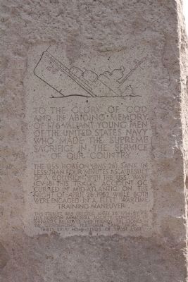
The USS Hobson (DMS 26) sank in less than four minutes as a result of a collision with the USS Wasp (CV-18) This tragic accident occured in mid Atlantic on the night of April 26 1952 while both were engaged in a fleet wartime training maneuver
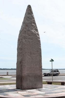
This Tribute was erected April 26 1954 by the USS Hobson Memorial Society composed of shipmates relatives and friends. The stones in the surrounding platform came from the thirty eight home states of those lost
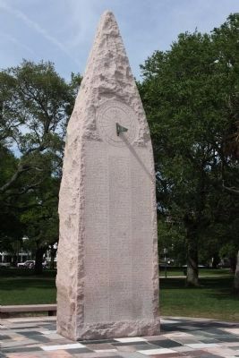
On the reverse of the Marker is a sundial with the date and time of the Hobson Sinking:
Ten Twenty Six PM
Below the sundial is inscribed the names, ages, and home towns of the 176 Hobson seamen who lost their lives in this tragedy.
Erected 1954 by USS Hobson Memorial Society.
Topics. This historical marker is listed in these topic lists: Disasters • Waterways & Vessels. A significant historical date for this entry is April 26, 1763.
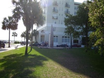
Location. 32° 46.178′ N, 79° 55.902′ W. Marker is in Charleston, South Carolina, in Charleston County . It is in South of Broad. Marker is at the intersection of King Street (State Highway 104) and Murray Boulevard, on the left when traveling south on King Street. In Battery Park - White Point Gardens. Touch for map. Marker is in this post office area: Charleston SC 29401, United States of America. Touch for directions.
Other nearby markers. At least 8 other markers are within walking distance of this marker. Still On Patrol (within shouting distance of this marker); Thirteen Inch Mortar (about 400 feet away, measured in a direct line); Thirteen - Inch Mortar (about 500 feet away); Civil War Torpedo Boatmen Memorial (about 500 feet away); The Colonel James English House (about 600 feet away); a different marker also named Thirteen - Inch Mortar (about 700 feet away); Stede Bonnet / Richard Worley (about 700 feet away); a different marker also named Thirteen - Inch Mortar (about 700 feet away). Touch for a list and map of all markers in Charleston.
Also see . . . USS Hobson (DD-464/DMS-26). ...she entered the Naval Shipyard and was converted to destroyer-minesweeper, and reclassified DMS-26 on 15 November 1944.
26 April 1952: The Hobson crossed the carrier's bow and was struck amidships. The force of the collision rolled the destroyer-minesweeper over, breaking her in two. (Submitted on May 20, 2009, by Mike Stroud of Bluffton, South Carolina.)
Photographed By Wikipedia
5. USS Hobson Tribute Marker
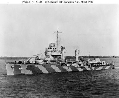
A cropped photograph of the USS Hobson off Charleston, South Carolina, 4 March 1942. She is painted in camouflage Measure 12 (Modified). This photograph has been censored to remove radar antennas atop her foremast and Mark 37 gun director.
Navy Military Photo # NH 53584
Click for more information.
Click for more information.
Credits. This page was last revised on February 16, 2023. It was originally submitted on May 18, 2009, by Mike Stroud of Bluffton, South Carolina. This page has been viewed 3,928 times since then and 136 times this year. Photos: 1, 2, 3. submitted on May 20, 2009, by Mike Stroud of Bluffton, South Carolina. 4. submitted on May 19, 2009, by Stanley and Terrie Howard of Greer, South Carolina. 5. submitted on May 20, 2009, by Mike Stroud of Bluffton, South Carolina. • Kevin W. was the editor who published this page.
