Beacon Hill in Boston in Suffolk County, Massachusetts — The American Northeast (New England)
The Common / The Freedom Trail / America's First Subway
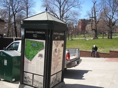
Boston Common Founded 1634
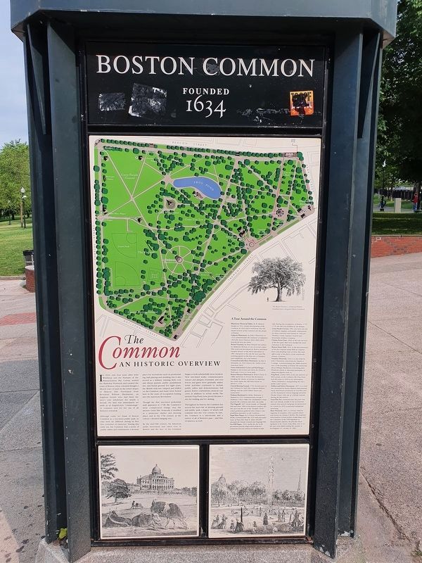
The Common
an Historic Overview
In 1634, only four years after John Winthrop and the Puritans of the Massachusetts Bay Colony settled the Shawmut Peninsula and created the town of Boston, these colonists bought a 48-acre tract of land on the lower slopes of Beacon Hill. Purchased from Reverend William Blackstone, an Anglican hermit who had been the area’s sole inhabitant for nearly a decade, the land was immediately set aside as an English-style “commonage,” or common area for the use of all Boston’s townfolk.
Although today we think of Boston Common as a tree-lined public park, its uses were far different during its first two centuries of existence . During this early era, the Common was a scene of public rallies and celebrations, a favorite place for recreations such as promenading, ball playing and sledding, but it also served as a military training field, cow and sheep pasture, public punishment site, and burial ground. For eight years, the British redcoats camped and drilled on the Common and many were buried here in the years of occupation leading into the American Revolution.
Though the first tree-lined pedestrian mall appeared in 1728, the Common’s most conspicuous foliage was the ancient Great Elm. Ironically it doubled as a protective shelter and meeting place, and in the 17th century as the colony’s dreaded hanging tree.
By the mid-19th century, the American parks movement had taken root in Boston and the face of the Common began to look substantially more modern. New tree-lined walks, commemorative statues and plaques, fountains, and iron fences and gates were gradually added, while activities continued to include public rallies and demonstrations, ball games, festive celebrations, musical concerts, in addition to sylvan strolls. The ancient Frog Pond, now paved, became a site for wading and ice skating.
Throughout its history, the Common has served the dual role of meeting ground and public park, a legacy of which will continue into the 21st century. In sum, the Common is a microcosm and a mirror of all of Boston’s past – and that of America as well.
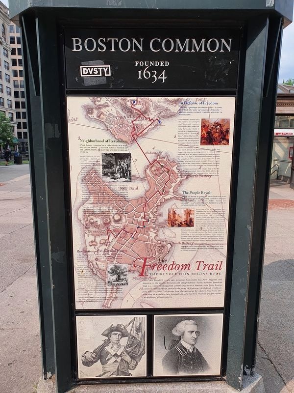
The Freedom Trail
Neighborhood of Revolution
“Paul Revere . . . started on a ride which, in a way has never ended.” - Esther Forbes, author of the classic study, Paul Revere and the World He Lived In
In the course of just two pivotal days – April 18 and 19, 1775 – the preceding years of unrest burst into insurrection. Paul and Rachel Revere, plus several of their sixteen children, lived in an old house in what is now Boston’s oldest neighborhood, the North End. Paul was a middle-class artisan, a trusted and active member of his community who belonged to the Masons, the Sons of Liberty and the North End Caucus. His neighbors included both patriots and loyalists to the British cause, like Gov. Thomas Hutchinson. On the night of April 18, Revere planned the hanging of two lanterns in the steeple of the Old North Church, as he and other express riders sped off to warn fellow patriots that British soldiers were on the march. By morning, colonial militia had assembled in Lexington and Concord, ready for the first military encounters of the Revolution.
When the British left “by sea” for Lexington and Concord, they were really crossing the Charles River. Camped on Boston Common, the redcoats slipped into their boats at the foot of the Common – where the landfill based Charles Street runs today – then rowed across the river to continue their march.
Revolution of Minds and Hearts
“ . . . In every human breast, God has implanted a principle, which we call love of Freedom . . . ” – Phillis Wheatley, African American slave-poet, member of Old South Congregation
For more than a century before the first musket was fired in America’s War for Independence, Puritan-bred Bostonians embraced a strong heritage of community and a culture of freedom that was remarkable among colonial settlements. Boston Common and its surrounding sites illustrate this unusual past, and include places where townfolk attended America’s first public school, governed their own church congregations, assembled and drilled local militia for self protection and stood toe-to-toe to protect their Puritan church land from Anglican intrusion. “The Revolution effected before the war commenced,” observed John Adams. “The Revolution was in the minds and the hearts of the people . . . ”
Boston Common itself was a site for a wide array of colonial activities that ranged from grazing cows and hanging enemies to marching armies and staging public protests.
In Defense of Freedom
“The day – perhaps the decisive day – is come, on which the fate of America depends.” – Abigail Adams, patriot, feminist, and wife of John Adams
Less than two months after the Battles of Lexington and Concord, patriots encountered what turned out to be the bloodiest battle of their War for Independence. Entrenched in a redoubt on Breed’s Hill in Charlestown, a mound mistakenly dubbed Bunker’s Hill, the ill-equipped colonists valiantly repelled two assaults by the redcoats before succumbing to the third attack. Though the British army won the battle, their losses were immense, inspiring patriots to continue armed resistance. By 1783, America had won her independence, but still had to fight to defend her hard-earned freedoms. The invincible U.S.S. Constitution, popularly known as “Old Ironsides,” was one of the newly-formed U.S. Navy frigates built to defend the young country – against pirates, the British or any others who would challenge our land and liberties.
Boston Common continued to be a major stage as the War for Independence evolved. Many of the British killed at the Battle of Bunker Hill, for example, were buried in the Common burying ground, located at its Boylston Street border.
The People Revolt
“What we meant in going for those Redcoats was this, we always had governed ourselves and we always meant to. They didn’t mean we should!” - Capt. Levi Preston, Patriot leader, in Reminiscences of the War
In the year 1750, few Bostonians even considered the idea of breaking away from their British mother country. Between the years 1761 and 1775, however, differing views of the rights of the colonies under British rule led to a series of actions, reactions and tumultuous encounters between Britain and her Boston colonists that snowballed toward war. Certain British laws and acts – like the Sugar, Stamp and Townshend Acts, the military occupation of Boston, and the Boston Massacre – increasingly incensed the liberty-loving colonists. Assembling in town meetings and swayed by the oratory of emerging leaders like James Otis, Sam Adams and Joseph Warren, Boston men and women began to take collective action, countering with boycotts, protests, and the famous Tea Party.
Curiously, Boston Common was a center for both side of the impending conflict, patriots assembled and protested here, while British regulars camped and drilled here during the pre-war years of military occupation.
The Revolution Begins Here
Over two hundred years ago, colonial Bostonians led New England and America on the road to freedom and independence. Today, Boston’s Freedom Trail is a 3-mile walking path connecting sixteen historic sites from Boston Common to Bunker Hill, that tells the story of Boston’s colorful and rebellious past. The Freedom Trail shows how the American Revolution was born, and how our nation was created and defended by ordinary people under extraordinary circumstances.
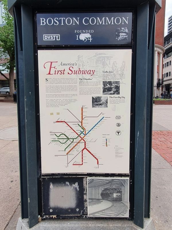
America's First Subway
September 1, 1897 was a day to remember in Boston history. In the hours of that morning crowds of curious onlookers assembled at the Park and Boylston Street stations. At 6:02 a.m., the object of their curiosity finally arrived: an open-bench four-wheel trolley car, overflowing with 175 passengers, completed the first official run of Boston's new subway.
Over 100,000 revelers mad the historic ride that day. Beginning in Allston, through Cambridge and finally descending into the subway tunnel at Boston's Public Garden. The actual "subway" passage, from the Public
Garden to the platforms at Boylston and Park, was only six-tenths of a mile. Despite its short length, it was worth all the pomp and circumstance because the first subway system in America had just been born.
After this historic opening day, the system grew rapidly, from that original half-mile strip, the Hub's public transit network has grown to a sprawling web serving seventy-nine cities and towns in the Greater Boston area.
Boston's various mass transit lines -- both above and below ground -- were consolidated under the Boston Elevated Railway Company (the "El") in 1922, which in turn was replaced by the Metropolitan Transit Authority (M.T.A.) in 1947. In 1964 M.T.A. was replaced by the Massachusetts Bay Transportation Authority (M.B.T.A.) which expanded the "T's" services and operates the entire system today.
The "Omnibus"
In the 18th-century public transportation had made its debut in Boston with the first old-fashioned stage coaches, transporting people from town to town. Local commuters were still largely traveling by foot or horse, at least until 1892, when Ephraim Dodge introduced the horse-drawn "omnibus."
In 1856, metal rails were laid on Boston's city streets in preparation for the arrival of horse drawn rail cars. This new mode of transportation was smoother, and faster than the old omnibuses. Two years later Brookline entrepreneur Henry M. Whitney began consolidating Boston's various horsecar lines under one company, and by 1889, Whitney introduced electrified trolley cars, which eventually eliminated horse power from Boston's public transit system.
Traffic Jams
Despite improvements in public transportation, downtown Boston had become a traffic nightmare by the end of the nineteenth century. One observer noted that at rush hour a person could walk down Tremont Street on the roofs of streetcars without ever touching the ground. This and other problems helped Boston decide to construct America's first subway.
The First Big Dig
Since 1964, the original stations and head-houses designed by city architect Edmund Wheelwright, have been honored as National Historic Landmarks and National Historic Civil Engineering Landmarks.
Topics. This historical marker is listed in these topic lists: Colonial Era • Notable Places • War, US Revolutionary. A significant historical year for this entry is 1634.
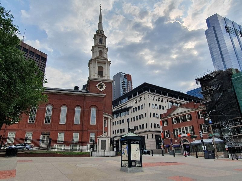
Location. 42° 21.392′ N, 71° 3.745′ W. Marker is in Boston, Massachusetts, in Suffolk County. It is in Beacon Hill. Marker is at the intersection of Tremont Street and Park Street, on the left when traveling north on Tremont Street. Touch for map. Marker is in this post office area: Boston MA 02108, United States of America. Touch for directions.
Other nearby markers. At least 8 other markers are within walking distance of this
marker. Power System of Boston’s Rapid Transit, 1889 (a few steps from this marker); Tremont Street Subway (a few steps from this marker); Boston Common (a few steps from this marker); Park Street Subway (a few steps from this marker); Park Street Church (within shouting distance of this marker); Park Street Congregational Church (within shouting distance of this marker); First Commercial Dental Laboratory in America (within shouting distance of this marker); Manufactory House Site (within shouting distance of this marker). Touch for a list and map of all markers in Boston.
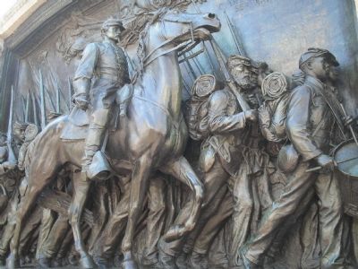
More about this marker. The top of The Common Marker contains a map of Boston Common with the location of various sites indicated. Next to this is a picture of Boston’s Great Elm Tree, with the caption “The Boston Common is a National Historic Landmark and a designated Boston Landmark.” Sites included in the marker’s “Tour Around the Common” include: Blackstone Memorial Tablet, Lafayette Monument, Brewer Fountain, Commodore John Barry Monument, Visitor Information Center and Park Ranger Station. Boston Massacre Memorial, Central Burying Ground, Parkman Bandstand, The Flagstaff, Papal Mass Plaque, Fox Hill Plaque, Carty Parade Ground, Beacon Street Mall, Founders Memorial, Frog Pond, Soldiers and Sailors Monument, Great Elm Site and the Shaw Memorial.
Also see . . . Boston Common. City of Boston.gov website (Submitted on May 18, 2009, by Bill Coughlin of Woodland Park, New Jersey.)
Credits. This page was last revised on January 30, 2023. It was originally submitted on May 18, 2009, by Bill Coughlin of Woodland Park, New Jersey. This page has been viewed 3,489 times since then and 47 times this year. Last updated on February 10, 2022, by Carl Gordon Moore Jr. of North East, Maryland. Photos: 1, 2, 3, 4. submitted on September 10, 2021, by J. Makali Bruton of Accra, Ghana. 5. submitted on May 18, 2009, by Bill Coughlin of Woodland Park, New Jersey. 6. submitted on September 10, 2021, by J. Makali Bruton of Accra, Ghana. 7, 8, 9. submitted on May 18, 2009, by Bill Coughlin of Woodland Park, New Jersey. • J. Makali Bruton was the editor who published this page.
