Three Bridges in Hunterdon County, New Jersey — The American Northeast (Mid-Atlantic)
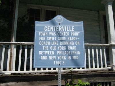
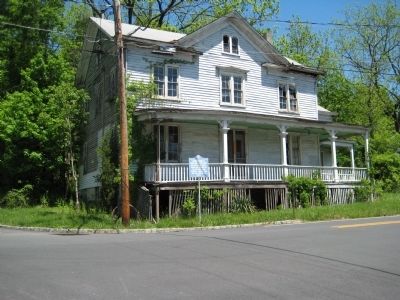
Centerville
Erected by Hunterdon County Cultural and Heritage Commission.
Topics and series. This historical marker is listed in these topic lists: Colonial Era • Roads & Vehicles. In addition, it is included in the New Jersey, Hunterdon County Cultural and Heritage Commission series list.
Location. 40° 32.313′ N, 74° 45.254′ W. Marker is in Three Bridges, New Jersey, in Hunterdon County. Marker is at the intersection of Old York Road and Pleasant Run Road, on the right when traveling north on Old York Road. Touch for map. Marker is in this post office area: Three Bridges NJ 08887, United States of America. Touch for directions.
Other nearby markers. At least 8 other markers are within 3 miles of this marker, measured as the crow flies. Bodine - Carkhuff House (approx. 0.7 miles away); Adrian Lane's Grist Mill (approx. 2.2 miles away); Readington Church (approx. 2.3 miles away); Cherry Hill Black Cemetery (approx. 2.3 miles away); Van Fleet's Corner School (approx. 2.4 miles away); Opie/River Road Bridge (approx. 2.7 miles away); The Province Line (approx. 2.8 miles away); South Branch Of The Central R.R. (approx. 2.8 miles away). Touch for a list and map of all markers in Three Bridges.
Additional commentary.
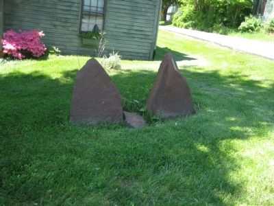
1. Stones across from historical marker
The stones are not previous markers of the route but were put there by the owner of the house as his attempt to stop cars from hitting his house. It has been hit three times in the last 15 years.
— Submitted December 4, 2017, by William Van Natta of Branchburg, New Jersey.
Credits. This page was last revised on February 23, 2018. It was originally submitted on May 19, 2009, by Alan Edelson of Union Twsp., New Jersey. This page has been viewed 1,448 times since then and 35 times this year. Photos: 1, 2, 3. submitted on May 19, 2009, by Alan Edelson of Union Twsp., New Jersey. • Kevin W. was the editor who published this page.


