Orwell in Addison County, Vermont — The American Northeast (New England)
Third Brigade Encampment – 1776
Mount Independence State Historic Site
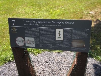
“ . . . our Men is clearing the Encamping Ground over the Lake.”
- Sgt. Timothy Tuttle, July 23, 1776
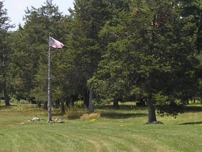
In July 1776 Northern Army commander Gen. Horatio Gates organized regiments at Mount Independence and Ticonderoga into four brigades. Each brigade averaged four regiments, with 1,000 men in a full strength regiment. Three brigades were on the Mount: the First where the star or picket fort would be built, the Second in the area of the future General Hospital, and the Third in this flat spot. Gates ordered the encampments be laid out according to plans in Englishman Humphrey Bland’s Treatise of Military Discipline (1762).
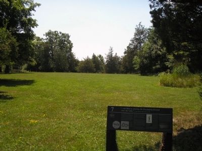
The Third Brigade, with soldiers from New England and New Jersey, ranged from 1,750 soldiers in August down to 1,050 in late October. The encampment probably covered 16 acres or less and was divided up by companies within regiments. Each regiment was arranged along a street, with a parade ground in the front and officer housing for the entire encampment to the rear.
After soldiers cleared the land they set up tents, sometimes raising them atop several rows of logs to increase the height. Soldiers in regiments that had lost their tents while retreating from the Canadian campaign built huts from brush, bark, logs, or sod. Lt. Benjamin Beal, 25th Continental Regiment from Massachusetts, wrote on July 13, 1776, “We went on to finish our huts, it rains. We covered them with bark but they leaked & We got wet.” The following day “we went to finish our house but it rained. We got our house so as it did not leak much.”
It was not always easy to follow Bland’s rules. Col. Elisha Porter of Massachusetts recorded:
July 20 – ordered all my Men over Ye River to Clearing
July 27 – In ye morning D[eputy] A[djutant] G[eneral] &c came & ordered me to remove me to remove ye Officer Houses &c & alter ye Front of my Encampment. This gave me much uneasiness to my Regt. & is what I shall be very unwilling to comply with.
July 29 – began to move some of our Log Houses we had built to alter ye Front of the Encampment.
July 30 – Regt busied in building & Clearing. Latrines were to be placed in front of the parade or at the camp rear, but in orders of July 15, 1776, “the General . . . recommends it in the strongest manner to the commanding officers of regiments to have their necessarys fix’d upon the brink of the precipices, or in such places as are least obnoxious..”
Soldiers used the springs or dug wells for water and cooked meals in designated areas to the rear of the camp. The army’s commissary issued daily rations. In camp men followed a strict regimen: drilling, mounting guard, gathering wood for fuel, maintaining a clean camp, and serving on fatigue or work parties building defenses. In free time, men improved their shelters, wrote home, read their mail and newspapers, visited fellow soldiers or the regimental sutler (peddler of provisions), mended clothes, or played cards and games.
Respect our history. Take only photographs.
Erected by Mount Independence State Historic Site.
Topics. This historical marker is listed in this topic list: War, US Revolutionary. A significant historical date for this entry is July 23, 1862.
Location. 43° 49.455′ N, 73° 22.802′ W. Marker is in Orwell, Vermont, in Addison County. Marker can be reached from Mount Independence Road, on the right when traveling south. Marker is along the walking trail in Mount Independence State Historic Site. Touch for map. Marker is in this post office area: Orwell VT 05760, United States of America. Touch for directions.
Other nearby markers. At least 8 other markers are within walking distance of this marker. Heritage Travelers over the Years (a few steps from this marker); Storehouse - 1776 (within shouting distance of this marker); General Hospital – 1777 (about 300 feet away, measured in a direct line); Foundation -1776 or 1777 (about 500 feet away); British Blockhouse - 1777 (about 500 feet away); To Repel the Enemy
(about 600 feet away); American Blockhouse – 1777 (about 600 feet away); The American Southern Defenses – 1776-1777 (about 600 feet away). Touch for a list and map of all markers in Orwell.
More about this marker. The bottom left of the marker contains a map of the Third Brigade encampment at Mount Independence. It has a caption of “Camps for the three brigades on Mount Independence were quite similar. Map ‘Ticonderoga & its Dependencies, August 1776.’ From The Autobiography, Reminiscences and Letters of Colonel John Trumbull, 1841.” The center of the marker features a picture of An American Soldier painted by Capt. Friedrich Konstantin von Germann, courtesy of Corner House Historical Publications. A photo of a soldier's chest appears at the bottom right of the marker. It has the caption, “Many officers had wooden campaign chests like this one owned by Col. Ebenezer Francis, who was stationed at Fort Ticonderoga, and died heroically at the Battle of Hubbardton on July 7, 1777. Collection of the Beverly, Massachusetts Historical Society.”
Related markers. Click here for a list of markers that are related to this marker. This series of markers are found on the walking
trails in Mount Independence State Historic Site.
Credits. This page was last revised on November 3, 2020. It was originally submitted on May 24, 2009, by Bill Coughlin of Woodland Park, New Jersey. This page has been viewed 1,386 times since then and 12 times this year. Photos: 1, 2, 3, 4, 5. submitted on May 24, 2009, by Bill Coughlin of Woodland Park, New Jersey.
