Fairport Harbor in Lake County, Ohio — The American Midwest (Great Lakes)
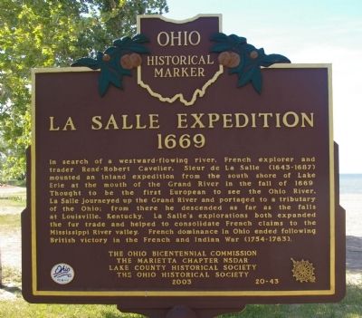
La Salle Expedition
1669
Erected 2003 by the Ohio Bicentennial Commission, The Marietta Chapter NSDAR, Lake County Historical Society, and The Ohio Historical Society. (Marker Number 20-43.)
Topics and series. This historical marker is listed in this topic list: Exploration. In addition, it is included in the Daughters of the American Revolution, and the Ohio Historical Society / The Ohio History Connection series lists. A significant historical year for this entry is 1669.
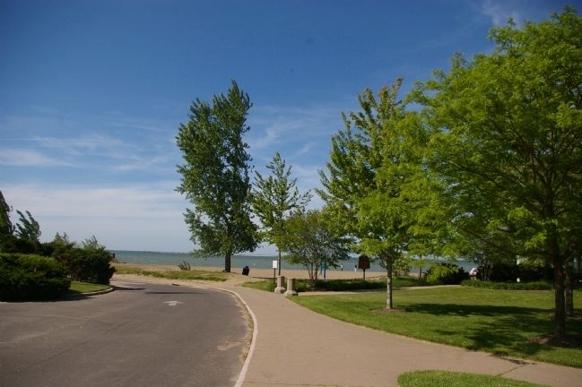
Location. 41° 45.51′ N, 81° 16.586′ W. Marker is in Fairport Harbor, Ohio, in Lake County. Marker is on Huntington Beach Drive. Touch for map. Marker is at or near this postal address: 301 Huntington Beach Drive, Painesville OH 44077, United States of America. Touch for directions.
Other nearby markers. At least 8 other markers are within 3 miles of this marker, measured as the crow flies. Fairport Harbor Lighthouse (about 600 feet away, measured in a direct line); Fairport is an Excellent Harbor (about 600 feet away); Lake Shore & Michigan Southern Station (approx. 2.4 miles away); Painesville United Methodist Church (approx. 2.8 miles away); Freedom Memorial (approx. 2.8 miles away); They Served (approx. 2.8 miles away); United States of America Congressional Medal of Honor Recipients (approx. 2.8 miles away); Painesville City Hall (approx. 2.9 miles away). Touch for a list and map of all markers in Fairport Harbor.
Credits. This page was last revised on June 16, 2016. It was originally submitted on May 25, 2009, by Christopher Busta-Peck of Shaker Heights, Ohio. This page has been viewed 1,889 times since then and 62 times this year. Photos: 1, 2. submitted on May 25, 2009, by Christopher Busta-Peck of Shaker Heights, Ohio.

