Hopewell, Virginia — The American South (Mid-Atlantic)
City Point
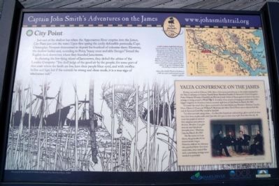
Captain John Smith’s Adventures on the James
— www.johnsmithtrail.org —
In choosing the low-lying island of Jamestown, they defied the advice of the London Company: “You shall judge of good air by the people; for some part of that coast where the lands are low, have their people blear eyed, and with swollen bellies and legs; but if the naturals be strong and clean made, it is a true sign of wholesome soil.”
Capt. John Smith’s Trail
John Smith knew the James River by its Algonquian name: Powhatan, the same as the region’s paramount chief. Smith traveled the river many times between 1607 and 1609, trading with Virginia Indians to ensure survival at Jamestown. What he saw of Virginia’s verdant woodlands and pristine waters inspired him to explore the greater Chesapeake Bay, chronicling its natural wonders.
(sidebar)
Yalta Conference on the James
During one week in February 1945, three of the most powerful men in the world convened for the Yalta Conference in Crimea. United States President Franklin D. Roosevelt, United Kingdom Prime Minister Winston Churchill, and Premier Joseph Stalin of Russia gathered to lay out a strategy to bring an end to World War II. A similar event, aimed at bringing an end to one of the biggest tragedies in American history, occurred right here at City Point on March 28, 1865.
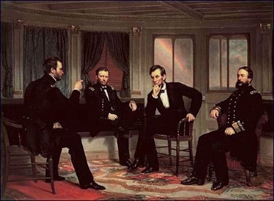
On board the vessel River Queen, anchored in the river before you, President Abraham Lincoln, Gens. Ulysses S, Grant and William T. Sherman, and Adm. David Porter met to discuss how the end of America's Civil War would be handled.
“Let them surrender and go home... Let them [the Confederate soldiers] all go, officers and all, let them have their horses to plow with, and, if you like, their guns to shoot crows with. Treat them liberally. We want these people to return to their allegiance and submit to the laws. Therefore, I say, give them the most liberal and honorable terms.” Abraham Lincoln, March 28, 1865.
On the waters in front of you, the groundwork for reconstruction began. However, without its visionary, who perished fewer than three weeks later, what seemed like such a promising strategy never reached its potential.
Erected by Captain John Smith’s Trail, James River Association, Virginia Department
of Conservation and Recreation, Chesapeake Bay Gateways Network. (Marker Number 16.)
Topics and series. This historical marker is listed in these topic lists: Exploration • Native Americans • Settlements & Settlers • War, US Civil. In addition, it is included in the Former U.S. Presidents: #16 Abraham Lincoln, the Former U.S. Presidents: #18 Ulysses S. Grant, and the Former U.S. Presidents: #32 Franklin D. Roosevelt series lists. A significant historical month for this entry is February 1945.
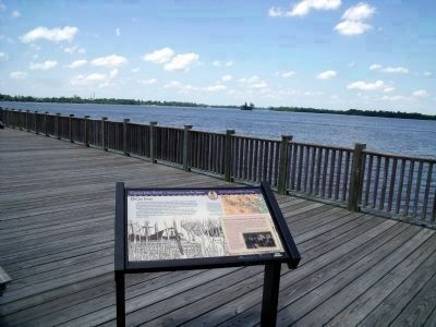
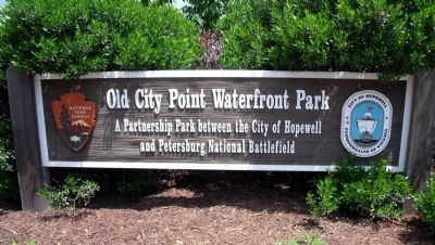
Location. 37° 18.977′ N, 77° 16.391′ W. Marker is in Hopewell, Virginia. Marker can be reached from Water Street near Pecan Avenue. This marker is located in the Old City Point Waterfront Park. Touch for map. Marker is in this post office area: Hopewell VA 23860, United States of America. Touch for directions.
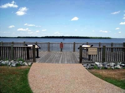
Other nearby markers. At least 8 other markers are within walking distance of this marker. Virginia Indians near City Point (here, next to this marker); a different marker also named City Point (within shouting distance of this marker); Clearing the Way (within shouting distance of this marker); Quartermaster Repair Shops (within shouting distance of this marker); A Busy Port (about 600 feet away, measured in a direct line); Taverns (about 600 feet away); Housing Several Thousand Federal Troops (about 600 feet away); Historic City Point (about 600 feet away). Touch for a list and map of all markers in Hopewell.
