Burson in Calaveras County, California — The American West (Pacific Coastal)
Camanche
[Upper Marker:]
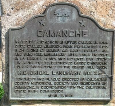
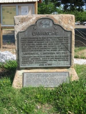
Named Camanche in 1849 after Camanche, Iowa. Once called Limerick. Peak population 1500. Rich mining at nearby Cat Camp, Poverty Bar, and Sand Hill. Mokelumne River water brought in by Lancha Plana and Poverty Bar ditch. Fire June 21, 1873, destroyed large Chinatown. Buhach manufactured on the nearby Hill Ranch.
Monument and plaque erected by Calaveras County Historical Society and Residents of Camanche, in cooperation with the California State Park Commission
April 8, 1956.
[Lower Marker:]
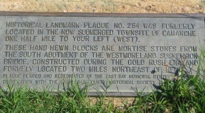
Historical landmark plaque no. 254 was formerly located at the now submerged townsite of Camanche one half mile to your left (West).
These hand hewn blocks are mortise stones from the south abutment of the Westmoreland suspension bridge, constructed during the Gold Rush era and formerly located two miles northeast of here.
Plaque placed and rededicated by the East Bay Municipal Utility District in cooperation with the Calavaeras County Historical Society May 5, 1968.
Erected 1956 by Calaveras County Historical Society, Residents of Camanche & State Park Commission. (Marker Number 254.)
Topics and series. This historical marker is listed in these topic lists: Natural Resources • Notable Places • Settlements & Settlers. In addition, it is included in the California Historical Landmarks series list. A significant historical month for this entry is April 1926.
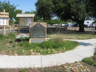
Location. 38° 12.421′ N, 120° 55.282′ W. Marker is in Burson, California, in Calaveras County. Marker can be reached from Camanche Parkway South. Marker is located at the Monument RV Campground on the South Shore of Camanche Lake. This is a fee use area, however staff will supply a 45 minute guess pass to view marker. Touch for map. Marker is in this post office area: Burson CA 95225, United States of America. Touch for directions.
Other nearby markers. At least 8 other markers are within 9 miles of this marker, measured as the crow flies. Lancha Plana (approx. 2.4 miles away); Campo Seco (approx. 3.9 miles away); Valley Spring (approx. 5.1 miles away); Buena Vista (approx. 6 miles away); Buena Vista Store (approx. 6 miles away); Double Springs (approx. 7.1 miles away); Jenny Lind (approx. 8.3 miles away); History of Clements Buckaroos (approx. 8.6 miles away).
Regarding Camanche. The town site was designated as California Registered Historical Landmark No. 254 on September 3, 1937.
Also see . . . Wikipedia Article on Camanche, California. (Submitted on June 7, 2009, by Syd Whittle of Mesa, Arizona.)
Additional keywords. Gold Rush
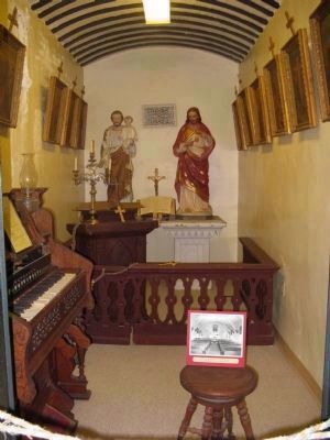
Photographed By Syd Whittle, August 23, 2010
5. Catholic Church of the Immaculate Conception - Built in 1887 - Camanche
On Display at the Calaveras County Historical Society Museum in San Andreas, California:
"Here is what has been saved from the Catholic Church at Camanche. The church was used until 1962. On Sunday, July 29th of that year the last Mass was given by Monsignor William Burke of Stockton, Ca. and Father Edward Donahue of St. Patrick's Church in Angels Camp, Ca. At the end of the Mass the candles were dimmed and the door was closed forever.
The wooden frame structure was 24 x 36 feet with six stained glass windows. It survived the elements for 75 years until the land was needed for the Camanche Reservoir. The church building was demolished in 1962. The town is now under water."
Credits. This page was last revised on January 20, 2020. It was originally submitted on June 7, 2009, by Syd Whittle of Mesa, Arizona. This page has been viewed 2,554 times since then and 46 times this year. Photos: 1, 2, 3, 4. submitted on June 7, 2009, by Syd Whittle of Mesa, Arizona. 5. submitted on August 23, 2010, by Syd Whittle of Mesa, Arizona.
