National Harbor in Fort Washington in Prince George's County, Maryland — The American Northeast (Mid-Atlantic)
Shifting Sands: The Story of Rosalie Island
Inscription.
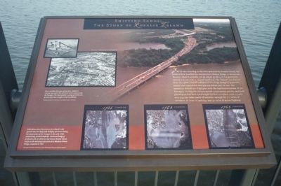
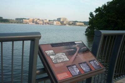
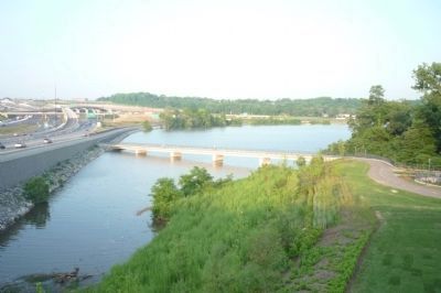
You’re now standing in the cove protected by Rosalie Island, the point of first landfall for the Woodrow Wilson Bridge in Maryland. Rosalie Island is actually not an island at all–it is a peninsula. Indeed it is not even a natural landform. The “island” was formed from the spoils (castoff sediments) of a huge dredging operation, which also created the cove you see before you. In 1941, the operation kicked into high gear with the rapid construction of the Pentagon. During the sixteen-month construction period, sand and gravel quarried here were barged upriver to a plant used to make over 435,000 cubic yards of concrete, enough for 17.5 miles of corridors, 67 acres of parking, and 30 miles of access highway.
Due to wartime shortages of materials, reinforced concrete was used in lieu of formed steel in constructing the Pentagon. This made possible a saving of 43,000 tons of steel, more than a enough to build a battleship.
[Two Photos Courtesy of Office of the Secretary of Defense.]
Early photos show the presence of an island in this general area, but large scale dredging operations during the construction of the Pentagon in the early 1940s substantially altered landforms. Continued dredging produced a pile of sediments that became Rosalie Island, visible on the Maryland side of the first Woodrow Wilson Bridge, completed in 1961.
[Three aerial photos of the Potomac River coastline in 1938, 1952, and 1963.] Historic photos courtesy of the Woodrow Wilson Bridge Project.
Erected 2009 by Woodrow Wilson Bridge Project.
Topics. This historical marker is listed in these topic lists: Bridges & Viaducts • Environment • War, World II • Waterways & Vessels. A significant historical year for this entry is 1941.
Location. 38° 47.527′ N, 77° 1.337′ W. Marker is in Fort Washington, Maryland, in Prince George's County. It is in the National Harbor. Marker is on the Woodrow Wilson Bridge Trail (U.S. I-95) 0.3 miles west of Harborview Avenue. The bicycle/pedestrian trail is accessible at the end of Harborview Avenue, north of National Harbor and west of Oxon Hill Road (MD-414). Touch for map. Marker is in this post office area: Oxon Hill MD 20745, United States of America. Touch for directions.
Other nearby markers. At least 8 other markers are within walking distance of this marker. Upper Marlboro (about 600 feet away, measured in a direct line); Andrews Air Force Base (about 600 feet away); Hyattsville (about 600 feet away); College Park (about 600 feet away); Piscataway (about 600 feet away); Clinton (about 600 feet away); Laurel (about 600 feet away); The Growth of the Black Middle Class (about 600 feet away). Touch for a list and map of all markers in Fort Washington.
Also see . . .
Woodrow Wilson Bridge. Wikipedia entry (Submitted on March 10, 2022, by Larry Gertner of New York, New York.)
Additional keywords. Smoot's Cove; National Harbor; Bald Eagle
Credits. This page was last revised on March 3, 2023. It was originally submitted on June 11, 2009, by Richard E. Miller of Oxon Hill, Maryland. This page has been viewed 2,397 times since then and 115 times this year. Photos: 1, 2, 3. submitted on June 11, 2009, by Richard E. Miller of Oxon Hill, Maryland. • Syd Whittle was the editor who published this page.


