Near Alberta in Brunswick County, Virginia — The American South (Mid-Atlantic)
Danieltown
A Side Raid: 32 Troopers Captured
— Wilson-Kautz Raid —
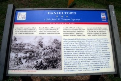
In June 1864, to deny Gen. Robert E. Lee the use of the South Side R.R. and the Richmond and Danville R.R., Gen. Ulysses S Grant sent Gen. James H. Wilson and Gen. August V. Kautz south of Petersburg on a cavalry raid to destroy track and rolling stock. Seven local men captured 32 of Wilson’s cavalrymen near here on the morning of June 23, when the detachment left the main column to destroy a bridge. Capt. George D. White, 3rd Virginia Cavalry, was at home in Boydton recuperating from a wound when he learned of the side raid. He recruited six neighbors and found the Federals taking breakfast at a local house.
“[Capt. George D. White] stationed his company of six mounted men... in such a manner as to present the appearance of a front rank of a cavalry force. Capt. White then made a circuit so as to avoid being seen by the enemy, and dashing boldly up to the party, defiantly ordered a surrender or he would cut them to pieces in a moment, at the same time pointing to the head of what seemed to be a squadron of cavalry. Overwhelmed with surprise and panic stricken [the Federal officer] asked for time to consult his men. Capt. White replied there was no time for parley. He would not grant a moment, but that they must stack arms in the road and march immediately up to the Dixie boys, or the Dixie boys would march to them. [The Federals] immediately stacked arms, [and] marched up to Capt. White's formidable body of cavalry. Upon finding that they had surrendered to six citizens, armed only with double barrel shot guns, their mortification was great, but it was too late to retrieve their misfortune”. -New York Times, July 7, 1864
Erected by Virginia Civil War Trails.
Topics and series. This historical marker is listed in this topic list: War, US Civil. In addition, it is included in the Virginia Civil War Trails series list. A significant historical month for this entry is June 1864.
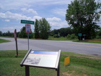
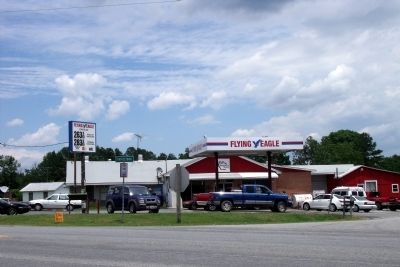
Location. 36° 54.284′ N, 77° 57.609′ W. Marker is near Alberta, Virginia, in Brunswick County. Marker is at the intersection of Christanna Highway (Virginia Route 46) and New Hope Road, on the right when traveling north on Christanna Highway. This marker is located in the parking lot of the Danieltown Market. Touch for map. Marker is in this post office area: Alberta VA 23821, United States of America. Touch for directions.
Other nearby markers. At least 8 other markers are within 7 miles of this marker, measured as the crow flies. Southside Virginia Community College (approx. 5.1 miles away); Fort Christanna (approx. 5.3 miles away); Old Brunswick Courthouse (approx. 5.3 miles away); Nellie Pratt Russell (approx. 5.3 miles away); Saint Paul’s Chapel School (approx. 5½ miles away); Brunswick County, Virginia (approx. 5.7 miles away); The Pickett Reservoir Lies Before You (approx. 5.7 miles away); St. John’s Protestant Episcopal Church (approx. 7 miles away). Touch for a list and map of all markers in Alberta.
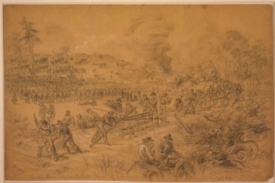
More about this marker. On the lower left is “Artist Alfred R. Waud's wartime drawing of Wilson's Raid.”
Also see . . . Wilson–Kautz Raid. Wikipedia entry (Submitted on April 23, 2022, by Larry Gertner of New York, New York.)
Credits. This page was last revised on April 23, 2022. It was originally submitted on June 22, 2009, by Bernard Fisher of Richmond, Virginia. This page has been viewed 1,390 times since then and 37 times this year. Photos: 1, 2, 3, 4. submitted on June 22, 2009, by Bernard Fisher of Richmond, Virginia.


