Near Dallas in Paulding County, Georgia — The American South (South Atlantic)
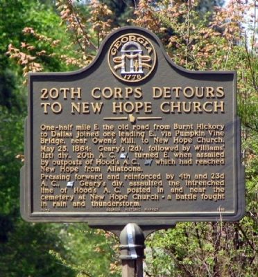
20th Corps Detours to New Hope Church
Pressing forward and reinforced by 4th and 23rd A.C., [US] Geary's div. assaulted the entrenched line of Hood's A.C. posted in and near the cemetery at New Hope Church - a battle fought in rain and thunderstorm.
Erected 1985 by Georgia Department of Natural Resources. (Marker Number 110-4.)
Topics and series. This historical marker is listed in this topic list: War, US Civil. In addition, it is included in the Georgia Historical Society series list. A significant historical date for this entry is May 25, 1900.
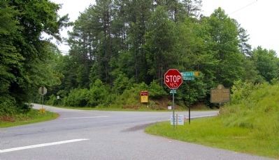
Location. 33° 58.451′ N, 84° 51.69′ W. Marker is near Dallas, Georgia, in Paulding County. Marker is at the intersection of Cartersville Highway (Georgia Route 61) and High Shoals Road / Shady Grove Church Road, on the right when traveling north on Cartersville Highway. Touch for map. Marker is in this post office area: Dallas GA 30132, United States of America. Touch for directions.
Other nearby markers. At least 8 other markers are within 5 miles of this marker, measured as the crow flies. Davis' Div. at Dallas (approx. 3.3 miles away); Old Burnt Hickory P.O. (approx. 3.4 miles away); A. Lafayette Bartlett (approx. 3.7 miles away); The Orphan Brigade (approx. 3.7 miles away); Paulding County (approx. 3.7 miles away); Dallas - New Hope Line (approx. 3.7 miles away); Dallas (approx. 3.9 miles away); Army of the Tenn. At Dallas (approx. 4.2 miles away). Touch for a list and map of all markers in Dallas.
Credits. This page was last revised on June 16, 2016. It was originally submitted on November 10, 2008, by David Seibert of Sandy Springs, Georgia. This page has been viewed 4,181 times since then and 28 times this year. Last updated on June 24, 2009, by David Seibert of Sandy Springs, Georgia. Photos: 1. submitted on November 10, 2008, by David Seibert of Sandy Springs, Georgia. 2. submitted on June 24, 2009, by David Seibert of Sandy Springs, Georgia. • Craig Swain was the editor who published this page.

