Boonsboro in Washington County, Maryland — The American Northeast (Mid-Atlantic)
The Maryland Campaign of 1862
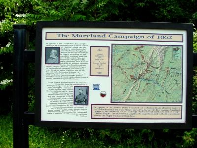
On September 4, 1862, General Robert E. Lee, hoping to shorten the war by winning a decisive victory on Northern soil, crossed the Potomac River into Maryland. Lee planned to draw the Army of the Potomac through South Mountain into Pennsylvania and fight on ground of his choosing. His plan depended on securing his supply line down the Shenandoah Valley past Harpers Ferry—then garrisoned by nearly 13,000 Federal troops. When the Federals did not withdraw, Lee decided to attack them. From his camp near Frederick, Maryland, he divided his army into five parts. Lee gambled he could take Harpers Ferry and regroup before the Federals realized what he had done. He sent three units under the command of General T. J. "Stonewall" Jackson from Frederick to Harpers Ferry. A fourth marched into Hagerstown to guard against a rumored movement of Union troops from Pennsylvania. A fifth unit formed the rear guard at Boonesboro.
General George B. McClellan organized the Army of the Potomac into three wings and marched out of Washington along a twenty-five mile front. Learning that Lee's army was divided and marching in opposite directions well to the west, McClellan began his pursuit into western Maryland on September 11. Moving faster than Lee expected, he entered Catoctin Valley on the 13th and reached the foot of South Mountain on the 14th. The Battle of South Mountain smashed Lee's plan to invade Pennsylvania but did buy him time to concentrate his scattered army. Lee assembled his army at Sharpsburg and set up a defensive position behind Antietam Creek on the 15th. The Harpers Ferry garrison surrendered that morning. This event allowed Jackson to rejoin Lee. The Battle of Antietam was fought two days later.
In response to Lee’s orders, Jackson marched via Williamsport and closed on Harper's Ferry from the north and west. McLaws moved via Brownsville Pass to occupy Maryland Heights, at the Southern end of Elk Ridge. Walker moved south and west to occupy Loudoun Heights. Lee moved with Longstreet to Hagerstown and D. H. Hill was ordered to cover the supply trains near Boonsboro.
Donated to the people of the United States by John and Candace Richards of Pennsylvania.
Topics. This historical marker is listed in this topic list: War, US Civil. A significant historical month for this entry is September 1841.
Location. 39° 28.229′ N, 77° 37.043′ W. Marker is in Boonsboro, Maryland, in Washington County. Marker is at the intersection of Reno Monument Road and the Appalachian Trail, on the left when traveling west on Reno Monument Road. Touch for map. Marker is at or near this postal address: 21605 Reno Monument Rd, Boonsboro MD 21713, United States of America. Touch for directions.
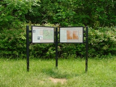
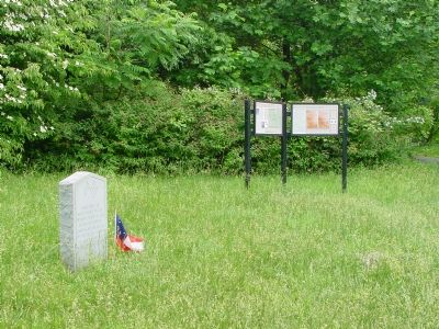
Other nearby markers. At least 8 other markers are within walking distance of this marker. The Lost Orders (here, next to this marker); Deaths of Two Generals (here, next to this marker); The Battle for Fox’s Gap (here, next to this marker); Welcome to Historic Wise's Field (a few steps from this marker); Near Here in Wise’s Field (a few steps from this marker); The "Wiregrass" Georgians (a few steps from this marker); 13th N.C. Regiment of Gen. Garland's Brigade (a few steps from this marker); Maj. Gen. Jesse L. Reno (within shouting distance of this marker). Touch for a list and map of all markers in Boonsboro.
Related markers. Click here for a list of markers that are related to this marker. To better understand the relationship, study each marker in the order shown.
Also see . . . Maryland Campaign. Wikipedia entry (Submitted on March 26, 2022, by Larry Gertner of New York, New York.)
Credits. This page was last revised on March 26, 2022. It was originally submitted on July 23, 2006, by J. J. Prats of Powell, Ohio. This page has been viewed 2,250 times since then and 28 times this year. Last updated on August 11, 2007, by Craig Swain of Leesburg, Virginia. Photos: 1, 2, 3. submitted on July 23, 2006, by J. J. Prats of Powell, Ohio.


