Harpers Ferry in Jefferson County, West Virginia — The American South (Appalachia)
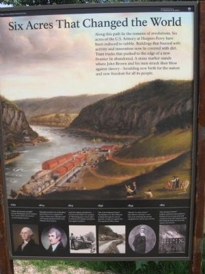
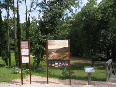
Six Acres That Changed the World
Harpers Ferry National Historical Park
— National Park Service, U.S. Department of the Interior —
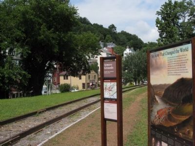
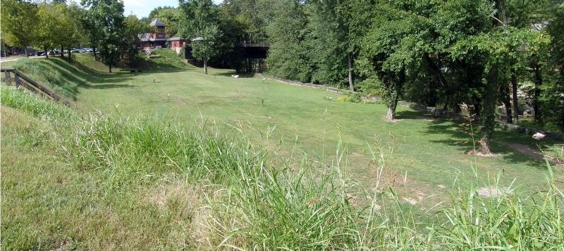
Along this path lie the remains of revolutions. Six acres of the U.S. Armory at Harpers Ferry have been reduced to rubble. Buildings that buzzed with activity and innovation now lie covered with dirt. Train tracks that pushed to the edge of a new frontier lie abandoned. A stone marker stands where John Brown and his men struck their blow against slavery heralding new birth for the nation and new freedom for all its people.
[Timeline:]
1795
"A place of immense strength"
George Washington chose Harpers Ferry as the site for the nation's second national armory.
1803
"Manufactured for me at this place"
Meriwether Lewis supplied his Corps of Discovery with guns and other goods produced here at the Harpers Ferry armory.
1819
"A greater degree of perfection...."
Inventor John Hall's new method of "fabricating arms exactly alike" revolutionized industry and pitted man against machine.
1836
"The Great National Project"
The Baltimore & Ohio Railroad rumbled through the armory grounds, racing west against the Chesapeake & Ohio Canal.
1859
"Slavery is a state of war"
John Brown's attempt to end slavery by attacking the armory catapulted the nation into civil war.
1861
"Our armory is burnt"
Virginia militiamen descended on Harpers Ferry to seize arms and equipment from the federal armory. Retreating Federals set fire to the armory and arsenal.
Erected by National Park Service, US Department of the Interior.
Topics. This historical marker is listed in these topic lists: Abolition & Underground RR • African Americans • Civil Rights • Colonial Era • Government & Politics • Settlements & Settlers • War, US Civil. A significant historical year for this entry is 1795.
Location. 39° 19.423′ N, 77° 43.801′ W. Marker is in Harpers Ferry, West Virginia, in Jefferson County. Marker is on Potomac Street, 0.1 miles north of Shenandoah Street, on the right when traveling north. Located at the old Armory Site in Harpers Ferry National Historic Site, to the left of the stairs leading down to the old armory site. Touch for map. Marker is in this post office area: Harpers Ferry WV 25425, United States of America. Touch for directions.
Other nearby markers. At least 8 other markers are within walking distance of this marker. Home of Joseph Perkins (a few steps from this marker); Armory Grounds (a few steps from this marker); Lewis and Clark (within shouting distance of this marker); Tailrace (within shouting distance of this marker); Short-lived Sanctuary (within shouting
distance of this marker); John Brown's Last Stand (within shouting distance of this marker); John Brown Monument (within shouting distance of this marker); A Perfect Heap of Ruins (within shouting distance of this marker). Touch for a list and map of all markers in Harpers Ferry.
Related markers. Click here for a list of markers that are related to this marker. Harpers Ferry Armory Trail Markers.
Credits. This page was last revised on April 26, 2020. It was originally submitted on July 3, 2009, by Henry T. McLin of Hanover, Pennsylvania. This page has been viewed 1,465 times since then and 29 times this year. Photos: 1, 2, 3. submitted on July 3, 2009, by Henry T. McLin of Hanover, Pennsylvania. 4. submitted on April 25, 2020, by Larry Gertner of New York, New York. • Craig Swain was the editor who published this page.


