Port Jervis in Orange County, New York — The American Northeast (Mid-Atlantic)
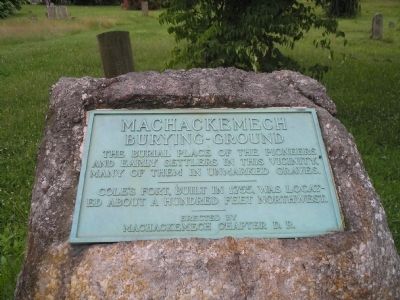
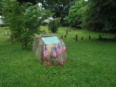
Machackemech Burying Ground
--------------------------
Cole’s Fort, built in 1755, was located about a hundred feet northwest.
----------
Erected by
Machackemech Chapter D. R.
Erected by Daughters of the Revolution, Machackemech Chapter.
Topics. This historical marker is listed in these topic lists: Cemeteries & Burial Sites • Colonial Era. A significant historical year for this entry is 1755.
Location. 41° 21.877′ N, 74° 41.039′ W. Marker is in Port Jervis, New York, in Orange County. Marker is at the intersection of E Main Street (U.S. 6) and Jersey Avenue, on the right when traveling west on E Main Street. Touch for map. Marker is in this post office area: Port Jervis NY 12771, United States of America. Touch for directions.
Other nearby markers. At least 8 other markers are within walking distance of this marker. Cole’s Fort (within shouting distance of this marker); Indian Raid (within shouting distance of this marker); Trolley Line (approx. ¼ mile away); Laurel Grove (approx. ¼ mile away); a different marker also named Indian Raid (approx. 0.4 miles away); The Revolutionary War (approx. 0.6 miles away in Pennsylvania); Old Mine Road (approx. 0.6 miles away); Gassmann Pavilion (approx. 0.6 miles away in Pennsylvania). Touch for a list and map of all markers in Port Jervis.
Credits. This page was last revised on June 16, 2016. It was originally submitted on July 5, 2009, by Bill Coughlin of Woodland Park, New Jersey. This page has been viewed 1,236 times since then and 32 times this year. Photos: 1, 2, 3. submitted on July 5, 2009, by Bill Coughlin of Woodland Park, New Jersey.


