Carson City, Nevada — The American Mountains (Southwest)
Eagle Valley
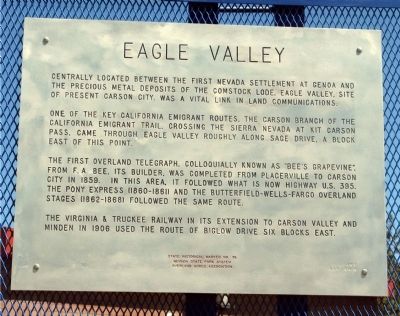
Centrally located between the first Nevada settlement at Genoa and the precious metal deposits of the Comstock Lode, Eagle Valley, site of present Carson City, was a vital link in land communications.
One of the key California emigrant routes, the Carson branch of the California Emigrant Trail, crossing the Sierra Nevada at Kit Carson Pass, came through Eagle Valley roughly along Sage Drive, a block east of this point.
The first overland telegraph, colloquially known as “Bee’s Grapevine”, from F. A. Bee, its builder, was completed from Placerville to Carson City in 1859. In this area, it followed what is now Highway US 395. The Pony Express (1860-1861) and the Butterfield-Wells Fargo Overland Stages (1862-1868) followed the same route.
The Virginia & Truckee Railway in its extension to Carson Valley and Minden in 1906 used the route of Bigelow Drive six blocks east.
Erected by Nevada State Park System and the Overland Acres Association. (Marker Number 76.)
Topics. This historical marker is listed in these topic lists: Communications • Railroads & Streetcars • Roads & Vehicles • Settlements & Settlers. A significant historical year for this entry is 1859.
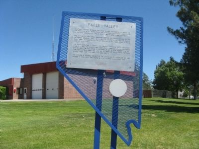
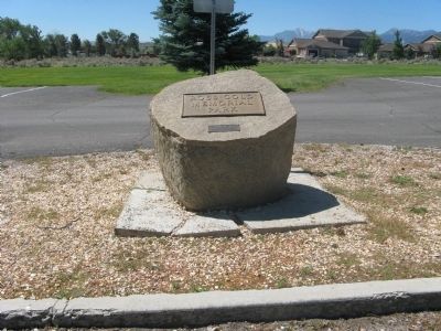
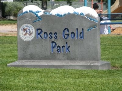
Location. 39° 7.499′ N, 119° 46.045′ W. Marker is in Carson City, Nevada. Marker is at the intersection of West Appion Way and Snyder Avenue, on the right when traveling west on West Appion Way. Marker is located near the fire station at the Ross Gold Memorial Park. Touch for map. Marker is at or near this postal address: 100 East Appion Way, Carson City NV 89701, United States of America. Touch for directions.
Other nearby markers. At least 8 other markers are within 3 miles of this marker, measured as the crow flies. Stewart Indian School (approx. 0.8 miles away); Dat-So-La-Lee (approx. 0.8 miles away); Logging Wagon (approx. 1.7 miles away); Gardner’s Ranch (approx. 1.9 miles away); Historic Flume and Lumberyard (approx. 1.9 miles away); Nevada State Children’s Home (approx. 2.4 miles away); Pioneer Cemetery (approx. 2.6 miles away); St. Charles Hotel (approx. 2.6 miles away). Touch for a list and map of all markers in Carson City.
Also see . . . New Amended Text for Marker. The Nevada State Historic Preservation Office (SHPO) recently updated the text of the roughly 260 state historical markers in Nevada. The Nevada SHPO placed the amended text of the markers on its website for each individual marker and will change the actual markers in the field as funding allows. Minor changes have been made to the marker for grammar, readability, and comment. The new marker text states Genoa is one of the first Nevada settlements to acknowledge the controversy of Nevada's first settlement (Genoa or Dayton). The link will take you to the Nevada SHPO page for the marker with the amended text. (Submitted on October 24, 2013, by Duane Hall of Abilene, Texas.)
Credits. This page was last revised on December 22, 2020. It was originally submitted on July 13, 2009, by Syd Whittle of Mesa, Arizona. This page has been viewed 1,257 times since then and 25 times this year. Photos: 1, 2, 3, 4. submitted on July 13, 2009, by Syd Whittle of Mesa, Arizona.


