Hagerstown in Washington County, Maryland — The American Northeast (Mid-Atlantic)
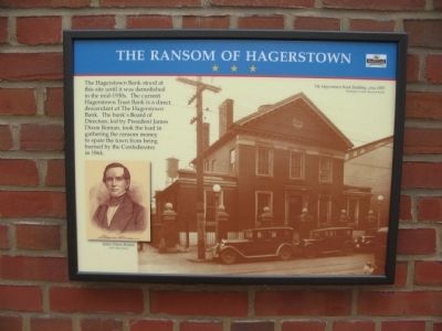
The Ransom of Hagerstown
Erected by Maryland Heritage Area.
Topics. This historical marker is listed in this topic list: War, US Civil. A significant historical year for this entry is 1864.
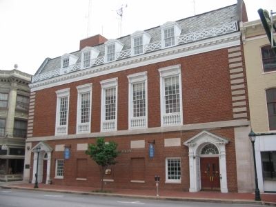
Location. 39° 38.546′ N, 77° 43.275′ W. Marker is in Hagerstown, Maryland, in Washington County. Marker is on West Washington Street, on the right when traveling east. Located on the Washington County Office Building. Touch for map. Marker is at or near this postal address: 35 West Washington Street, Hagerstown MD 21740, United States of America. Touch for directions.
Other nearby markers. At least 8 other markers are within walking distance of this marker. John Brown (within shouting distance of this marker); Hagerstonians in the Civil War (within shouting distance of this marker); A City Divided (within shouting distance of this marker); Hagerstown Commercial Core Historic District (within shouting distance of this marker); a different marker also named A City Divided (about 300 feet away, measured in a direct line); Hagerstown Ransomed (about 300 feet away); Treatment of the Wounded (about 400 feet away); Washington County Courthouse (about 400 feet away). Touch for a list and map of all markers in Hagerstown.
More about this marker. On the left is a portrait of James Dixon Rodman. On the right is a photo of the bank, circa 1935.
Also see . . . Crossroads of the Civil War. More information about the Civil War activities in Hagerstown and Washington County, Maryland. (Submitted on July 15, 2009, by Craig Swain of Leesburg, Virginia.)
Credits. This page was last revised on June 16, 2016. It was originally submitted on July 14, 2009, by Craig Swain of Leesburg, Virginia. This page has been viewed 1,143 times since then and 14 times this year. Photos: 1, 2. submitted on July 14, 2009, by Craig Swain of Leesburg, Virginia.

