Near Dallas in Paulding County, Georgia — The American South (South Atlantic)
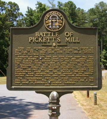
Battle of Pickett’s Mill
Elements of the 4th, 14th and 23rd Corps under Maj. Gen. Oliver O. Howard [US] with over 18,000 men passed this point seeking the extreme right of the Confederate army. The Federal forces attacked a point where the Army of Tennessee’s line bent back to the south. The brigades of Hazen, Gibson and Scribner blundered into a deep ravine one-half mile east of here to attack the Confederates under Maj. Gen. Patrick Cleburne. The brigades were defeated one after another in the heavily-wooded ravine where fired upon from three directions.
The Confederates were the clear victors of the five-hour battle. The result of the victory was a few days delay in Sherman’s [US] Atlanta Campaign.
Erected 1996 by Georgia Department of Natural Resources. (Marker Number 110-27.)
Topics and series. This historical marker is listed in this topic list: War, US Civil. In addition, it is included in the Georgia Historical Society series list. A significant historical month for this entry is May 1864.
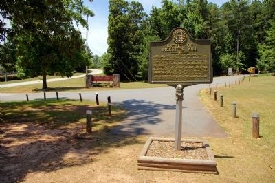
Location. 33° 58.308′ N, 84° 45.97′ W. Marker is near Dallas, Georgia, in Paulding County . Marker is at the intersection of Mount Tabor Church Road and Garrison Road, on the left when traveling south on Mount Tabor Church Road. The marker is just off the entrance road to Pickett's Mill Battlefield State Historic Site. Touch for map. Marker is at or near this postal address: 4432 Mt Tabor Church Road, Dallas GA 30157, United States of America. Touch for directions.
Other nearby markers. At least 8 other markers are within 2 miles of this marker, measured as the crow flies. Pickett's Mill Memorial (approx. 0.4 miles away); Brown's Mill (approx. 0.8 miles away); a different marker also named Battle of Pickett's Mill (approx. 1˝ miles away); The Federal Attack on Hood’s Corps (approx. 1.6 miles away); New Hope Church Cemetery (approx. 1.7 miles away); The Worst Aircraft Disaster in Georgia History (approx. 1.7 miles away); New Hope Battlefield (approx. 1.7 miles away); Polk’s March to Lost Mountain (approx. 1.7 miles away). Touch for a list and map of all markers in Dallas.
Regarding Battle of Pickett’s Mill. Pickett's Mill Battlefield State Historic Site contains one of the best-preserved battlefields of the Civil War, from a battle known by survivors as "the Hell hole."
Related markers. Click here for a list of markers that are related to this marker. Battle of Pickett's Mill
Credits. This page was last revised on October 21, 2020. It was originally submitted on July 14, 2009, by David Seibert of Sandy Springs, Georgia. This page has been viewed 3,287 times since then and 25 times this year. Photos: 1, 2. submitted on July 14, 2009, by David Seibert of Sandy Springs, Georgia. • Craig Swain was the editor who published this page.

