Dallas in Paulding County, Georgia — The American South (South Atlantic)
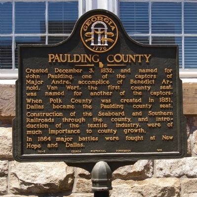
Paulding County
In 1864 major battles were fought at New Hope and Dallas.
Erected 1953 by Georgia Historical Commission. (Marker Number 110-5.)
Topics and series. This historical marker is listed in these topic lists: Industry & Commerce • Railroads & Streetcars • Settlements & Settlers • War, US Civil • War, US Revolutionary. In addition, it is included in the Georgia Historical Society series list. A significant historical date for this entry is December 3, 1875.
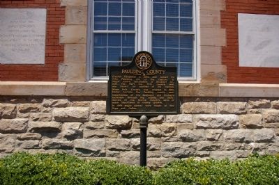
Location. 33° 55.434′ N, 84° 50.475′ W. Marker is in Dallas, Georgia, in Paulding County. Marker is on Main Street (Georgia Route 61) 0 miles south of West Memorial Drive (Georgia Route 381), on the right when traveling south. The marker is located behind the Paulding County Courthouse, facing the renovated "Historic Town Square.". Touch for map. Marker is in this post office area: Dallas GA 30132, United States of America. Touch for directions.
Other nearby markers. At least 8 other markers are within 2 miles of this marker, measured as the crow flies. A. Lafayette Bartlett (within shouting distance of this marker); Dallas (approx. 0.2 miles away); Davis' Div. at Dallas (approx. 0.4 miles away); Dallas - New Hope Line (approx. 0.4 miles away); The Orphan Brigade at Dallas (approx. ¾ mile away); Federal Line (approx. one mile away); The Orphan Brigade (approx. 1.2 miles away); Armstrong's Advance (approx. 1.4 miles away). Touch for a list and map of all markers in Dallas.
Credits. This page was last revised on February 1, 2020. It was originally submitted on July 22, 2009, by David Seibert of Sandy Springs, Georgia. This page has been viewed 1,379 times since then and 60 times this year. Last updated on July 23, 2009, by David Seibert of Sandy Springs, Georgia. Photos: 1, 2, 3, 4, 5. submitted on July 22, 2009, by David Seibert of Sandy Springs, Georgia. • Craig Swain was the editor who published this page.


