Near Fredericksburg in Spotsylvania County, Virginia — The American South (Mid-Atlantic)
Battle of Fredericksburg
The Slaughter Pen
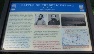
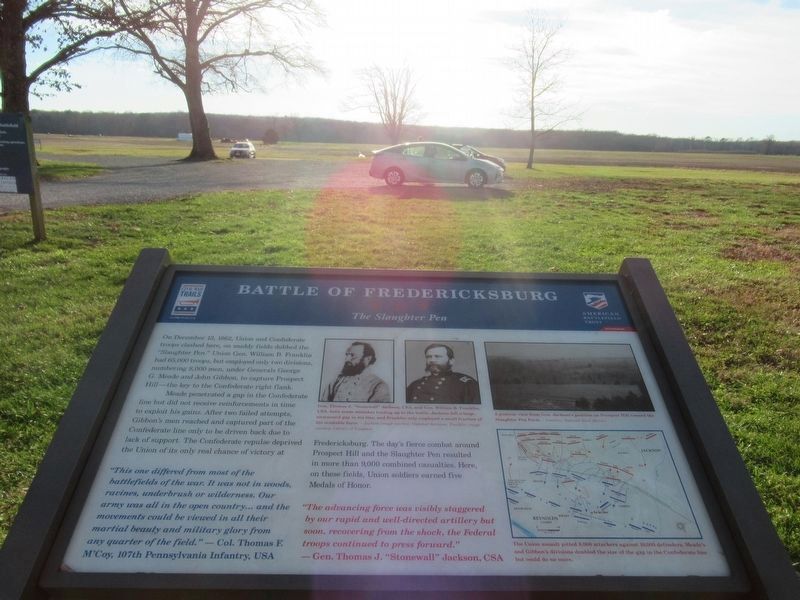
On December 13, 1862, Union and Confederate troops clashed here, on muddy fields dubbed the "Slaughter Pen." Union Gen. William B. Franklin had 65,000 troops, but employed only two divisions, numbering 8,000 men, under Generals George G. Meade and John Gibbon, to capture Prospect Hill - the key to the Confederate right flank.
Meade penetrated a gap in the Confederate line but did not receive reinforcements in time to exploit his gains. After two failed attempts, Gibbon's men reached and captured part of the Confederate line only to be driven back due to lack of support. The Confederate repulse deprived the Union of its only real chance of victory at Fredericksburg. The day's fierce combat around Prospect Hill and the Slaughter Pen resulted in more than 9,000 combined casualties. Here, on these fields, Union soldiers earned five Medals of Honor.
"This one differed from most of the battlefields of the war. It was not in woods, ravines, underbrush or wilderness. Our army was all in the open country… and the movements could be viewed in all their martial beauty and military glory from any quarter of the field."
- Col. Thomas F. M'Coy, 107th Pennsylvania Infantry, USA
"The advancing force was visibly staggered by our rapid and well-directed artillery but soon, recovering from the shock, the Federal troops continued to press forward."
- Gen. Thomas J. "Stonewall" Jackson, CSA
Erected 2009 by Civil War Preservation Trust and Virginia Civil War Trails.
Topics and series. This historical marker is listed in this topic list: War, US Civil. In addition, it is included in the Virginia Civil War Trails series list. A significant historical month for this entry is December 1702.
Location. 38° 15.862′ N, 77° 26.481′ W. Marker is near Fredericksburg, Virginia, in Spotsylvania County. Marker is on Tidewater Trail (U.S. 17), on the right when traveling south. Located on the Civil War Preservation Trust's Slaughter Pen Farm trail. Please obtain permission before entering the property. Call CWPT at (800) 298-7878. Touch for map. Marker is at or near this postal address: 11190 Tidewater Trail, Fredericksburg VA 22408, United States of America. Touch for directions.
Other nearby markers. At least 8 other markers are within walking distance of this marker. A different marker also named Battle of Fredericksburg (here, next to this marker); The Slaughter Pen Farm (a few steps from this marker); a different marker also named Slaughter Pen Farm (within shouting distance of this marker); a different marker also named Slaughter Pen Farm (about 800 feet away, measured in a direct line); Colonial Fort (approx. 0.2 miles away); a different
marker also named Slaughter Pen Farm (approx. 0.2 miles away); a different marker also named Slaughter Pen Farm (approx. ¼ mile away); a different marker also named Slaughter Pen Farm (approx. 0.3 miles away). Touch for a list and map of all markers in Fredericksburg.
More about this marker. In the upper center are portraits of Gens. Jackson and Franklin. Gen. Thomas J. "Stonewall" Jackson, CSA and Gen. William B. Franklin, USA, both made mistakes leading up to the battle, Jackson left a large, unmanned gap in his line, and Franklin only employed a small fraction of his available force.
In the upper right is A postwar view from Gen. Jackson's position on Prospect Hill toward the Slaughter Pen Farm.
On the lower right is a map showing movements in this sector of the battle. The Union assault pitted 8,000 attackers against 10,000 defenders. Meade's and Gibbon's divisions doubled the size of the gap in the Confederate line but could do no more.
Also see . . . The Slaughter Pen. Civil War Preservation Trust virtual tour of the Slaughter Pen Farm. (Submitted on July 26, 2009, by Craig Swain of Leesburg, Virginia.)

3. Civil War Preservation Trust
Help preservation like the Slaughter Pen Farm.
Click for more information.
Click for more information.
Photographed By Craig Swain, July 25, 2009
5. Entrance to the Sluaghter Pen Farm
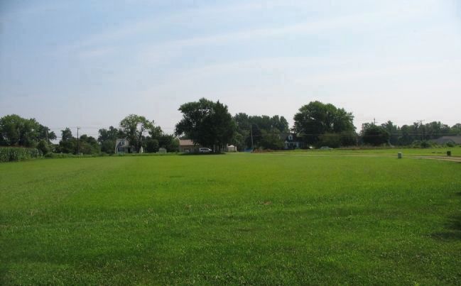
Looking from the marker location back toward the highway. The right side of Meade's Division passed over this ground, marching toward the camera during the Federal advance around mid-day. Later when Confederate counterattacks pushed Meade's troops back, portions of Birney's Division of the Federal III Corps moved up in this vicinity.
Photographed By Craig Swain, July 25, 2009
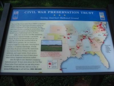
6. Civil War Preservation Trust
Saving America's Hallowed Ground
Saving America's Hallowed Ground
Double click the photo above for a better view of the map.
The Civil War Preservation Trust (CWPT) is America's largest nonprofit organization devoted to saving our nation's endangered Civil War battlefields. During more than 20 years crusading for preservation, CWPT has rescued 25,000 acres of hallowed ground in 18 states from sprawl and development.
Sadly, only one in five Civil War battlefields, so vital to our national heritage, is protected. Nearly 30 acres are lost every day. If not for the concerted efforts of CWPT and its partners, the very land you stand on might be a strip mall, a housing development, or a highway interchange. Already more than 20 percent of Civil War battlefields have been lost forever. Without well-funded, deliberate, and urgent action, future generations will be denied even more of those places where history happened and heroes walked.
Join the fight to save America's remaining hallowed ground. To learn more about the Civil War Preservation Trust and how you can help protect battlefields just like this one, visit us online at www.civilwar.org, or call toll free, (888) 606-1400.
Credits. This page was last revised on February 2, 2023. It was originally submitted on July 26, 2009, by Craig Swain of Leesburg, Virginia. This page has been viewed 1,392 times since then and 19 times this year. Photos: 1. submitted on July 26, 2009, by Craig Swain of Leesburg, Virginia. 2. submitted on February 23, 2022, by Benjamin Harrison Allen of Amissville, Virginia. 3, 4, 5, 6. submitted on July 26, 2009, by Craig Swain of Leesburg, Virginia.
