Near Fredericksburg in Spotsylvania County, Virginia — The American South (Mid-Atlantic)
Slaughter Pen Farm
Retreat and Counterattack
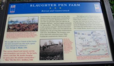
"For my part the more I think of that battle, the more annoyed I am that such a great chance should have failed me."
— Gen. George G. Meade, USA
"Our cannon flamed and roared, and the roar of musketry was terrific. The foe halts, wavers, and flies. We, double charging our guns, pour the canister among them."
— "Ben," Pee Dee (S.C.) Artillery, CSA
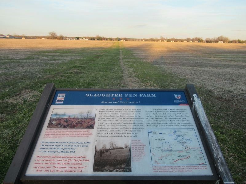
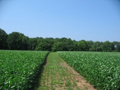
Forced back but not ready to give up, Gen. John Gibbon's soldiers launched three counterattacks, but each was repulsed. Hopelessness set in. "It was with real pain that I gave the order for the brigade to fall back," reported brigade commander Col. Adrian Root. "The officers and men received it with surprise and grief." Audacious Georgians pursued the Union soldiers into this field but ran headlong into late-arriving Union reinforcements under Gen. David Birney. The Georgians were driven back with substantial losses. Other Confederate counterattacks failed as well.
The fighting south of Fredericksburg left more than 5,000 Union and 4,000 Confederate soldiers dead, wounded, or missing. With its failure here, the Union lost its best chance for victory at Fredericksburg. The Union army fell back across the Rappahannock River and camped for more than four months before a new commander, Gen. Joseph Hooker, dared to cross the river again.
Erected 2009 by Civil War Preservation Trust and Virginia Civil War Trails.
Topics and series. This historical marker is listed in this topic list: War, US Civil. In addition, it is included in the Virginia Civil War Trails series list.
Location. 38° 15.713′ N, 77° 26.946′ W. Marker is near Fredericksburg, Virginia, in Spotsylvania County. Marker can be reached from Tidewater Trail (U.S. 17), on the right when traveling south. Located on the American Battlefield Trust's Slaughter Pen Farm trail. Touch for map. Marker is at or near this postal address: 3380 Shannon Airport Cir, Fredericksburg VA 22408, United States of America. Touch for directions.
Other nearby markers. At least 8 other markers are within walking distance of this marker. A different marker also named Slaughter Pen Farm (about 700 feet away, measured in a direct line); a different marker also named Slaughter Pen Farm (approx. 0.2 miles away); a different marker also named Slaughter Pen Farm (approx. 0.2 miles away); a different marker also named Slaughter Pen Farm (approx. 0.2 miles away); a different marker also named Slaughter Pen Farm (approx. 0.3 miles away); Engines of Destruction (approx. 0.3 miles away); Bernard's Cabins (approx. 0.3 miles away); a different marker also named Slaughter Pen Farm (approx. 0.3 miles away). Touch for a list and map of all markers in Fredericksburg.
More about this marker. In the upper left is a painting depicting the Federal advance. Col. Charles Collis of the 114th Pennsylvania Infantry led his regiment into battle and stemmed the Confederate counterthrust. When his regiment wavered, Collis galloped to the front, seized a regimental flag, and rallied his troops. For these deeds, he was awarded the Medal of Honor. Collis later commissioned artist Carl Rochling to depict the charge.
In the lower center is a photo of a veterans reunion on the field. After the war, veterans of the Union First Corps gathered on Prospect Hill just above the R.F & P. Railroad tracks. Doubtless, many recalled their charge up the slope pictured here.
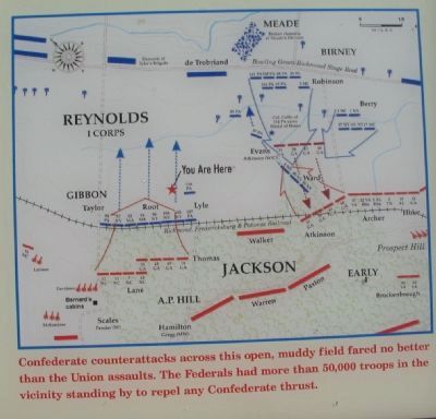
In the lower right is a map of this sector of the battlefield showing unit positions and movements. Confederate counterattacks across this open, muddy field fared no better than Union assaults. The Federals had more than 50,000 troops in the vicinity standing by to repel any Confederate thrust.
Also see . . . The Slaughter Pen Farm. Civil War Preservation Trust virtual tour of the Slaughter Pen Farm. (Submitted on July 27, 2009, by Craig Swain of Leesburg, Virginia.)

3. Civil War Preservation Trust
Help preservation like the Slaughter Pen Farm.
Click for more information.
Click for more information.
Credits. This page was last revised on February 2, 2023. It was originally submitted on July 27, 2009, by Craig Swain of Leesburg, Virginia. This page has been viewed 1,376 times since then and 22 times this year. Last updated on January 9, 2023, by Bradley Owen of Morgantown, West Virginia. Photos: 1. submitted on July 27, 2009, by Craig Swain of Leesburg, Virginia. 2. submitted on February 23, 2022, by Benjamin Harrison Allen of Amissville, Virginia. 3. submitted on July 26, 2009, by Craig Swain of Leesburg, Virginia. 4, 5, 6. submitted on July 27, 2009, by Craig Swain of Leesburg, Virginia. • Bernard Fisher was the editor who published this page.
