Near Keslers Cross Lanes in Nicholas County, West Virginia — The American South (Appalachia)
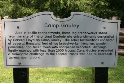
Camp Gauley
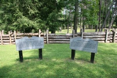
Used in battle reenactments, these log breastworks stand near the site of the original Confederate entrenchments designated by General Floyd as Camp Gauley. The rebel fortifications consisted of several thousand feet of log breastworks, trenches, wooden palisades, and felled trees with sharpened branches. Although lightly manned with less than 2000 troops, Camp Gauley presented a formidable challenge to the Federal troops who had to approach across open ground.
Topics. This historical marker is listed in these topic lists: Military • War, US Civil. A significant historical year for this entry is 2000.
Location. 38° 12.542′ N, 80° 56.495′ W. Marker is near Keslers Cross Lanes, West Virginia, in Nicholas County. Marker is at the intersection of Carnifex Ferry Crossing Road and County Route 23, on the right when traveling south on Carnifex Ferry Crossing Road. This historical marker is located on the actual site of the field of battle, and is situated south of the Patterson House, on land that has been turned into a state park in order to preserve and honor the memory of the Civil War Battle of Carnifex Ferry. Perhaps the best course to travel to get to this historical marker is go to the intersection of US 19 and State Route 129 (located just south of Summerville West Virginia), then turn onto State Route 129 and west for about 6.0 miles (turning left/south onto the Carnifex Ferry Crossing road)before arriving at the state park. Touch for map. Marker is in this post office area: Keslers Cross Lanes WV 26675, United States of America. Touch for directions.
Other nearby markers. At least 8 other markers are within walking distance of this marker. A Soldier's Recollection (a few steps from this marker); Old Ferry Road (within shouting distance of this marker); Artillery Thunder (about 400 feet away, measured in a direct line); Henry Patterson House (about 500 feet away); Friendly Fire (about 600 feet away); The Silent Witness (about 600 feet away); The Battle of Carnifex Ferry (about 600 feet away); "Follow Me My Men, Charge!" (about 700 feet away). Touch for a list and map of all markers in Keslers Cross Lanes.
Also see . . .
1. Battle of Carnifex Ferry. Absolute Astronomy website entry (Submitted on July 28, 2009, by Dale K. Benington of Toledo, Ohio.)
2. Carnifex Ferry Battlefield State Park. West Virginia State Parks website entry (Submitted on July 28, 2009, by Dale K. Benington of Toledo, Ohio.)
3. Carnifex Ferry Battlefield - National Register of Historic Places Nomination Form. West Virginia Division of Culture and History website entry (Submitted on July 28, 2009, by Dale K. Benington of Toledo, Ohio.)
Credits. This page was last revised on January 24, 2022. It was originally submitted on July 28, 2009, by Dale K. Benington of Toledo, Ohio. This page has been viewed 1,359 times since then and 28 times this year. Photos: 1, 2. submitted on July 28, 2009, by Dale K. Benington of Toledo, Ohio. • Craig Swain was the editor who published this page.

