Near Fort Howard in Baltimore County, Maryland — The American Northeast (Mid-Atlantic)
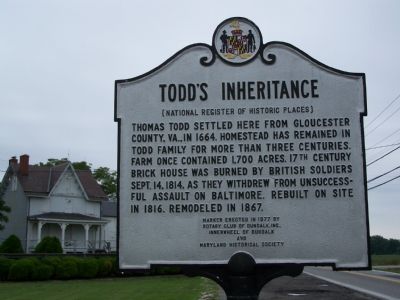
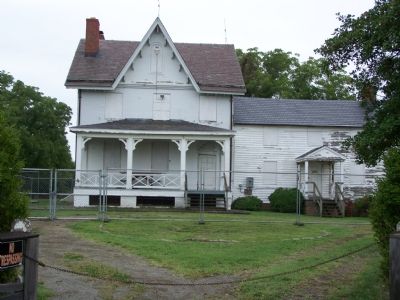
Todd’s Inheritance
(National Register of Historic Places)
Erected 1977 by Rotary Club of Dundalk, Innerwheel of Dundalk and Maryland Historical Society.
Topics. This historical marker is listed in these topic lists: Colonial Era • Settlements & Settlers • War of 1812. A significant historical date for this entry is September 14, 1935.
Location. 39° 12.85′ N, 76° 26.271′ W. Marker is near Fort Howard, Maryland, in Baltimore County. Marker is on North Point Road (Maryland Route 20) 0.3 miles south of McComas Road, on the left when traveling south. Touch for map. Marker is in this post office area: Sparrows Point MD 21219, United States of America. Touch for directions.
Other nearby markers. At least 8 other markers are within walking distance of this marker. A Heavy Price (within shouting distance of this marker); The Presbytery of Baltimore (about 300 feet away, measured in a direct line); The Landing (approx. 0.4 miles away); Unexpected Resistance (approx. 0.6 miles away); War in the Chesapeake (approx. 0.6 miles away); Wetlands (approx. 0.7 miles away); Dreaded Alarm (approx. ¾ mile away); The Rebirth of a Maryland Historical Treasure (approx. 0.8 miles away).
Credits. This page was last revised on November 22, 2019. It was originally submitted on August 19, 2007, by Bill Pfingsten of Bel Air, Maryland. This page has been viewed 3,761 times since then and 97 times this year. Photos: 1, 2. submitted on August 19, 2007, by Bill Pfingsten of Bel Air, Maryland. 3. submitted on December 27, 2014, by Allen C. Browne of Silver Spring, Maryland. • J. J. Prats was the editor who published this page.


