Financial District in Manhattan in New York County, New York — The American Northeast (Mid-Atlantic)
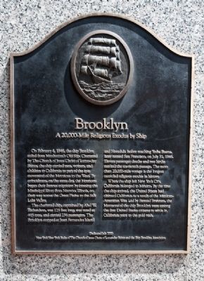
Brooklyn
A 20,000-Mile Religous Exodus by Ship
On February 4, 1846, the ship Brooklyn sailed from Manhattan's Old Slip. Chartered by the Church of Jesus Christ of Latter-day Saints, the ship carried men, women, and children to California as part of the epic movement of Mormons to the West. By coincidence, on the same day, the Mormons began their famous migration by crossing the Mississippi River from Nauvoo, Illinois, on their way across the Great Plains to the Salt Lake Valley.
The chartered ship, captained by Abel W. Richardson, was 125 feet long, was rated at 445 tons, and carried 234 passengers. The Brooklyn stopped at Juan Fernandez Island and Honolulu before reaching Yerba Buena, later named San Francisco, on July 31, 1846. Eleven passenger deaths and two births marked the six-month passage. The more than 20,000-mile voyage is the longest recorded religious exodus in history.
When the ship left New York City, California belonged to Mexico. By the time the ship arrived, the United States had claimed California as a result of the Mexican-American War. Led by Samuel Brannan, the Mormons of the ship Brooklyn were among the first United States citizens to settle in California prior to the gold rush.
Erected 2000 by New York New York Stake of the Church of Jesus Christ of Latter-day Saints and the Ship Brooklyn Association.
Topics. This historical marker is listed in these topic lists: Churches & Religion • Waterways & Vessels. A significant historical month for this entry is February 2001.
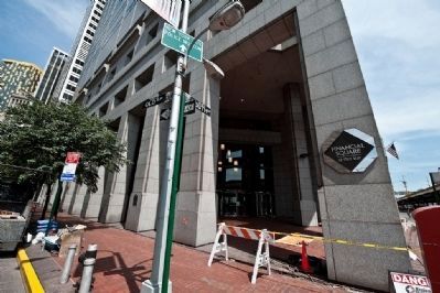
Location. 40° 42.218′ N, 74° 0.479′ W. Marker is in Manhattan, New York, in New York County. It is in the Financial District. Touch for map. Marker is at or near this postal address: 32 Old Slip, New York NY 10004, United States of America. Touch for directions.
Other nearby markers. At least 8 other markers are within walking distance of this marker. 100 Old Slip - New York City Police Museum (within shouting distance of this marker); In Memory of (within shouting distance of this marker); First Precinct Police Station (within shouting distance of this marker); Reframing Neglect (about 300 feet away, measured in a direct line); India House / British Memorial Garden in Hanover Square (about 500 feet away); Deutsche Bank Memorial Fountain (about 600 feet away); New York’s Municipal Slave Market (about 600 feet away); The Slave Market: Wall Street, 2023 (about 600 feet away). Touch for a list and map of all markers in Manhattan.
Also see . . . The Good Ship Brooklyn. "Perhaps of all these colonies none had a more romantic history than the one that sailed around South America to California on the good ship "Brooklyn." Samuel Brannan, an elder in New York City and vicinity who
later became prominent in California history, conceived the idea of taking his flock by water to California and there meeting the company who had left under Brigham Young, presumably for the same port." (Submitted on August 16, 2009, by Syd Whittle of Mesa, Arizona.)

Photographed By Syd Whittle, April 26, 2009
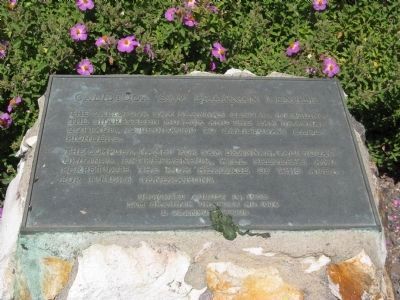
3. Calistoga Sam Brannan Center Marker
Sam Brannon became a successful businessman in San Francisco. He later settled in Calistoga where he was instrumental in developing that area. This marker is located at his cottage in Calistoga. This is now the home of the Calistoga Sam Brannon Center and the Sharpsteen Museum.
Click for more information.
Click for more information.
Credits. This page was last revised on January 31, 2023. It was originally submitted on August 10, 2009, by Ronald Claiborne of College Station, Texas. This page has been viewed 1,579 times since then and 37 times this year. Photos: 1, 2. submitted on August 10, 2009, by Ronald Claiborne of College Station, Texas. 3. submitted on May 3, 2009, by Syd Whittle of Mesa, Arizona. • Syd Whittle was the editor who published this page.

