Bolton in Atlanta in Fulton County, Georgia — The American South (South Atlantic)
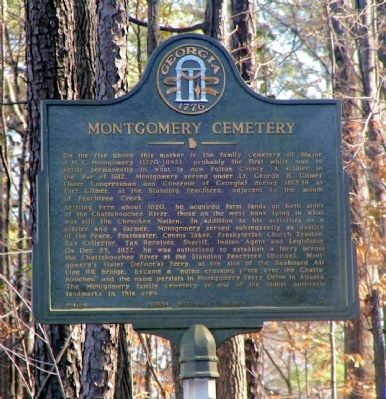
Montgomery Cemetery
Settling here about l82O, he acquired farm lands on both sides of the Chattahoochee River, those on the west bank lying in what was still the Cherokee Nation. In addition to his activities as a solder and farmer, Montgomery served subsequently as Justice of the Peace, Postmaster, Census Taker, Presbyterian Church Trustee, Tax Collector, Tax Receiver, Sheriff, Indian Agent and Legislator. On Dec. 25, 1837, he was authorized to establish a ferry across the Chattahoochee River at the Standing Peachtree (Bolton). Montgomery’s (later DeFoor’s) Ferry at the site of the Seaboard Air Line RR Bridge became a “noted crossing place over the Chattahoochee” and the name persists in Montgomery Ferry Drive in Atlanta. The Montgomery family cemetery is one of the oldest authentic landmarks in this area.
Erected 1961 by Georgia Historical Commission. (Marker Number 060-190.)
Topics and series. This historical marker is listed in these topic lists: Cemeteries & Burial Sites • Native Americans • Settlements & Settlers. In addition, it is included in the Georgia Historical Society series list. A significant historical month for this entry is December 1861.
Location. 33° 49.161′ N, 84° 27.102′ W. Marker is in Atlanta, Georgia, in Fulton County. It is in Bolton. Marker is on Marietta Boulevard NW, ¼ mile south of Bolton Road NW, on the right when traveling south. The marker is located in heavy brush and trees well off the roadway, adjacent to a building (currently a restaurant). It can be very difficult to see (and even more difficult to reach). Touch for map. Marker is in this post office area: Atlanta GA 30318, United States of America. Touch for directions.
Other nearby markers. At least 8 other markers are within walking distance of this marker. Johnston’s Army Crossed the River (approx. half a mile away); Standing Peach Tree (approx. 0.6 miles away); Fort Peach Tree (approx. 0.6 miles away); Montgomery's Ferry (approx. 0.6 miles away); Casey's Hill (approx. 0.7 miles away); Battle at Moore’s Mill (approx. ¾ mile away); Moore's Mill (approx. ¾ mile away); Atlanta's Outer Line (approx. 0.8 miles away). Touch for a list and map of all markers in Atlanta.
Additional keywords. Ferries
Credits. This page was last revised on February 8, 2023. It was originally submitted on August 10, 2009, by David Seibert of Sandy Springs, Georgia. This page has been viewed 1,266 times since then and 30 times this year. Photo 1. submitted on August 10, 2009, by David Seibert of Sandy Springs, Georgia. • Craig Swain was the editor who published this page.
Editor’s want-list for this marker. A wide shot of the marker and its surroundings. • Can you help?
