Lexington in Lexington County, South Carolina — The American South (South Atlantic)
World War II Bombing Ranges
[Front]:
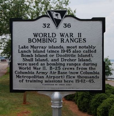
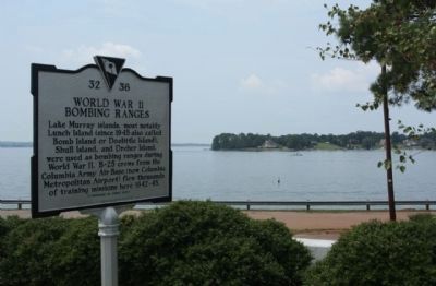
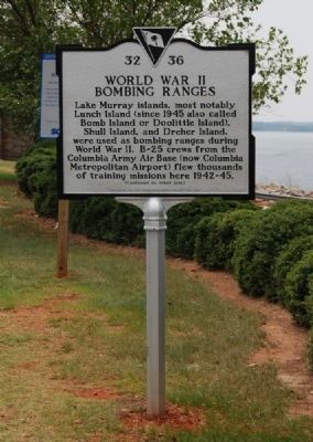
Lake Murray islands, most notably Lunch Island (since 1945 also called Bomb Island or Doolittle Island), Shull Island, and Dreher Island, were used as bombing ranges during World War II. B-25 crews from the Columbia Army Air Base (now Columbiana Metropolitan Airport) flew thousands of training missions here 1942-1945.
[Reverse]:
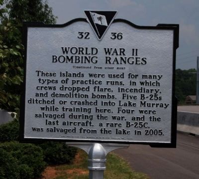
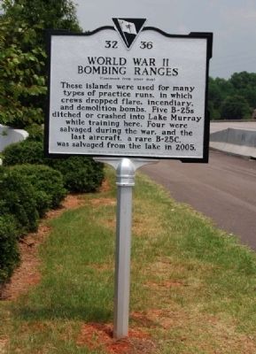
These islands were used for many types of practice runs, in which crews dropped flare, incendiary, and demolition bombs. Five B-25s ditched or crashed into Lake Murray while training here. Four were salvaged during the war, and the last aircraft, a rare B-25C, was salvaged from the lake in 2005.
Erected 2007 by Lake Murray B-25 Rescue Project, Inc. (Marker Number 32-36.)
Topics. This historical marker is listed in these topic lists: Air & Space • Military • Notable Events • Notable Places • War, World II. A significant historical year for this entry is 1945.
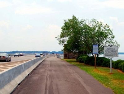
Location. 34° 3.756′ N, 81° 13.267′ W. Marker is in Lexington, South Carolina, in Lexington County. Marker is on North Lake Drive (State Highway 6), on the right when traveling south. Marker is located on the west side of the north entrance, at the start of the pedestrian bridge. Touch for map. Marker is in this post office area: Lexington SC 29072, United States of America. Touch for directions.
Other nearby markers. At least 10 other markers are within 6 miles of this marker, measured as the crow flies. Lake Murray (here, next to this marker); Town of Irmo (approx. 2.7 miles away); Richlex School Site (approx. 3.6 miles away); Bethlehem Church (approx. 3.7 miles away); Providence Church (approx. 3.9 miles away); St. Paul Church / Oak Grove (approx. 4.2 miles away); Zion Lutheran Church / Dreher's Fort (approx. 4.8 miles away); St. Andrew's Lutheran Church (approx. 5.1 miles away); Cotton Gin (approx. 5.3 miles away); Kitchen (approx. 5.3 miles away). Touch for a list and map of all markers in Lexington.
Also see . . .
1. Lake Murray's B-25. Lake Murray website entry:
The Story of B-25s at Lake Murray started with Japan's attack on Pearl Harbor on December 7, 1941 in World War II. (Submitted on August 10, 2009, by Brian Scott of Anderson, South Carolina.)
2. B-25 Mitchell. Wikipedia entry:
The North American B-25 Mitchell was an American twin-engined medium bomber manufactured by North American Aviation. (Submitted on August 10, 2009, by Brian Scott of Anderson, South Carolina.)
3. Lake Murray's Mitchell. Smithsonian Magazine website entry:
At about 10:45 a.m. on April 4, 1943, Bryce Lever was looking for fishing worms on the south shore of Lake Murray in South Carolina when he saw an airplane flying low, heading toward the water. (Submitted on August 10, 2009, by Brian Scott of Anderson, South Carolina.)
4. B-25 WWII plane retrieved from depths of Lake Murray. Airplanes Underwater website entry:
Sixty–two years after plunging into Lake Murray, one of the last remaining Army Air Corps war planes has been rescued from 150 feet beneath the lake’s surface. (Submitted on August 10, 2009, by Brian Scott of Anderson, South Carolina.)
5. These pictures were taken of the Mitchell B-25 from Lake Murray. SC Lakes website entry:
They lifted the plane from 150ft water to only a few feet below a barge. (Submitted on August 10, 2009, by Brian Scott of Anderson, South Carolina.)
6. Lake Murray (South Carolina). Wikipedia entry:
Lake Murray is a reservoir in the U.S. state of South Carolina. It is approximately 50,000 acres (200 km²) in size, and has roughly 500 miles (800 km) of shoreline. (Submitted on August 10, 2009, by Brian Scott of Anderson, South Carolina.)
Credits. This page was last revised on January 15, 2022. It was originally submitted on August 10, 2009, by Brian Scott of Anderson, South Carolina. This page has been viewed 3,958 times since then and 71 times this year. Photos: 1. submitted on August 10, 2009, by Brian Scott of Anderson, South Carolina. 2. submitted on August 22, 2011, by Mike Stroud of Bluffton, South Carolina. 3, 4, 5, 6. submitted on August 10, 2009, by Brian Scott of Anderson, South Carolina. 7. submitted on August 22, 2011, by Mike Stroud of Bluffton, South Carolina.
