Leesylvania in Prince William County, Virginia — The American South (Mid-Atlantic)
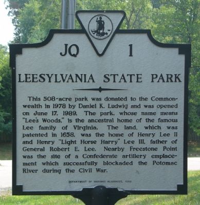
Leesylvania State Park
Erected 1989 by Department of Historic Resources. (Marker Number JQ-1.)
Topics and series. This historical marker is listed in these topic lists: Colonial Era • Parks & Recreational Areas • War, US Civil • Waterways & Vessels. In addition, it is included in the Virginia Department of Historic Resources (DHR) series list. A significant historical month for this entry is June 1737.
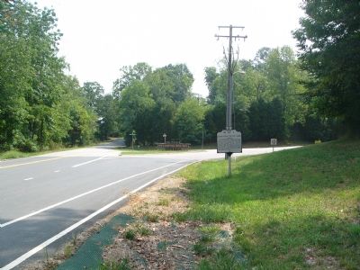
Location. 38° 36.16′ N, 77° 15.919′ W. Marker is in Leesylvania, Virginia, in Prince William County. Marker is at the intersection of Neabsco Road (County Route 610) and Daniel K. Ludwig Drive, on the right when traveling east on Neabsco Road. Touch for map. Marker is in this post office area: Woodbridge VA 22191, United States of America. Touch for directions.
Other nearby markers. At least 8 other markers are within walking distance of this marker. War in the Chesapeake (approx. 0.7 miles away); Confederate Winter Camps (approx. 0.7 miles away); Leesylvania (approx. 0.7 miles away); Julie J. Metz Amphitheater (approx. 0.7 miles away); A Railroad Runs Through It (approx. ¾ mile away); The Lee Family Cemetery (approx. 0.8 miles away); The Lee and Fairfax Family Cemetery (approx. 0.8 miles away); Neabsco Ironworks & Mills (approx. 0.8 miles away). Touch for a list and map of all markers in Leesylvania.
Regarding Leesylvania State Park. Leesylvania State Park, the ancestral home of the Lee family, sits along the Potomac River, south of Washington, DC. Today the park offers a range of recreational activities and beautiful views of the river, one of the Chesapeake's largest tributaries. But the park also has a long and fascinating history.
Situated on “Freestone Point,” referring to the sandstone which early settlers took from the property for building purposes, the park lands were once part of Leesylvania Plantation. Henry “Light Horse Harry” Lee III, a revolutionary war colonel and father of Robert E. Lee, was born here. The Lee mansion burned in the 18th century, but the family gravesite remains, as do the ruins of a later 19th century house. Visitors can also see the site of a Confederate gun emplacement from the Civil War.
Fees: $3 per car weekdays and $4 weekends during the main season (April 1 - Oct 31) and $3 all days during the winter.
Also see . . .
1. Map of the park (in PDF). (Submitted on August 24, 2007, by Kevin W. of Stafford, Virginia.)
2. Leesylvania State Park info from Department of Conservation and Recreation. (Submitted on August 24, 2007, by Kevin W. of Stafford, Virginia.)
Credits. This page was last revised on October 7, 2023. It was originally submitted on August 24, 2007, by Kevin W. of Stafford, Virginia. This page has been viewed 1,539 times since then and 63 times this year. Last updated on October 3, 2023, by N. Jozsa of Woodbridge, Virginia. Photos: 1, 2. submitted on August 24, 2007, by Kevin W. of Stafford, Virginia. • Bill Pfingsten was the editor who published this page.

