Silver City in Lyon County, Nevada — The American Mountains (Southwest)
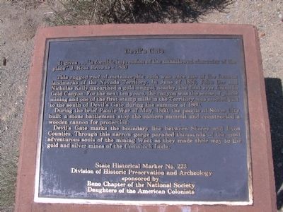
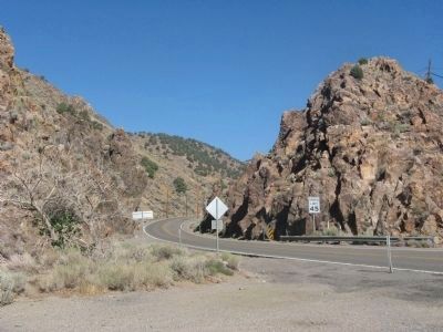
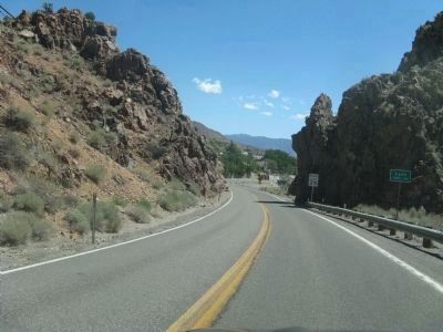
Devilís Gate
It givesÖ “a forcible impression of the unhallowed character of the place” J. Ross Brown – 1860
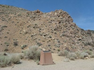
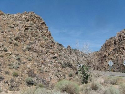
This rugged reef of metamorphic rock was once one of the famous landmarks of the Nevada Territory. In June of 1850, John Orr and Nicholas Kelly unearthed a gold nugget nearby, the first ever found in Gold Canyon. For the next ten years, the canyon was the scene of placer mining and one of the first stamp mills in the Territory was erected just to the south of Devilís Gate during the summer of 1860.
During the brief Paiute War of May, 1860, the people of Silver City built a stone battlement atop the eastern summit and constructed a wooden cannon for protection.
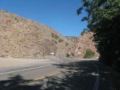
Devilís Gate marks the boundary line between Story and Lyon Counties. Through this narrow gorge paraded thousands of the most adventurous souls of the mining West as they made their way to the gold and silver mines of the Comstock Lode.
Division of Historical Preservation and Archeology
sponsored by
Reno Chapter of the National Society
Daughters of the American Colonists
Erected by Nevada Division of Historical Preservation and Archeology and the Reno Chapter of the National Society of the Daughters of the American Colonists. (Marker Number 223.)
Topics and series. This historical marker is listed in these topic lists: Landmarks • Notable Places • Roads & Vehicles • Settlements & Settlers. In addition, it is included in the Daughters of the American Colonists series list. A significant historical month for this entry is May 1860.
Location. 39° 15.96′ N, 119° 38.58′ W. Marker is in Silver City, Nevada, in Lyon County. Marker is on Main Street (Nevada Route 342), on the left when traveling north. Touch for map. Marker is in this post office area: Silver City NV 89428, United States of America. Touch for directions.
Other nearby markers. At least 8 other markers are within 2 miles of this marker, measured as the crow flies. Ill-Fated Brothers - Hosea and Ethan Grosh (approx. 0.2 miles away); Silver City Schoolhouse (approx. 0.2 miles away); Johntown (approx. 0.7 miles away); American City (approx. 1.9 miles away); Jumbo (West Comstock) (approx. 1.9 miles away); Gold Hill Hotel (approx. 1.9 miles away); Gold Hill Brewery (approx. 2 miles away); I.O.O.F. Monument (approx. 2 miles away). Touch for a list and map of all markers in Silver City.
Regarding Devilís Gate. The Devilís Gate Toll House was located at the lower end of this toll road that operated between Gold Hill and Silver City.
Also see . . . New Amended Text for Marker. The Nevada State Historic Preservation Office (SHPO) website entry:
SHPO recently updated the text of the roughly 260 state historical markers in Nevada. The Nevada SHPO placed the amended text of each individual marker on its website and will change the actual markers in the field as funding allows. Minor changes have been made to the marker for grammar and readability. In regards to content, the marker was amended to remove the reference to John Orr and Nicholas Kelly, to indicate the canyon to the south was the scene of placer mining, and to change the name of the Paiute War to the Pyramid Lake War. The link will take you to the Nevada SHPO page for the marker with the amended text. (Submitted on November 12, 2013, by Duane Hall of Abilene, Texas.)
Additional keywords. Comstock Lode
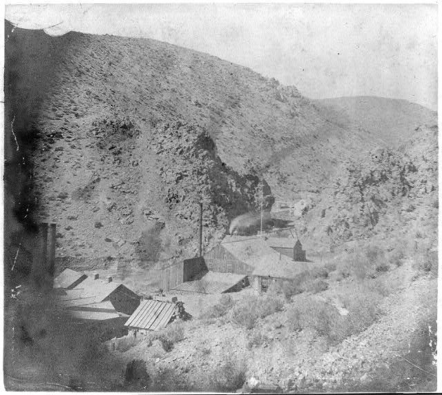
Photographed By Lawrence & Houseworth, Publisher, 1866
6. Devilís Gate
One photo from a pair published as a stereographic view.
Library of Congress
Click for more information.
Click for more information.
Credits. This page was last revised on October 23, 2021. It was originally submitted on August 12, 2009, by Syd Whittle of Mesa, Arizona. This page has been viewed 3,331 times since then and 221 times this year. Photos: 1, 2, 3. submitted on August 12, 2009, by Syd Whittle of Mesa, Arizona. 4, 5. submitted on August 25, 2009, by Syd Whittle of Mesa, Arizona. 6. submitted on August 12, 2009, by Syd Whittle of Mesa, Arizona. 7. submitted on August 25, 2009, by Syd Whittle of Mesa, Arizona.
