Stafford in Stafford County, Virginia — The American South (Mid-Atlantic)
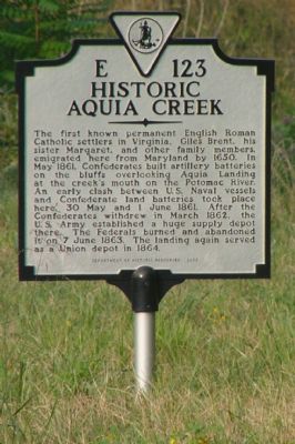
Historic Aquia Creek
Erected 2003 by Department of Historic Resources. (Marker Number E-123.)
Topics and series. This historical marker is listed in these topic lists: Churches & Religion • Colonial Era • Native Americans • Settlements & Settlers • War, US Civil • Wars, US Indian • Waterways & Vessels. In addition, it is included in the Virginia Department of Historic Resources (DHR) series list. A significant historical month for this entry is March 1862.
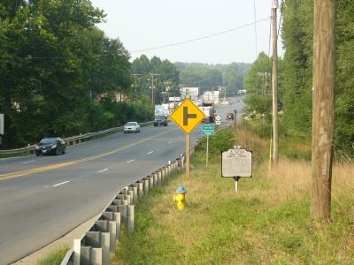
Location. 38° 28.429′ N, 77° 23.691′ W. Marker is in Stafford, Virginia, in Stafford County. Marker is on Jefferson Davis Highway (U.S. Rt 1) south of County Route 637, on the right when traveling north. Touch for map. Marker is in this post office area: Stafford VA 22554, United States of America. Touch for directions.
Other nearby markers. At least 8 other markers are within 2 miles of this marker, measured as the crow flies. First Roman Catholic Settlement in Virginia (approx. 0.2 miles away); In the Name of Christ the King (approx. 0.2 miles away); Aquia Church (approx. 0.8 miles away); Fleurries (approx. 0.8 miles away); Peyton’s Ordinary (approx. 1.6 miles away); Little Forest Baptist Church (approx. 1.7 miles away); Mary Kittamaquund (approx. 1.7 miles away); Island Ownership (approx. 1.8 miles away). Touch for a list and map of all markers in Stafford.
More about this marker. This marker replaced a marker with the same number and title erected in the late 1920s or early 1930s (most likely on a taller pole) that read, “Giles Brent built a house here in 1647. After the Indian war of 1676 this creek was for ten years the northern frontier of Virginia. The Army of the Potomac, coming from the James, landed here in August, 1862. For campaigns in 1862-63 this stream was the supply base of the Union army.”
Credits. This page was last revised on December 27, 2019. It was originally submitted on August 24, 2007, by Kevin W. of Stafford, Virginia. This page has been viewed 2,217 times since then and 86 times this year. Photos: 1, 2. submitted on August 24, 2007, by Kevin W. of Stafford, Virginia. • J. J. Prats was the editor who published this page.

