Wellsburg in Brooke County, West Virginia — The American South (Appalachia)
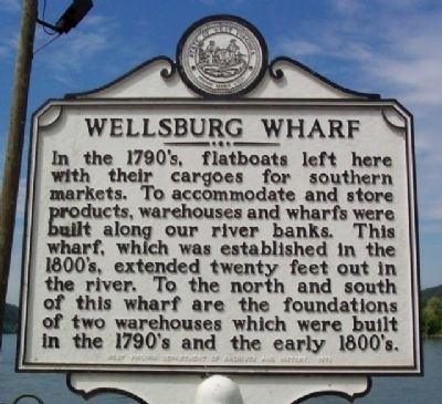
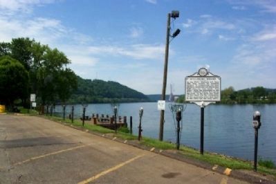
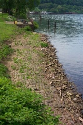
Wellsburg Wharf
Erected 1970 by West Virginia Department of Archives and History.
Topics and series. This historical marker is listed in these topic lists: Industry & Commerce • Settlements & Settlers • Waterways & Vessels. In addition, it is included in the West Virginia Archives and History series list.
Location. 40° 16.134′ N, 80° 36.868′ W. Marker is in Wellsburg, West Virginia, in Brooke County. Marker is at the intersection of Main Street and 6th Street, on the right when traveling south on Main Street. Touch for map. Marker is in this post office area: Wellsburg WV 26070, United States of America. Touch for directions.
Other nearby markers. At least 8 other markers are within walking distance of this marker. The Lewis and Clark Connection (within shouting distance of this marker); Patrick Gass (within shouting distance of this marker); Miller's Tavern (within shouting distance of this marker); Wellsburg's Giant Sycamore (within shouting distance of this marker); 1788 Wells Log House (about 300 feet away, measured in a direct line); 1849 (about 400 feet away); Wellsburg (approx. ¼ mile away); Isaac Duvall and Company (approx. ¼ mile away). Touch for a list and map of all markers in Wellsburg.
Credits. This page was last revised on June 16, 2016. It was originally submitted on August 14, 2009, by William Fischer, Jr. of Scranton, Pennsylvania. This page has been viewed 1,307 times since then and 18 times this year. Photos: 1, 2, 3. submitted on August 14, 2009, by William Fischer, Jr. of Scranton, Pennsylvania. • Syd Whittle was the editor who published this page.


