Crow Agency in Big Horn County, Montana — The American West (Mountains)
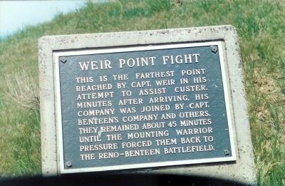
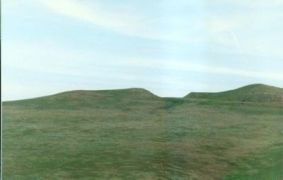
Weir Point Fight
(Little Bighorn Battlefield)
Topics. This historical marker is listed in these topic lists: Native Americans • Wars, US Indian.
Location. 45° 32.146′ N, 107° 23.651′ W. Marker is in Crow Agency, Montana, in Big Horn County. Marker is on Little Bighorn Battlefield Road. at Interstate 90 at Mile Marker 510 near U.S. 212. East of I-90. Touch for map. Marker is in this post office area: Crow Agency MT 59022, United States of America. Touch for directions.
Other nearby markers. At least 8 other markers are within walking distance of this marker. Weir Point (about 500 feet away, measured in a direct line); Custer Last Seen (approx. 0.2 miles away); Sharpshooter Ridge (approx. 0.4 miles away); Medicine Tail Coulee (approx. 0.8 miles away); Custer’s Advance (approx. 0.8 miles away); Reno’s Valley Fight (approx. 0.9 miles away); Reno’s Retreat (approx. 0.9 miles away); Crow's Nest (approx. 0.9 miles away). Touch for a list and map of all markers in Crow Agency.
Regarding Weir Point Fight. The two-day battle took place between the U.S. Army's Seventh Cavalry, guided by Crow and Arikara scouts and led by Lt. Col. George Armstrong Custer, against bands of Lakota Sioux, Cheyenne, and Arapaho, led by Chief Sitting Bull.
Little Bighorn was the pinnacle of the Indians' power. They had achieved their greatest victory yet, but soon their tenuous union fell apart in the face of the white onslaught. Outraged over the death of a popular Civil War hero on the eve of the Centennial, the nation demanded and received harsh retribution .
Also see . . .
1. Battle of Little Bighorn. (Submitted on August 14, 2009, by Mike Stroud of Bluffton, South Carolina.)
2. Captain Thomas Benton Weir, Wikipedia entry. ... Weir disobeyed orders to remain on what is now called Reno Hill. Instead, Weir (and eventually other soldiers including Benteen) moved north to attempt to support Custer, who had led a detachment to attack the encampment from that direction. The effort was too late to save Custer and over 200 of his men, all of whom were killed. ... (Submitted on June 24, 2012, by Mike Stroud of Bluffton, South Carolina.)
Credits. This page was last revised on June 16, 2016. It was originally submitted on August 14, 2009, by Mike Stroud of Bluffton, South Carolina. This page has been viewed 3,510 times since then and 134 times this year. Photos: 1, 2. submitted on August 14, 2009, by Mike Stroud of Bluffton, South Carolina. • Craig Swain was the editor who published this page.

