Saint Michael in Cambria County, Pennsylvania — The American Northeast (Mid-Atlantic)
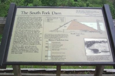
The South Fork Dam
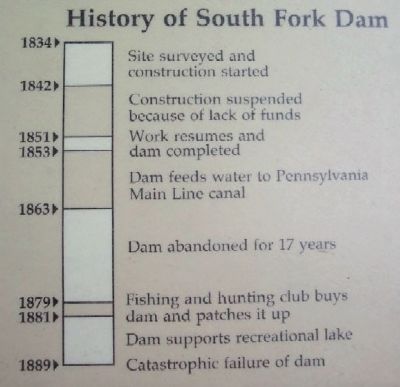
Although well-engineered for its time, years of neglect and unsound alterations had made the dam unsafe. By 1889, the water control tower had burned down, and the iron outlet pipes had been removed, making it impossible to control the lake level. Earlier breaches in the dam had been improperly filled with stone, dirt, brush, and even manure. The dam had settled and sagged at the center, inviting a washout. In addition, fish screens had reduced the capacity of the spillway to handle overflow.
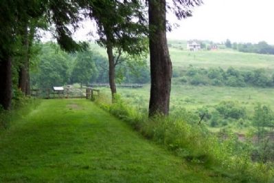
On May 31, 1889, under the force of rising floodwaters, the dam gave way, creating the gaping hole in front of you. From here the flood wave thundered 14 miles downstream to Johnstown, killing more than 2,200.
“The dam itself, or the parts of it which were left standing, showed undoubtedly that it was well and thoroughly built....”
American Society of Civil Engineers, January 15, 1890
Erected by National Park Service.
Topics. This historical marker is listed in these topic lists: Disasters • Man-Made Features • Notable Events. A significant historical date for this entry is January 15, 1872.
Location. 40° 20.909′ N, 78° 46.526′ W. Marker is in Saint Michael, Pennsylvania, in Cambria County. Marker is on the grounds of the Johnstown Flood National Memorial, on the remains of the South Fork Dam overlooking the Little Conemaugh River. The marker is about 500 feet NE of the Hunters Run parking area, off Locust Street (PA Route 869). Touch for map. Marker is in this post office area: South Fork PA 15956, United States of America. Touch for directions.
Other nearby markers. At least 8 other markers are within 4 miles of this marker, measured as the crow flies. The Dam Melts Away (approx. ¼ mile away); Lake Conemaugh (approx. ¼ mile away); The Unger House (approx. ¼ mile away); May 31, 1889 (approx. ¼ mile away); Johnstown Flood (approx. half a mile away); American Legion Post 551 Veterans Memorial (approx. ¾ mile away); Saint Michael World War II Honor Roll (approx. 1.3 miles away); Allegheny Portage Railroad (approx. 3.7 miles away). Touch for a list and map of all markers in Saint Michael.
Photographed By William Fischer, Jr., June 26, 2009
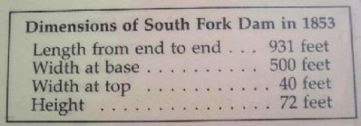
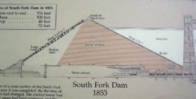
2. The South Fork Dam 1853
Artist's conception of a cross section of the South Fork Dam in 1853, the year it was completed. By the time of the flood, the dam had changed. The control tower had burned, the outlet pipes had been scrapped, and the stone culvert had been filled in. Remains of the culvert are often visible from this viewpoint.
Photographed By William Fischer, Jr., June 26, 2009
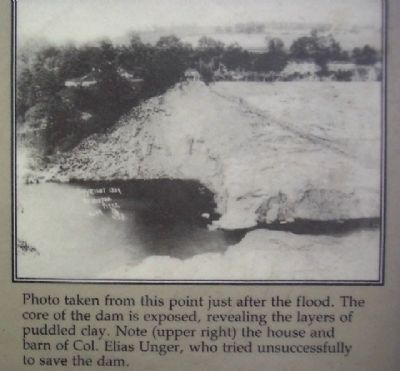
5. South Fork Dam Photo After Breach
Photo taken from this point just after the flood. The core of the dam is exposed, revealing the layers of puddled clay. Note (upper right) the house and barn of Col. Elias Unger, who tried unsuccessfully to save the dam.
Photographed By William Fischer, Jr.,
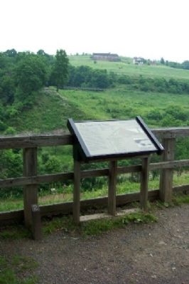
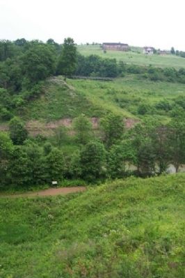
8. Breach in the South Fork Dam
Little Conemaugh River at center of photo. Former Pennsylvania Railroad tracks against far remains of dam were installed after the destruction of the dam. At distance on hill are the Elias Unger House (white) and National Park Service Visitor Center (made to look like Unger's barn).
Credits. This page was last revised on June 16, 2016. It was originally submitted on August 22, 2009, by William Fischer, Jr. of Scranton, Pennsylvania. This page has been viewed 4,088 times since then and 31 times this year. Photos: 1, 2, 3, 4, 5, 6, 7, 8. submitted on August 22, 2009, by William Fischer, Jr. of Scranton, Pennsylvania. • Kevin W. was the editor who published this page.
