Stafford in Stafford County, Virginia — The American South (Mid-Atlantic)
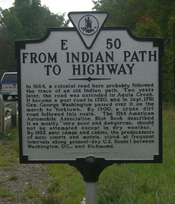
From Indian Path to Highway
Erected 1998 by Department of Historic Resources. (Marker Number E-50.)
Topics and series. This historical marker is listed in these topic lists: Colonial Era • Communications • Industry & Commerce • Native Americans • Patriots & Patriotism • Roads & Vehicles • War, US Revolutionary. In addition, it is included in the Virginia Department of Historic Resources (DHR) series list. A significant historical month for this entry is September 1781.
Location. 38° 24.164′ N, 77° 25.252′ W. Marker is in Stafford, Virginia, in Stafford County. Marker is on Jefferson Davis Highway (U.S. Rt 1), on the right when traveling south. Touch for map. Marker is at or near this postal address: 1705 Jefferson Davis Hwy, Stafford VA 22554, United States of America. Touch for directions.
Other nearby markers. At least 8 other markers are within one mile of this marker, measured as the crow flies. Stafford Training School (about 600 feet away, measured in a direct line); Trooper Jessica Jean Cheney (approx. 0.8 miles away); Veterans Memorial (approx. 0.8 miles away); 11th Corps Road (approx. one mile away); Union Army Double-Track Corduroy Road (approx. one mile away); German-Americans and the Eleventh Corps (approx. one mile away); Union Battery (approx. one mile away); a different marker also named Union Battery (approx. one mile away). Touch for a list and map of all markers in Stafford.
More about this marker. This marker replaced one with the same number but titled “Indian Trail” erected in the late 1920s or early 1930s that read, “Here ran the original Indian trail. In 1664 a road was opened here and in 1666 it was extended to Aquia Creek. In 1750 this became a post road. In September, 1781, Washington passed over this road on the way to Yorktown, and over it the French army later marched north.”
Credits. This page was last revised on December 13, 2021. It was originally submitted on August 28, 2007, by Kevin W. of Stafford, Virginia. This page has been viewed 2,585 times since then and 54 times this year. Photos: 1, 2. submitted on August 28, 2007, by Kevin W. of Stafford, Virginia. • J. J. Prats was the editor who published this page.

