The Tidal Basin in Southwest Washington in Washington, District of Columbia — The American Northeast (Mid-Atlantic)
Japanese Stone Lantern
National Mall and Memorial Parks
— National Park Service, U.S. Department of the Interior —
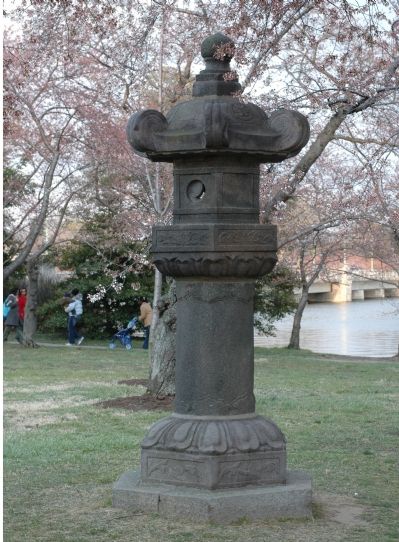
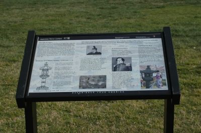
The Gift of Light. Presented to the city of Washington on March 30, 1954, this stone lantern symbolizes the enduring cultural partnership that re-emerged between Japan and the United States after World War II. The lantern is one of two memorializing Tokugawa Iemitsu, the third shogun, or military lord, of the Tokugawa Dynasty, under his posthumous name Daiyuinden. Carved about 1651, it stood for over 300 years on the grounds of the Toeizan Kan'eiji Temple which contained the remains of the Tokugawa Shoguns. The temple was located in the ancient city of Edo, present-day Tokyo, in Ueno Park, a place famous for its cherry blossoms. Its twin stands there to this day.
The stone lantern is part of a gift-giving cycle that began in 1912 with Japan's donation of cherry trees. The lantern commemorates the 100th anniversary of Commodore Matthew Perry's historic mission to Japan and stands as a gesture of everlasting peace and friendship. It also represents the concept of healing wounds and moving toward universal understanding.
A Commemoration. Matthew Calbraith Perry, Commodore of the U.S. Navy, opened the doors of trade with Japan, ending the country's 200 year policy of isolationism.
Perry made two treks, first in 1852 and again in 1854, in an effort to secure safe entry of American vessels to Japanese ports for trade, obtain supplies for the commercial whaling fleet, and ensure a safe return of shipwrecked sailors. In March, 1854, improved relations with Japan became reality when representatives of Japan and the United States signed the Treaty of Kanagawa.
Lighting the Way. The National Park Service and the National Conference of State Societies (NCSS) have conducted the Lantern Ceremony since 1954. Every year, the lantern is lit by the Embassy of Japan's appointed Cherry Blossom Princess.
The audience will count down from five, and like the Olympic torch, the lantern is lit in an exciting traditional event that signals the arrival of spring and represents one of the most beautiful times in the Nation's Capital.
Erected by National Park Service, U.S. Department of the Interior.
Topics. This historical marker is listed in these topic lists: Peace • War, World II. A significant historical month for this entry is March 1850.
Location. This marker has been replaced by another marker nearby. It was located near 38° 53.211′ N, 77° 2.473′ W. Marker was in Southwest Washington in Washington, District of Columbia. It was in The Tidal Basin. Marker was on Independence Avenue Southwest east of West Basin Drive Southwest, on the right when traveling east. Touch for map. Marker was in this post office area: Washington DC 20037, United States of America. Touch for directions.
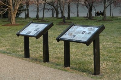
Other nearby markers. At least 8 other markers are within walking distance of this location. A Symbol of International Friendship (here, next to this marker); Lighting the Way (here, next to this marker); The First Japanese Cherry Trees (within shouting distance of this marker); John Paul Jones Memorial (about 700 feet away, measured in a direct line); District of Columbia War Memorial (about 700 feet away); a different marker also named District of Columbia War Memorial (about 700 feet away); a different marker also named John Paul Jones Memorial (approx. 0.2 miles away); Washington Monument (approx. 0.2 miles away). Touch for a list and map of all markers in Southwest Washington.
Regarding Japanese Stone Lantern. This marker was replaced by "A Symbol of International Friendship" marker.
Also see . . . Western Intrusions and the end of the Tokugawa Rule. (Submitted on April 3, 2006.)
Additional commentary.
1. Anatomy of a Stone Lantern ~ ishidourou
A diagram on the marker describes each part of the stone lantern. From top to bottom:
houju — A sacred gem believed to possess the power to banish evil, cleanse

Photographed By Tom Fuchs, March 25, 2006
3. Daiyuinden Memorial Lantern
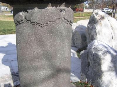
The inscription on the lantern translates as follows: This stone lantern is dedicated to Daiyuinden at the Toeizan Temple of Musashi Province this twentieth day of November of the fourth year of Keian by Matsuura-Shizunobu, Lord of Hizen.
kasa — Acts as an umbrella over the fire box. A hexagonal shape, it terminates in scrolls with three cherry blossoms decorating the hood.
hiburkuro — Where the fire is lit. It is hexagonal and imaginative, with the full and crescent phases of the moon on the light openings.
chuudal — Middle base of lantern. Hexagonal with an inverted lotus forming the lower part.
sao — The shaft of the stone lantern that is set on a base and supports the entire lantern. The lantern bears an inscription written in Japanese on the side facing the water.
kiso — The base of a stone lantern.
kidan — The platform or podium.
— Submitted April 2, 2006.
Credits. This page was last revised on January 30, 2023. It was originally submitted on April 2, 2006, by Tom Fuchs of Greenbelt, Maryland. This page has been viewed 27,464 times since then and 757 times this year. Last updated on November 3, 2010, by Timothy Carr of Birmingham, Alabama. Photos: 1. submitted on April 2, 2006, by Tom Fuchs of Greenbelt, Maryland. 2. submitted on March 30, 2006, by Tom Fuchs of Greenbelt, Maryland. 3. submitted on April 2, 2006, by Tom Fuchs of Greenbelt, Maryland. 4. submitted on January 6, 2015, by J. Makali Bruton of Accra, Ghana. • Bill Pfingsten was the editor who published this page.


