Ridgewood in Bergen County, New Jersey — The American Northeast (Mid-Atlantic)
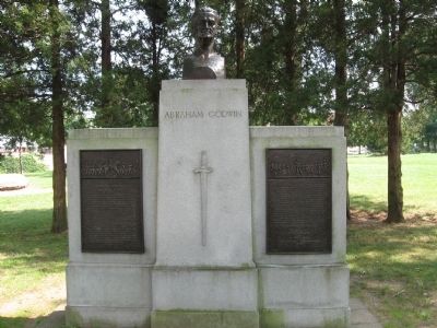
Abraham Godwin
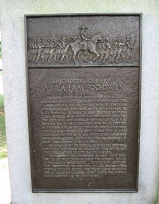
Soldier, Statesman, artist, poet, engraver, musician and gracious host. Born July 16, 1763.
His career began at the age of thirteen when his brother, David, aged eleven, he left home at Totowa to join Captain Woolverton's Minute Men with the mother's consent. The boys were musicians. Abraham playing a fife, David a drum. Their destination was a station at the corner of Partition and Horse and Cart Streets, New York City, now Fulton and William Streets. There the boys saw their father who had been commissioned Captain of Marines aboard the Lady Washington lying in port.
Abraham went to Fishkill joining his brother, Captain Henry Godwin's regiment, the Fifth of the Line, January 17, 1777, as a fife major.
The regiment was ordered to Fort Montgomery to lay the chain across the Hudson River. He was in the Governor's life guard at Schenectady protecting the frontier at Lake Otsego under General Sullivan during the Finger Lakes campaign and at Yorktown, where he witnessed the surrender of Cornwallis to Washington.
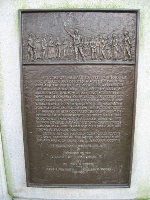
After the war he married, settled in Totowa, now Patterson and devoted himself to the fine arts, and the pursuit of civil life; was elected to the Legislature 1803-07; Rose to Rank of Brigadier General New Jersey State Militia in 1814 marched a Company of Paterson volunteers to Sandy Hook was received with great acclaim and worked on the entrenchments; 1828 nominated for Presidential elector on the Jackson ticket.
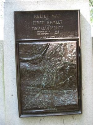
January 1st 1829 occured the great event of interest to this community: its first name was Godwinville in honor of Abraham Godwin. This section covered Parmus, Newtown (Wortendyke) Midlank Park, Ridgewood and Glen Rock and was known as Franklin Township.
Godwin Avenue, formerly Godwinville Road is the only remnant of the honor conferred on him and was much cherished by Abraham Godwin.
He passed to the greater life 1855.
Erected by the Village of Ridgewood NJ 1951
Dr. John B. Hopper, Mayor
James S. Anderson William F. Moore Commissioners
Erected 1951.
Topics. This historical marker is listed in these topic lists: Settlements & Settlers • War, US Revolutionary. A significant historical date for this entry is January 17, 1777.
Location. 40° 58.749′ N, 74° 7.048′ W. Marker is in Ridgewood, New Jersey, in Bergen County. Marker is at the intersection of E. Ridgewood Avenue and Van Neste Square, on the right when traveling south on E. Ridgewood Avenue. Located in Ridgewood Municipal Park. Touch for map. Marker is in this post office area: Ridgewood NJ 07451, United States of America. Touch for directions.
Other nearby markers. At least 8 other markers are within walking distance of this marker. Ridgewood Veterans Memorial (a few steps from this marker); Ridgewood 9-11 Memorial (about 300 feet away, measured in a direct line); Archibald – Vroom House (about 400 feet away); Beech Street School (approx. 0.2 miles away); Ridgewood Station (approx. 0.2 miles away); Joseph H. Chapman Summer Residence (approx. 0.8 miles away); Historic Glen Avenue (approx. 0.8 miles away); Hopper House (approx. 0.9 miles away). Touch for a list and map of all markers in Ridgewood.
Credits. This page was last revised on November 24, 2019. It was originally submitted on September 3, 2009, by Michael Herrick of Southbury, Connecticut. This page has been viewed 1,613 times since then and 25 times this year. Photos: 1, 2, 3, 4. submitted on September 3, 2009, by Michael Herrick of Southbury, Connecticut. • Bill Pfingsten was the editor who published this page.


