West Point in Orange County, New York — The American Northeast (Mid-Atlantic)
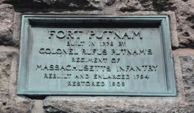
Fort Putnam
Colonel Rufus Putnam’s
Regiment of
Massachusetts Infantry
Rebuilt and enlarged 1794
Restored 1909
Lower Marker:
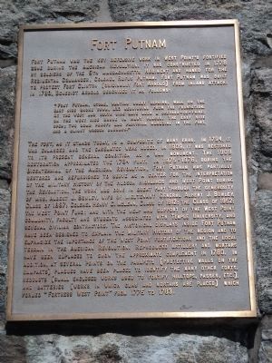
“Fort Putman, stone, wanting great repairs. Wall on the east side broke down, and rebuilding from the foundation. At the west and south side have been a chevaux-de-frise; on the west side broke in many places. The east side open; two bomb proofs and provision magazine in the fort, and a slight wooden barrack.”
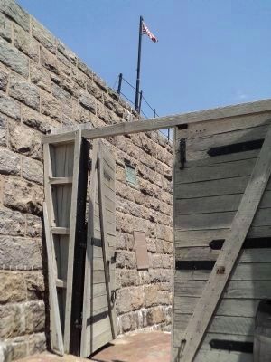
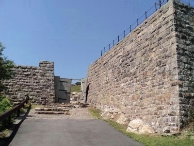
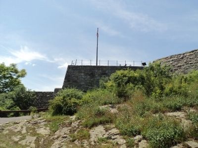
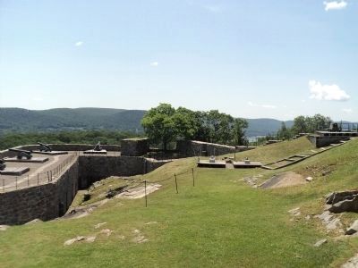
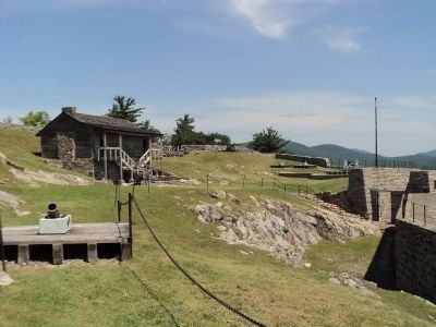
The fort, as it stands today, is a composite of many eras. In 1794, it was enlarged and the casemates were added. In 1909, it was restored to its present general condition as a war monument. The 1909 restoration approximated the 1794 fort. In 1975 – 1976, during the Bicentennial of the American Revolution, Fort Putman was partially restored and refurbished to serve as a center for the interpretation of the military history of the Hudson Highlands and West Point during the Revolution. The work was done in great part through the generosity of Mrs. Albert J. Bowley, wife of Lieutenant General Albert J. Bowley, Class of 1897; Colonel Henry C. McLean, Class of 1912; the Class of 1952; the West Point Fund; and with the help and support of the West Point community, faculty and students associated with Temple University, and several civilian contractors. The historical displays inside Fort Putnam have been designed to explain the military history of the region and to emphasize the importance of the West Point fortifications and the local terrain in the American Revolution. Reproduced artillery and mortars have been emplaced to show the approximate complement in 1780. In addition, at several points on the parapets (protective walls on the ramparts) plaques have been placed to identify the many other forts, redoubts (small enclosed works used to fortify hilltops, passes, etc.), and batteries (works in which guns and mortars are placed) which formed “Fortress West Point” from 1775 to 1783.
Topics. This historical marker is listed in these topic lists: Forts and Castles • War, US Revolutionary. A significant historical year for this entry is 1778.
Location. 41° 23.407′ N, 73° 57.817′ W. Marker is in West Point, New York, in Orange County. Marker can be reached from Delafield Road, on the right when traveling north. Marker is on the grounds of the United States Military Academy at the end of a walking trail that begins on Delafield Road. Touch for map. Marker is in this post office area: West Point NY 10996, United States of America. Touch for directions.
Other nearby markers. At least 8 other markers are within walking distance of this marker. Sherburne’s Redoubt (a few steps from this marker); Artillery and Mortars (a few steps from this marker); Fort Arnold (a few steps from this marker); Casemates (a few steps from this marker); Cannon (a few steps from this marker); a different marker also named Fort Putnam (a few steps from this marker); Archeology, 1974 (a few steps from this marker); Revolutionary War Fortifications (a few steps from this marker). Touch for a list and map of all markers in West Point.
Additional commentary.
1. Private Amos Stoddard: Mustering-in with General Baron de Steuben at Fort Putnam, Spring 1779
In his unfinished autobiography manuscript, published in the 2016 book, The Autobiography Manuscript of Major Amos Stoddard, Amos Stoddard tells us of his enlistment at the age of 16 years in the first part of 1779 at his hometown of Lenox, Massachusetts, and walking nearly 125 miles to “the highlands,” where he mustered-in at Fort Putnam (named Fort Arnold for a brief time in 1780, and then Fort Clinton after the traitorous betrayal that same year).
The new recruits were first lined-up for inspection by General Baron de Steuben himself (probably there on his rounds to “train-the-trainers” in the use of the recently completed Blue Book training manual). As the Baron approached, Amos Stoddard describes his experience as follows:
Fearing that my undersize would induce him to reject me, I gradually gathered the dirt under my heels — and when he arrived opposite to me in the line he asked me several questions — and finally said, ‘perhaps you may do’ — and at the same time putting the hilt of his sword under my chin saying, ‘you must learn to hold up your head!’ The hun eye and fierce countenance of the Baron, together with the large start glittering on his breast, in some measure terrified me, and caused a trembling in my limbs.Amos Stoddard’s description of his routine as a recruit at Fort Putnam in his autobiography is highly interesting and informative. It is a rare example of conditions and soldiery life at this ancient fort.
Amos Stoddard initially served in the infantry (for five months) and then enlisted for the duration of the War and chose to join the artillery - which he had noticed were exempt from general fatigue and guard duty. He was assigned to an artillery company under the command of Captain
Henry Burbeck, “in which we experienced as much enjoyment as usually falls to the lot of soldiers.” Amos Stoddard and Henry Burbeck became reacquainted many years after the War when Amos Stoddard’s name was submitted to the U.S. Senate by President John Adams in May 1798 and he was commissioned a captain in the Regiment of Artillerists and Engineers. Henry Burbeck remained his mentor and friend until the death of Major Amos Stoddard at the Siege of Fort Meigs, Ohio during the War of 1812.
Source: The Autobiography Manuscript of Major Amos Stoddard, 2016
— Submitted March 18, 2021, by Robert Stoddard of Idyllwild, California.
Credits. This page was last revised on April 3, 2021. It was originally submitted on September 5, 2009, by Bill Coughlin of Woodland Park, New Jersey. This page has been viewed 1,331 times since then and 63 times this year. Photos: 1, 2. submitted on June 16, 2012, by Bill Coughlin of Woodland Park, New Jersey. 3, 4. submitted on June 9, 2012, by Bill Coughlin of Woodland Park, New Jersey. 5. submitted on June 8, 2012, by Bill Coughlin of Woodland Park, New Jersey. 6. submitted on June 9, 2012, by Bill Coughlin of Woodland Park, New Jersey. 7, 8, 9, 10. submitted on June 8, 2012, by Bill Coughlin of Woodland Park, New Jersey.
