Port Royal in Caroline County, Virginia — The American South (Mid-Atlantic)
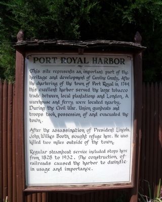
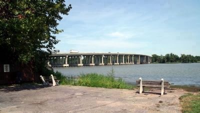
Port Royal Harbor
After the assassination of President Lincoln, John Wilkes Booth sought refuge here. He was killed two miles outside of the town.
Regular steamboat service included stops here from 1828 to 1932. The construction of railroads caused the harbor to dwindle in usage and importance.
Topics and series. This historical marker is listed in these topic lists: Industry & Commerce • War, US Civil • Waterways & Vessels. In addition, it is included in the Former U.S. Presidents: #16 Abraham Lincoln series list. A significant historical year for this entry is 1744.
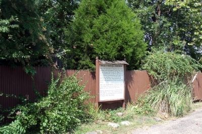
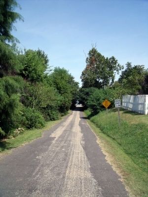
Location. 38° 10.346′ N, 77° 11.326′ W. Marker is in Port Royal, Virginia, in Caroline County. Marker is on King Street, 0.1 miles north of Water Street, on the right when traveling north. Touch for map. Marker is at or near this postal address: 813 Water Street, Port Royal VA 22535, United States of America. Touch for directions.
Other nearby markers. At least 8 other markers are within walking distance of this marker. Port Royal (a few steps from this marker); a different marker also named Port Royal (within shouting distance of this marker); St. Peter's Church (about 500 feet away, measured in a direct line); Dorothy Roy (about 600 feet away); The Earliest Inhabitants: Native Americans (about 700 feet away); The Fox Tavern: A Colonial Landmark (about 800 feet away); a different marker also named Port Royal (approx. 0.2 miles away); The Sacred Lot (approx. ¼ mile away). Touch for a list and map of all markers in Port Royal.
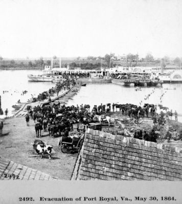
Regarding Port Royal Harbor. “The orders from army headquarters to close down the Belle Plain and Fredericksburg base areas, and to transfer all support activities to Port Royal, were issued on May 22, 1864. At that time the Army of the Potomac was situated in the vicinity of Guinea Station. Grant was simply moving his supply depot closer to the theater of operations. By May 24, all the wounded from the North Anna River were being sent to Port Royal, which, by May 26, was approaching full operational status. Ironically, on that same day, when the last Union troops were preparing to abandon Fredericksburg for Port Royal (it took several days to close down a major base area), Grant had already concluded that his North Anna thrust had been checked. Thus, on May 26, 1864, along with Grant’s decision to disengage from the North Anna River and proceed southward toward Hanovertown, came the decision to phase out Port Royal. A new depot had already been selected along the Pamunkey River at a landing known as White House.” Frassanito, William A. Grant and Lee: The Virginia Campaigns, 1864-1865, 1983, p151.
Also see . . .
1. Welcome To Historic Port Royal. Historic Port Royal, Inc. (Submitted on September 7, 2009, by Bernard Fisher of Richmond, Virginia.)
2. John Wilkes Booth: Escape of an Assassin & War on Chesapeake Bay. Maryland Civil War Trails. (Submitted on September 7, 2009, by Bernard Fisher of Richmond, Virginia.)
Credits. This page was last revised on May 12, 2019. It was originally submitted on September 7, 2009, by Bernard Fisher of Richmond, Virginia. This page has been viewed 1,890 times since then and 22 times this year. Photos: 1, 2, 3, 4, 5, 6. submitted on September 7, 2009, by Bernard Fisher of Richmond, Virginia.
