Near Kinsale in Westmoreland County, Virginia — The American South (Mid-Atlantic)
Northumberland County / Westmoreland County
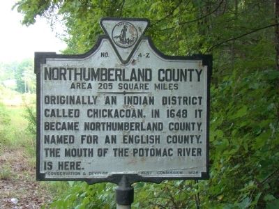
Northumberland County. Area 205 square miles. Originally an Indian district called Chicacoan. In 1648 it became Northumberland County, named for an English county. The mouth of the Potomac River is here.
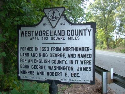
Westmoreland County. Area 252 square miles. Formed in 1653 from Northumberland and King George, and named for an English county. In it were born George Washington, James Monroe, and Robert E. Lee.
Erected 1928 by Conservation & Development Commission. (Marker Number Z-4.)
Topics and series. This historical marker is listed in this topic list: Political Subdivisions. In addition, it is included in the Former U.S. Presidents: #05 James Monroe, and the Virginia Department of Historic Resources (DHR) series lists. A significant historical year for this entry is 1648.
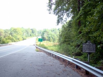
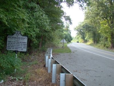
Location. 38° 0.467′ N, 76° 35.283′ W. Marker is near Kinsale, Virginia, in Westmoreland County. Marker is on Cople Highway (Virginia Route 202) just west of the Hampton Hall Bridge over Hampton Hall Branch, on the right when traveling east. Touch for map. Marker is in this post office area: Kinsale VA 22488, United States of America. Touch for directions.
Other nearby markers. At least 8 other markers are within 3 miles of this marker, measured as the crow flies. The War of 1812 / British Attacks at Kinsale and Mundy Point (approx. half a mile away); British Attacks at Kinsale and Muddy Point / The War of 1812 (approx. half a mile away); Kinsale (approx. 1.1 miles away); Relentless Raids (approx. 1.6 miles away); War in the Chesapeake (approx. 1.6 miles away); “O! say can you see…” (approx. 1.6 miles away); Historic District of Kinsale, Virginia (approx. 1.6 miles away); McCoy Revolutionary Soldiers (approx. 3.1 miles away). Touch for a list and map of all markers in Kinsale.
Regarding Northumberland County / Westmoreland County. From the Northumberland County Wikipedia entry: Of the 172 counties that have ever existed in Virginia’s history, Northumberland ended up being “ancestor” of 116 of these—more than the current number of counties (several having been lost to other states).
From the Northumberland County website: Northumberland County, Virginia, was originally known as Chickacoan, an Indian district on the Northern Neck, lying between the Rappahannock and Potomac rivers, tributaries of the Chesapeake Bay. ¶ In 1648, this “Mother County of the Northern Neck” was organized and named after County Northumberland, England. The first white settler to make a permanent home in the county was Col. John Mottrom, sometime between 1635-1640. ¶ In 1648 Northumberland County, Virginia, was officially formed by an act passed by the Burgesses in Jamestown, Virginia. It was later divided into three additional counties: Lancaster, Richmond and Westmoreland. Northumberland County has an area of approximately 222 square miles and a population of 12,400 people. ¶ For hundreds of years, Northumberland remained a county largely isolated from the rest of the state due to the lack of a road network. But in 1926, with the bridge crossing from Essex County to the Northern Neck, with access to the west, growth began in the area.
From the Westmoreland County Wikipedia entry: As originally established by the House of Burgesses from Northumberland County, Virginia in 1653, the territory of Westmoreland County encompassed much of what later become the various counties and cities of Northern Virginia, including the city of Alexandria, Arlington County, Fairfax County, and Prince William County. These remained Westmoreland until 1664, when Stafford County, Virginia was formed. ¶ Westmoreland County was the birthplace of George Washington, the first President of the United States (at the former settlement of Bridges Creek, Virginia); James Monroe, the fifth President of the United States; and General Robert E. Lee, commander of the Confederate armies. It was the residence of Col. Nicholas Spencer, who patented the land at Mount Vernon in 1674 with his friend Lt. Col. John Washington, ancestor of George Washington. Spencer, who served as President of the Council and acting Governor of Virginia, was the cousin of and agent for the Barons Colepeper, proprietors of the Northern Neck.
Credits. This page was last revised on July 14, 2021. It was originally submitted on September 15, 2009, by J. J. Prats of Powell, Ohio. This page has been viewed 1,400 times since then and 81 times this year. Photos: 1, 2, 3, 4. submitted on September 15, 2009, by J. J. Prats of Powell, Ohio.


