Holly Hill in Orangeburg County, South Carolina — The American South (South Atlantic)
Holly Hill
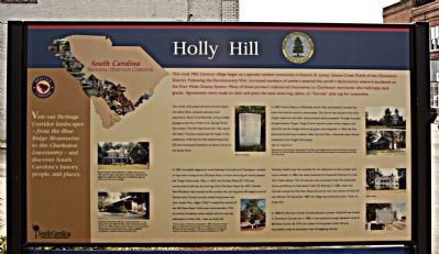
The sturdy, who preserved and survived malaria and yellow fever, amassed extensive land acquisitions. Bunch Ford Road (SC 314) [Marker picture included] provided passage across Four Holes to St. George Parish, Dorchester. The Old State Road (US 176) was an old Indian Trail that transversed the length of the settlement. It fell into the Old Gaillard Road (SC 27) that connected Charleston to Vance's Ferry on the Santee River. In 1800, Francis Asbury, a Methodist circuit rider and preacher, founded the area's first church around a stump pulpit. The church was located at the head of gate where tar and other naval products were processed. Through the years tar-gate became Target. Target Church was the center of the religious and social life and the Target Community grew and prospered. In 1855, the first school attracted many students. After the Civil War, a Reconstruction School reopened in the Target Community.
In 1823, increased stagecoach travel between Columbia and Charleston resulted in improved routing of the Old State Road. A more direct leg of road by-passed the Target Community. Also, in 1825, the Camden Road (SC 310) was constructed to fall into the new leg of the Old Stone Road. By 1827, Camden Fort Plantation was erected at this junction site, serving some 80 wagons around harvest time. Farmers quickly settled along these two new routes, Four ridges ("hills") crossed this section of the Old Stone Road. Holly trees were abundant. Mail arrived by horseback, twice weekly and the mail was addressed as Holly Hills - later Holly Hill. Visionary leaders saw the necessity for the settlement to have contact with more markets. In 1894, the state chartered the Eutawville Railroad to cross Four Holes Swamp. This 34-mile spur line connected Holly Hill, Eutawville, Vance, and Elloree to Charleston's then SC Railroad. In 1886, where the railroad crossed the Old Stone Road, the site for the rural hamlet of Holly Hill was defined. On December 1887, the village was chartered as the "Town of Holly Hill".
In 1868 the districts in South Carolina became counties. Holly Hill was named in Charleston County, but in 1880, it was replaced through legislation to be in Berkeley County. By 1910, the citizens of the greater Holly Hill area successfully voted its annexation into Orangeburg County.
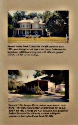
(Top left picture)
Bennett House, Frank Culbertson, a NASA astronaut since 1985, spent his high school days in this house. Colbertson has logged over 6,000 hours flying time in 40 different types of aircraft, and 350 carrier landings.
(Lower left picture)
Sweatman's Bar-be-que affords a unique experience in rustic dining. Their menu features their national famed bar-be-que. Built in 1890's, Margie and R.O. Sweatman have preserved the best feature of this old home to create a delightful atmosphere. Located on Eutaw Road (SC 453).
(Lower picture)
The rural town, Holly Hill, incorporated in 1887, was built around a grove of Holly trees, The last tree from the grove, estimated to be 98 years old, was removed in 1957, but a replacement was planted as part of the South Carolina Tricentennial Celebration in 1970. ( Includes the SC Highway Marker "Holly Hill")
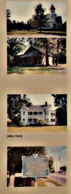
(Right pictures)
Target Church; McCoy School; Jeffers Home; SC Highway Marker "Holly Hill"
Erected by South Carolina National Heritage Corridor.
Topics and series. This historical marker is listed in these topic lists: Agriculture
• Churches & Religion • Industry & Commerce • Settlements & Settlers • Waterways & Vessels. In addition, it is included in the Francis Asbury, Traveling Methodist Preacher, and the South Carolina Heritage Corridor series lists. A significant historical month for this entry is December 1887.
Location. 33° 19.327′ N, 80° 24.749′ W. Marker is in Holly Hill, South Carolina, in Orangeburg County. Marker is at the intersection of State Street (U.S. 176) and Depot Street, on the left when traveling east on State Street. Touch for map. Marker is in this post office area: Holly Hill SC 29059, United States of America. Touch for directions.
Other nearby markers. At least 8 other markers are within 9 miles of this marker, measured as the crow flies. A different marker also named Holly Hill (about 300 feet away, measured in a direct line); Target Methodist Church (approx. 2.4 miles away); Berkeley County (approx. 4.8 miles away); Eutawville (approx. 6.7 miles away); Harleyville (approx. 7.7 miles away); Astronaut Frank L. Culbertson, Jr. (approx. 7.8 miles away); Spring Hill Methodist Church (approx. 8.1 miles away); Eutaw Springs Battlefield Park (approx. 8.8 miles away). Touch for a list and map of all markers in Holly Hill.
Regarding Holly Hill. Notable Residents:
Willie Randolph - former Major League Baseball player and manager •
Brett Gardner - New York Yankees baseball player •
Eddie Sweat - groom to U. S. Triple Crown winner Secretariat. (Wikipedia)
Additional commentary.
1. south of Holly Hill
Approximately 13 miles south of Holly Hill is the National Audubon Society's Francis Beidler Forest in Four Holes Swamp. It is known for the largest remaining stand of virgin bald cypress/tupelo gum swamp forest left anywhere in the world. .
— Submitted September 17, 2009, by Mike Stroud of Bluffton, South Carolina.
Credits. This page was last revised on December 14, 2019. It was originally submitted on September 17, 2009, by Mike Stroud of Bluffton, South Carolina. This page has been viewed 2,691 times since then and 193 times this year. Photos: 1, 2, 3. submitted on September 17, 2009, by Mike Stroud of Bluffton, South Carolina. • Craig Swain was the editor who published this page.


