Point Pleasant in Mason County, West Virginia — The American South (Appalachia)
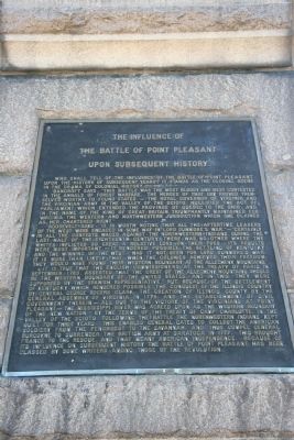
The Battle of Point Pleasant
The Chief Event of Lord Dunmore's War
— Point Pleasant Battle Monument —
Inscription.
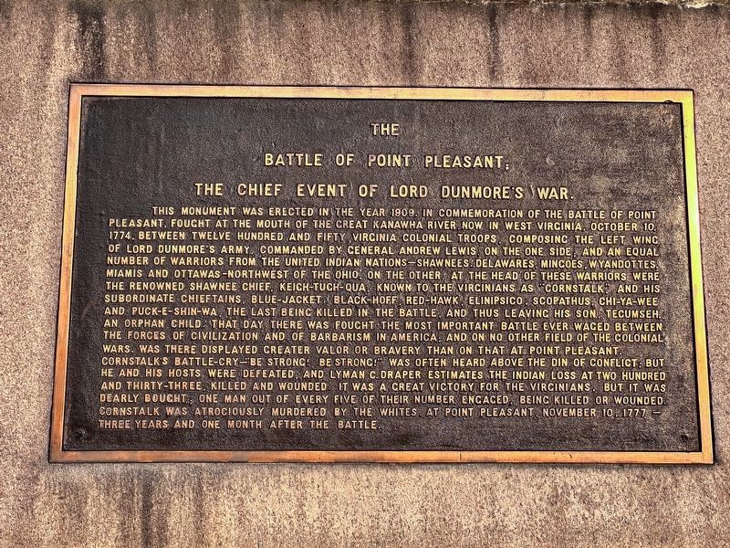
[Front Plaque, Facing East.]
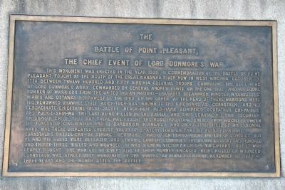
This monument was erected in the year 1909 in commemoration of the Battle of Point Pleasant, fought at the mouth of the Great Kanawha River, now in West Virginia, October 10, 1774. Between twelve hundred and fifty Virginia colonel troops, composing the left wing of Lord Dunmore's Army, commanded by General Andrew Lewis, on the one side; and an equal number of warriors from the united Indian nations - Shawnees, Delawares, Mingoes, Wyandottes, Miamis, and Ottawas - Northwest of the Ohio, on the other. At the head of these warriors were the renowned Shawnee Chief, Keich-tuch-qua, known to Virginians as "Cornstalk," and his subordinate chieftains, Blue-Jacket, Black-Hoff, Red-Hawk, Elinipsico, Scopathus, Chi-ya-wee and puck-e-shin-wa, the last being killed in the battle , and thus leaving his son, Tecumseh, an orphan child. That day there was fought the most important battle ever waged between the forces of civilization and of barbarism in America; and on no other field of the colonial wars, was there displayed greater valor or bravery than on that at Point Pleasant.
Cornstalk's battle-cry-"Be Strong! Be Strong!" was often heard above the din of conflict; but he and his hosts were defeated, and Lyman C. Draper estimates the Indian loss at two hundred and thirty three, killed and wounded. It was a great victory for the Virginians, but it was dearly bought; one man out of every five of their number engaged, being killed or wounded. Cornstalk was atrociously murdered by whites, at Point Pleasant, November 10, 1777 - three years and one month after the battle.
[Bottom Side Plaque, Facing South.]
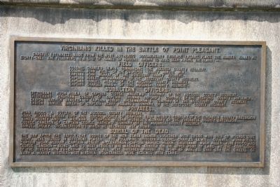
Careful estimates, made from the most authentic documentary evidence extant, place the number killed at eighty-one. The following is a list of names of persons known to have been among the slain:-
Colonel Charles Lewis, Commanding the Augusta County Regiment.
Colonel John Field, of the Culpeper County Minute Men.
Captain John Murray, of the Botetourt County Regiment.
Captain Robert McClennahan, of the Botetourt County Regiment.
Captain Samuel Wilson, of the Augusta County Regiment.
Captain Charles Ward, of the Augusta County Regiment.
Subaltern Officers.
Lieutenant Hugh Allen, of Captain George Matthews'
Company, of the Augusta County Regiment.
Lieutenant Jonathan Cundiff, of Captain Thomas Buford's Company, of the Bedford County Riflemen.
Ensign amuel Baker, of Captain Henry Pauling's Company, of the Botetourt County Regiment.
Ensign Samuel Baker, of Captain Henry Paulding's company, of the Botetourt County Regiment.
Privates.
Mark Williams, Roger Topp and Joseph Hughey, of Captain Evan Shelby's Company, of the Fincastle County Battalion.
James Mooney and - Hickman, of Captain William Russell's Company, of the Fincastle County Battalion.
George Cameron, of Captain George Mathews' Company, of the Augusta County Regiment.
Samuel Croley, organization to which he belonged not known.
the upper point of land, at the confluence of the rivers - now Tu-Endi-Wei Park. All were interred without the pomp of war, but that day the cheeks of many a hardy Virginia-West Virginia mountaineer were bedewed with tears.
[Top Side Plaque, Facing South.]
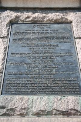
The Virginian Army
That
Fought the Battle of Point Pleasant.
Indian depredations on the Virginian frontier began early in 1774, and on the 12th of May, that year, Lord Dunmore, the Colonial Governor of Virginia, informed the House of Burgesses of the beginning of hostilities. that body, on the next day, directed him to put into force the laws against invasion and insurrection. He hastened over the Blue ridge and organized the right wing, or northern division of an army, commanded by himself, for the invasion of the Indian country northwest of the Ohio from "Rosegill," in Middlesex County, under date of July 12th. Lord Dunmore issued orders to General Andrew Lewis, to collect troops to form the left wing of the army, for the march into the Ohio wilderness. General Lewis issued a call for volunteers to assemble at Union, on the site of the present town of Lewisburg, Greenbrier County, now West Virginia.
There an organization of the troops was effected as follows:
General Andrew lewis, commanding Left Wing, or Southern Division.
The Augusta County Regiment.
Colonel Charles Lewis, Commanding (648 men.)
Captains of Companies.
Colonel William Fleming, Commanding (450 men.)
Captains of Companies.
Colonel William Christian, Commanding (350 men.)
CAPTAINS OF COMPANIES.
John Field, Commanding. (140 men.) The Dunmore County Volunteers, Captain Thomas Slaughter, Commanding. (40 men.) The Bedford County Riflemen, Captain Thomas Buford, Commanding. (44 men.) The Kentucky Pioneers, Captain James Harrod, Commanding. (27 men.)
The army left Camp Union in September, in the following order: The Augusta regiment, on the 6th; the Culpeper Minute Men, on the 7th. The Botetourt Regiment, with the companies of Russell and Shelby, of the Fincastle Battalion, and the Bedford rifles, on the 12th; Herbert's Company, of the Fincastle Battalion, on the 23rd; and the remainder of the Fincastle Battalion, on the 27th. Except Captain Bledsoe who was left in command at that place. October 10th - the Battle Day - All the troops had arrived at the mouth of the Great Kanawha, except the last part of the Fincastle Battalion, then within thirty miles of that place, and the Dunmore County Volunteers, at the mouth of Elk River - now Charleston - the capital of West Virginia.
Erected 1909.
Topics. This historical marker is listed in these topic lists: Colonial Era • Wars, US Indian. A significant historical year for this entry is 1909.
Location. 38° 50.358′
N, 82° 8.442′ W. Marker is in Point Pleasant, West Virginia, in Mason County. Marker is on Main Street, 0 miles 1st Street, on the right when traveling south. Touch for map. Marker is in this post office area: Point Pleasant WV 25550, United States of America. Touch for directions.
Other nearby markers. At least 8 other markers are within walking distance of this marker. Colonel Andrew Lewis (a few steps from this marker); Liberty Tree (within shouting distance of this marker); Livia S. Poffenbarger (within shouting distance of this marker); Point Pleasant Battle / War of 1812 (within shouting distance of this marker); The Mansion House (within shouting distance of this marker); Ann Bailey (within shouting distance of this marker); Col. Charles Lewis (within shouting distance of this marker); a different marker also named The Mansion House (within shouting distance of this marker). Touch for a list and map of all markers in Point Pleasant.
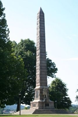
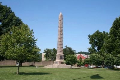
More about this marker. This historical marker is the most notable and significant of several historical markers that are situated at the Point Pleasant Battlefield State Park, in downtown Point Pleasant, West Virginia. It is a tall stone shaft that dominates the landscape. The park itself is located on the east side of the Kanawha River at the
point of its confluence with the Ohio River.
Also see . . .
1. Battle of Point Pleasant. This link is provided by Absolute Astronomy. (Submitted on July 13, 2009, by Dale K. Benington of Toledo, Ohio.)
2. The Battle of Point Pleasant – October 10, 1774. This web link is published by the West Virginia, Department of Natural Resources, for any individuals that are interested in Tu-Endie-Wei, Point Pleasant Battle Monument State Park. (Submitted on July 13, 2009, by Dale K. Benington of Toledo, Ohio.)
3. Battle of Point Pleasant. This link is published and made available by, Wikipedia, the free encyclopedia. (Submitted on July 13, 2009, by Dale K. Benington of Toledo, Ohio.)
4. Lord Dunmore's War and the Battle of Point Pleasant. This link is published and made available by, "Ohio History Central," an online encyclopedia of Ohio History. (Submitted on July 13, 2009, by Dale K. Benington of Toledo, Ohio.)
Additional commentary.
1. Smithsonian American Art Museum — Art Inventories Catalog description.
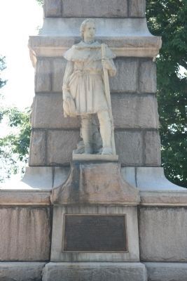
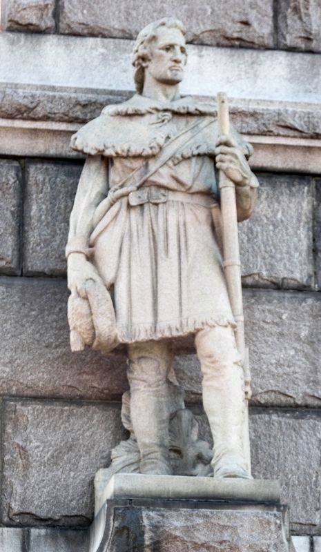
Dedicated October 10, 1909. It is an 84-foot tall granite obelisk with a statue of a colonial frontiersman located on the East side. The frontiersman
stands on a horizontal extension of the base of the obelisk, approximately six feet from the ground. He wears a knee-length hunting shirt, fringed around the edges and gathered at the waist by a wide belt with a heavy buckle. His head is turned slightly to the proper left. His brow is wrinkled and he gazes downward.
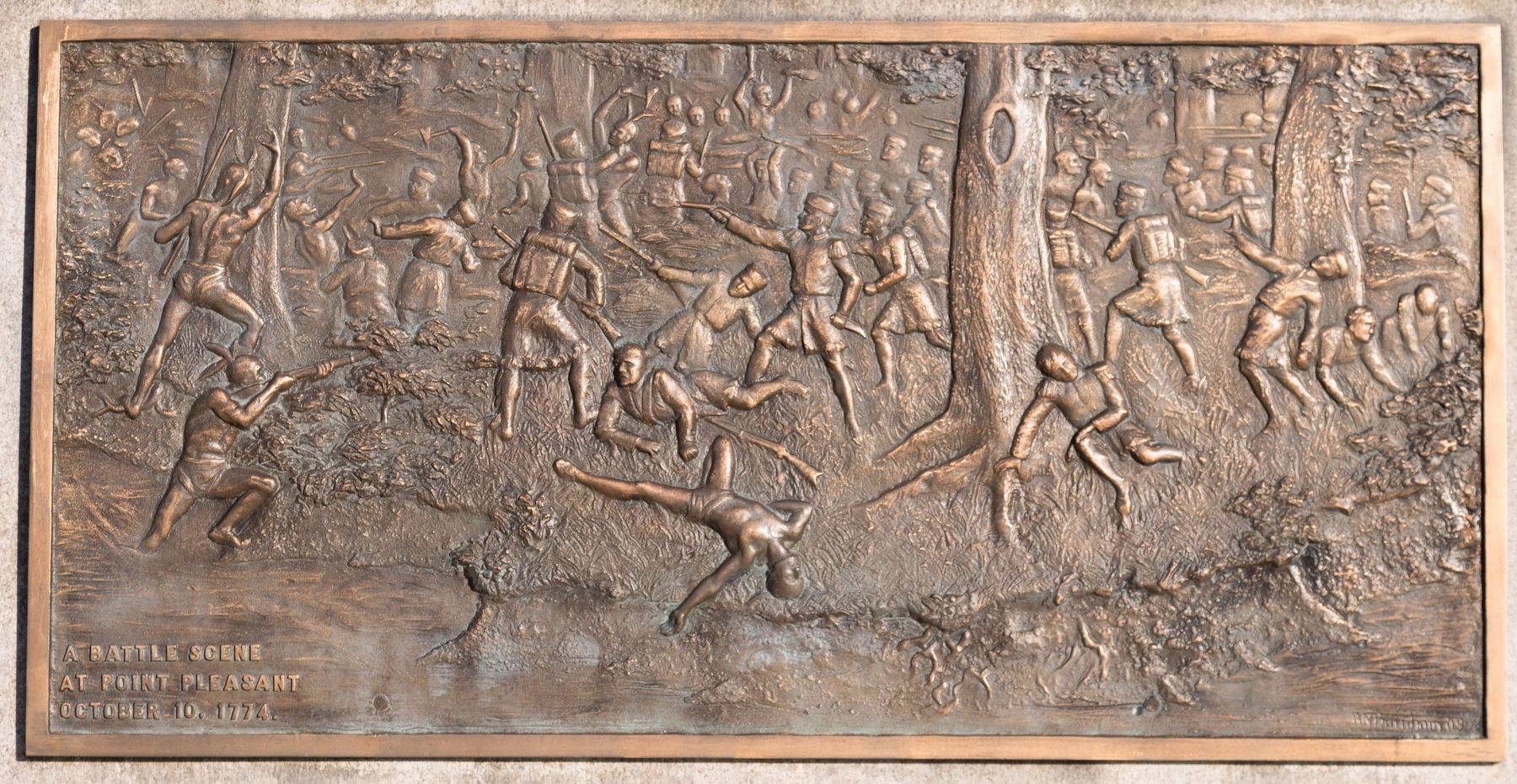
The frontiersman wears “button-up leggings” which extend from the arch of his foot to above the knee. He carries a pouch and powderhorn on his proper right side, held by a strap over his proper left shoulder. A broad-blade knife in a sheath is attached at his waist on his proper left side. He holds a raccoon cap at his proper right side. On the bottom West side of the monument is a bronze plaque depicting the Battle of Point Pleasant.
The figure is made of Westerly granite, the shaft Balfour granite, and the plaques are bronze.
The statue commemorates the Battle of Point Pleasant, which took place on Oct. 10, 1774, between 1,250 Virginia colonial troops composing the left wing of Lord Dunmore's army and an equal number of warriors from the united Indian nations — Shawnee, Delaware, Mingos, Wyandottes, Miamis, and Ottawas. The Indians were led by Shawnee Chief Keigh-tugh-qua
(Cornstalk).
The idea for the monument originated as early as 1860. In 1875, the legislature of West Virginia granted an appropriation of $3,500. In 1901, ground was purchased for the park, then named Tu-endie-wie (or “Meeting of the two rivers”). DAR chapters also contributed funding. In 1905, the West Virginia legislature appropriated an additional $5,000; and in 1908 the U.S. Congress gave $10,000. The statue was erected under the supervision of the U.S. War Department.
— Submitted October 24, 2018, by J. J. Prats of Powell, Ohio.
Credits. This page was last revised on September 5, 2023. It was originally submitted on July 13, 2009, by Dale K. Benington of Toledo, Ohio. This page has been viewed 9,311 times since then and 677 times this year. Last updated on September 19, 2009, by Dale K. Benington of Toledo, Ohio. Photos: 1, 2, 3, 4, 5. submitted on July 13, 2009, by Dale K. Benington of Toledo, Ohio. 6. submitted on July 14, 2009, by Dale K. Benington of Toledo, Ohio. 7. submitted on October 24, 2018, by J. J. Prats of Powell, Ohio. 8, 9. submitted on July 14, 2009, by Dale K. Benington of Toledo, Ohio. 10. submitted on October 24, 2018, by J. J. Prats of Powell, Ohio. 11. submitted on September 3, 2023, by J.T. Lambrou of New Boston, Michigan. • Kevin W. was the editor who published this page.
