Near Boise in Ada County, Idaho — The American West (Mountains)
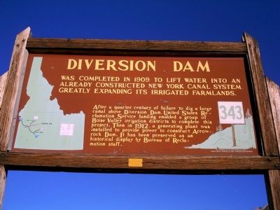
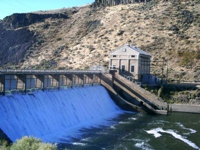
Diversion Dam
After a quarter century of failure to dig a large canal above Diversion Dam, United States Reclamation Service funding enabled a group of Boise Valley irrigation districts to complete this project. Then in 1912, a generating plant was installed to provide power to construct Arrowrock Dam. It has been preserved as an historical display by Bureau of Reclamation staff.
Erected by Idaho Historical Society. (Marker Number 343.)
Topics and series. This historical marker is listed in these topic lists: Agriculture • Natural Resources. In addition, it is included in the Idaho State Historical Society series list. A significant historical year for this entry is 1909.
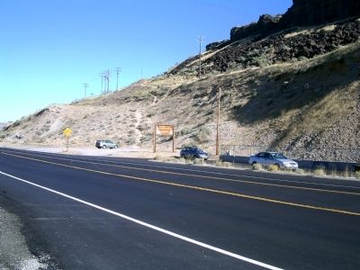
Location. 43° 32.34′ N, 116° 5.562′ W. Marker is near Boise, Idaho, in Ada County. Marker is on State Highway 21 at milepost 8,, 0.3 miles east of Warm Springs Avenue, on the right when traveling south. Touch for map. Marker is in this post office area: Boise ID 83716, United States of America. Touch for directions.
Other nearby markers. At least 8 other markers are within walking distance of this marker. A different marker also named Diversion Dam (within shouting distance of this marker); Fort Boise (approx. 0.9 miles away); Kelton Road (approx. 0.9 miles away); Idaho's Emigrant Trails (approx. 0.9 miles away); Ezra Meeker (approx. 0.9 miles away); Bonneville Point (approx. 0.9 miles away); The Oregon Trail (approx. 0.9 miles away); Beaver Dick's Ferry (approx. 0.9 miles away). Touch for a list and map of all markers in Boise.
Regarding Diversion Dam. In the late 1800's, the Idaho Territory needed to attract homesteaders to farm the Boise Valley, which was then a dry sagebrush desert. Arthur Foote, an engineer, designed a canal to turn the valley into lush green farmland.
Credits. This page was last revised on June 16, 2016. It was originally submitted on September 20, 2009, by Rebecca Maxwell of Boise, Idaho. This page has been viewed 1,994 times since then and 30 times this year. Photos: 1, 2, 3. submitted on September 20, 2009, by Rebecca Maxwell of Boise, Idaho. • Craig Swain was the editor who published this page.


