Farmington in San Juan County, New Mexico — The American Mountains (Southwest)
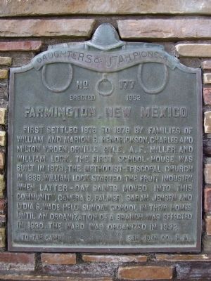
Farmington, New Mexico
Erected 1952 by Daughters of the Utah Pioneers, To-tah Camp, San Juan Co., N.M. (Marker Number 177.)
Topics and series. This historical marker is listed in this topic list: Settlements & Settlers. In addition, it is included in the Daughters of Utah Pioneers series list. A significant historical year for this entry is 1876.
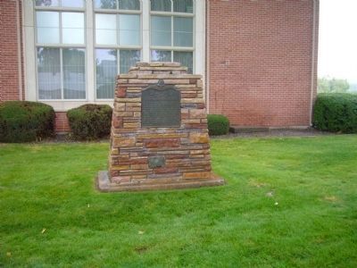
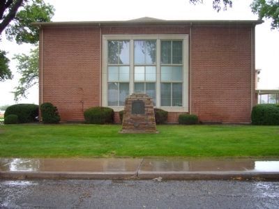
Location. 36° 44.063′ N, 108° 12.561′ W. Marker is in Farmington, New Mexico, in San Juan County. Marker is on Locke Avenue, 0 miles north of Apache Street, on the left when traveling north. In downtown Farmington, New Mexico, from Main Street turn north on Auburn Avenue. Go north four blocks to Apache Street and turn right. Go east one block and turn left onto Locke Avenue, on the east side of the LDS Church building. Marker is on the lawn near the chapel. Touch for map. Marker is at or near this postal address: 400 West Apache Street, Farmington NM 87401, United States of America. Touch for directions.
Other nearby markers. At least 8 other markers are within 13 miles of this marker, measured as the crow flies. Footloose in Farmington: (approx. 0.4 miles away); The Hunters (approx. 0.4 miles away); Harriet Belle Amsden Sammons (1876-1954) (approx. 2.3 miles away); a different marker also named Farmington (approx. 4 miles away); Settlement of Kirtland (approx. 8.2 miles away); Salmon Ruin (approx. 10.3 miles away); City of Bloomfield (approx. 11.1 miles away); Aztec Ruins National Monument (approx. 12.7 miles away). Touch for a list and map of all markers in Farmington.
More about this marker. Elevation 5,369 feet.
Regarding Farmington, New Mexico. Three rivers, the Animas, La Plata, and San Juan, flow down from the mountains of Colorado and come together at Farmington. The Native Americans called this place To-tah, which means waters flowing together. The Anasazi, Pueblo, Ute, Navajo, and Apache tribes inhabited the region from ancient times. It became part of the Jicarilla Apache reservation, but on the 4th of July, 1876, this portion of the reservation was thrown open to settlement, and a large number of whites, chiefly from Colorado, entered and staked claims. Most of the first settlers were cattlemen who brought their herds down from Colorado. In the spring of 1877 a general store was opened by A.F. Miller. George Spencer opened trade with the Indians in 1880, his establishment being a tent. Indian trading posts remain an important business in Farmington to this day.
In the early days there was frequent trouble with rustlers, with cowboys "shooting up the town", and troubles between the Indians and whites. A drunken cowboy shot an Indian on the streets of Farmington in 1883. Although the man was not killed, the Indians threatened to go on the warpath, and two days later several hundred Navajos surrounded the town. A friendly Indian came and warned the settlers, and said that if the farmers and ranchers stayed in their homes they would not be hurt, for the Indians were after the "tejanas," or cowboys. The matter was eventually solved through negotiations.
William Locke came in October, 1878, from Florence, Colorado. He brought the first fruit trees to the valley, and after a few years his orchards covered 84 acres. Others soon followed his lead, after learning that the Farmington area had an ideal climate for fruit-raising. The soil was fertile and with irrigation many crops flourished. Apples, pears, peaches, nectarines, plums, apricots, and other fruits all thrived here.
The first L.D.S. (Mormon) settlers came in 1878. The Mormons founded several small towns to the west of Farmington, between the Farmington town limits and the Navajo Reservation, including Kirtland, Fruitland, and Waterflow. Some Mormons settled in Farmington also. They were mostly farmers and businessmen, several becoming prominent in the community.
The population of Farmington was only 750 in 1907. It grew slowly but steadily until reaching 3,637 in 1950, then the oil and gas boom hit the area. The population exploded as thousands moved into Farmington, mainly from Texas, Louisiana, and Oklahoma. Within three years, the population had increased nearly ten-fold, reaching 35,000 in 1953. The orchards were all torn out and turned into housing developments. Today the population is around 50,000. About 63% of the population is white, 18% Native American, and 18% Hispanic.
Also see . . . Farmington, New Mexico. Wikipedia article (Submitted on September 28, 2009.)
Credits. This page was last revised on June 16, 2016. It was originally submitted on September 28, 2009. This page has been viewed 2,456 times since then and 87 times this year. Last updated on September 28, 2009. Photos: 1. submitted on September 28, 2009. 2, 3. submitted on October 3, 2010, by Bill Kirchner of Tucson, Arizona. • Syd Whittle was the editor who published this page.


