Würzburg, Bavaria, Germany — Central Europe
The Lower Main Mill
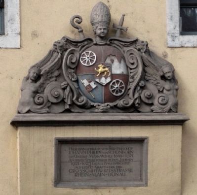
Translated, the marker reads:
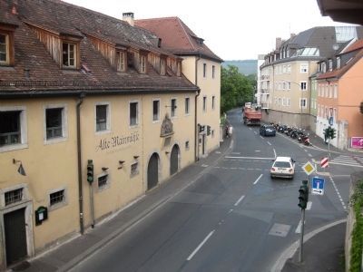
From 1644-1921 here stood the Lower Main Mill, built by Prince-bishop Johann Philipp von Schoenborn. In its place this building was built in the years 1921-1923 as the first power plant of the Greater Rhine-Main-Danube Navigational Route.
Topics. This historical marker is listed in these topic lists: Industry & Commerce • Notable Buildings.
Location. 49° 47.598′ N, 9° 55.627′ E. Marker is in Würzburg, Bayern (Bavaria). Marker is at the intersection of Mainkai and Karmelitenstrasse, on the left when traveling north on Mainkai. Touch for map. Marker is at or near this postal address: Mainkai 1, Würzburg BY 97070, Germany. Touch for directions.
Other nearby markers. At least 8 other markers are within walking distance of this marker. Gasthof zum Hirschen / The Inn of the Stag (about 120 meters away, measured in a direct line); Hof Castell (about 150 meters away); Hof "Zum Stachel" / The Mace Inn (about 180 meters away); Emy Roeder (about 180 meters away); Geschichte des Anwesens / History of this property (about 210 meters away); Norbert Glanzberg (about 240 meters away); Old Cranes (approx. 0.3 kilometers away); Der Kreuzgang des Neumuensterstiftes / The Cloister of the Neumuenster Seminary (approx. 0.3 kilometers away). Touch for a list and map of all markers in Würzburg.
Also see . . .
1. Alte Mainmuehle. The restaurant's website. Click on the English flag for English. then click on the "Alte Mainmuehle" choice on the left. Then for the history, click on "History" on the right. (Submitted on September 29, 2009.)
2. Pegel Würzburg. Wikipedia.org's extensive (German language) article on the point of measurement of the Main River's flow in Wuerzburg. The section on both the mill and the power plant under the heading "Mühlen", about 3/4 down the page. Includes pictures. (Submitted on September 29, 2009.)
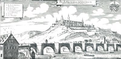
Photographed By Matthäus Merian, 1648
4. The Mill, the Old Main Bridge, and the Marienberg Fortress
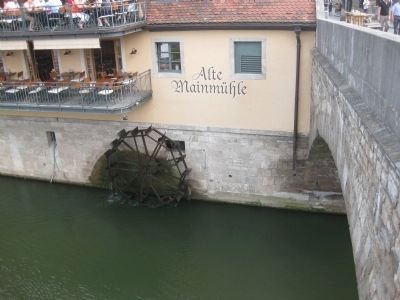
The mill, according to the Alte Mainmuehle Restaurant's website, "...was built as a grain mill by the prince bishops in 1643 in order to provide the city with flour in case of a siege. In later years a hammer-mill was added which was also water-powered. The water thrown up by the mill-wheel was welcome for several reasons. Fish were thrown up by the turbulence and the fisherman could always be assured of landing good catch by standing under the Alte Mainmühle."
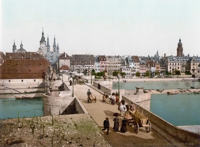
Detroit Photographic Company, Photochrom provided courtesy of the US Library of Congress, 1890/1900
5. The Old Main Bridge with Lower Main Mill Building Adjacent to Bridge on Left
The Alte Mainmuehle Restaurant's website, continued, "...But for practical purposes the first 'fitness centre' was invented here. The citizens of Wuerzburg used the waves generated by the mill-wheel as a swiming pool with artificial waves. Swimming against the waves was considered to be particularly healthy."
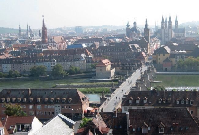
Photographed By Andrew Ruppenstein, August 27, 2009
6. View from Marienberg Fortress Showing Old Main Bridge and Lower Main Mill Building (Left of Bridge)
The power station (mentioned on the marker), was the first of 54 power stations constructed by the Rhein-Main-Donau AG power company. The plant was originally outfitted with two Francis turbines to supply power to the city. The plant was updated in 1950-52, and then modernized and automated in 1987-88, with the installation of three Kaplan turbines.
Credits. This page was last revised on January 2, 2024. It was originally submitted on September 28, 2009, by Andrew Ruppenstein of Lamorinda, California. This page has been viewed 1,422 times since then and 6 times this year. Photos: 1, 2, 3. submitted on September 28, 2009, by Andrew Ruppenstein of Lamorinda, California. 4, 5, 6. submitted on September 29, 2009, by Andrew Ruppenstein of Lamorinda, California. • Syd Whittle was the editor who published this page.
