Montgomery in Orange County, New York — The American Northeast (Mid-Atlantic)
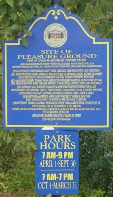
Site of Pleasure Ground
Part of Original Archibald Kennedy Patent
1850-1878-Site of first Orange County Fairs, circuses, used for sports, and field trips.
1861-Part of entire farm land of Alanson-Elizabeth Hawkins Sears, notable families. Later inherited by daughter Hannah & George Senior-prominent merchant.
1879-1920 Montgomery Driving Park Association frequent harness racing competitions upon one half mile track named “Pleasure Grounds” S. Walsh, notable trainer, driver, area wide winner.
1900-"Community C1ub" Montgomery Academy Alumni spurred interest thereon for village improvements for scouting events, recreational, educational, local & county wide use.
1900-Charles Tice-cattle dealer, butcher, (livestock yard) lower 9 Acres.
1918-Dayton MacMurtrie’s-Large dairy produced “Grade A Milk” for daily home delivery, on entire farm for half a century.
1980-Attorney Thomas Hadaway purchased upper track anticipating future need of public works, police department & relaxation.
1998-Residents approved purchase (from developer) of acreage along Wallkill River for relaxation & recreation.
1998-Historic marker dedicated at Bachelor Street.
2004-Dedication Program.
Erected 2004 by Village of Montgomery.
Topics. This historical marker is listed in these topic lists: Agriculture • Charity & Public Work • Entertainment. A significant historical year for this entry is 1810.
Location. 41° 31.274′ N, 74° 14.541′ W. Marker is in Montgomery, New York, in Orange County. Marker is at the intersection of Union St (New York State Route 211) and Pleasure Ground St, on the right when traveling south on Union St. Touch for map. Marker is at or near this postal address: 136 Union St,, Montgomery NY 12549, United States of America. Touch for directions.
Other nearby markers. At least 8 other markers are within 4 miles of this marker, measured as the crow flies. Ward’s Bridge (approx. 0.6 miles away); Montgomery House (approx. 0.8 miles away); German Town (approx. 0.9 miles away); “Colored Cemetery" (approx. 1.3 miles away); Mastadon Dig 1800 (approx. 1.6 miles away); Smith Homestead (approx. 2.2 miles away); Town of Montgomery Civil War Monument (approx. 3.8 miles away); Walden House (approx. 3.9 miles away). Touch for a list and map of all markers in Montgomery.
Credits. This page was last revised on November 28, 2019. It was originally submitted on October 9, 2009, by Clifton Patrick of Chester, NY, United States. This page has been viewed 1,418 times since then and 18 times this year. Photo 1. submitted on October 9, 2009, by Clifton Patrick of Chester, NY, United States. • Bill Pfingsten was the editor who published this page.
