Frederick in Frederick County, Maryland — The American Northeast (Mid-Atlantic)
Jug Bridge Monument
Inscription.
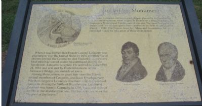
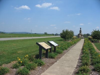
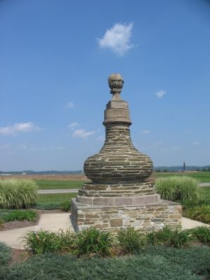
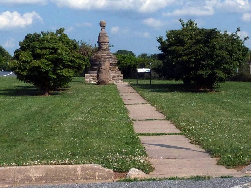
The stone demijohn and memorial plaque, placed by the Sons of the American Revolution, were originally located on a bridge crossing the Monocacy River about 2 miles east of this site. The stone bridge of four arches and two 65-foot spans was constructed in 1808. It collapsed on March 3, 1942. The Francis Scott Key Memorial Foundation, Inc., provided funds for relocation of these monuments.
When it was learned that French General Lafayette was planning to visit the United States in 1824, a committee of citizens invited the General to visit Frederick, since many local men had served under his command during the Revolution. Lafayette accepted. He arrived on December 24, 1824, and was met by Fredericktonians on the Monocacy Bridge just outside of town.
Among those present to greet him were the Mayor, several members of Congress, and local Revolutionary War hero Sergeant Lawrence Everhart, who had rescued Lafayette during the Battle of Brandywine. Lawrence Everhart was born in Germany in 1755, but lived most of his life in the Middletown area. He was referred to as the “bravest of the brave.”
Erected 1998.
Topics and series. This historical marker and monument is listed in these topic lists: Bridges & Viaducts • War, US Revolutionary . In addition, it is included in the Lafayette’s Farewell Tour, and the The Historic National Road series lists. A significant historical month for this entry is March 1816.
Location. Marker has been reported missing. It was located near 39° 24.306′ N, 77° 23.022′ W. Marker was in Frederick, Maryland, in Frederick County. Marker was at the intersection of Bowman’s Farm Road and Patrick Street, on the right when traveling east on Bowman’s Farm Road. Just west of the overpass of I-70 / U.S. 40. In a pull off area between the interstate, Bowman Road, and Patrick Street. Touch for map. Marker was in this post office area: Frederick MD 21705, United States of America. Touch for directions.
Other nearby markers. At least 8 other markers are within 2 miles of this location, measured as the crow flies. Jug Bridge (here, next to this marker); General LaFayette (within shouting distance of this marker); The Frederick Brick Works (approx. 1.2 miles away); The Lower Depot Neighborhood / The Frederick Brick Works (approx. 1.2 miles away); The Frederick County History Bell (approx. 1.3 miles away); Gen. Bradley T. Johnson (approx. 1.3 miles away); The Everedy Company (approx. 1.3 miles away); Tanneries (approx. 1.4 miles away). Touch for a list and map of all markers in Frederick.
Regarding Jug Bridge Monument.
Much of the marker has weathered badly. A drawing of a “Medallion designed by James Pearl, 1964” honoring the Jug Bridge is on the left side. Portraits of General Lafayette and Sergeant Lawrence Everhart are on the right.
Also see . . .
1. Jug Bridge Monument. Note the inscriptions on the monument. (Submitted on September 5, 2007, by Craig Swain of Leesburg, Virginia.)
2. Biography of Lafayette. Includes details of his four trips across the Atlantic to America. (Submitted on September 5, 2007, by Craig Swain of Leesburg, Virginia.)
3. Lawrence Everhart. Wikipedia entry:
This source does not mention any interaction between Lafayette and Everhart at Brandywine, stating the two became acquainted at Yorktown. (Submitted on September 5, 2007, by Craig Swain of Leesburg, Virginia.)
Credits. This page was last revised on April 25, 2022. It was originally submitted on September 5, 2007, by Craig Swain of Leesburg, Virginia. This page has been viewed 3,025 times since then and 34 times this year. Last updated on July 19, 2019, by Allen C. Browne of Silver Spring, Maryland. Photos: 1, 2, 3. submitted on September 5, 2007, by Craig Swain of Leesburg, Virginia. 4. submitted on July 19, 2019, by Allen C. Browne of Silver Spring, Maryland. • Bill Pfingsten was the editor who published this page.


