Vincennes in Knox County, Indiana — The American Midwest (Great Lakes)
Vincennes University
Marker Plaque
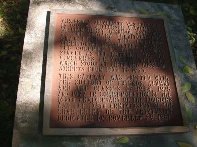
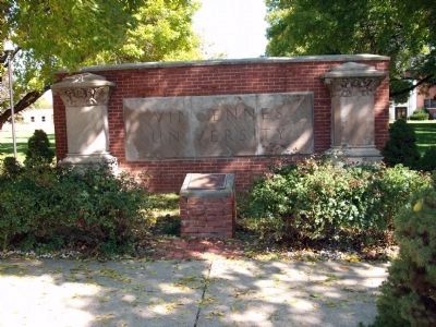
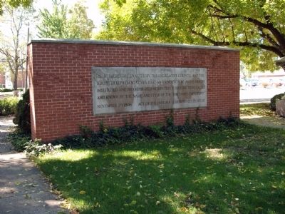
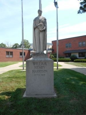
Vincennes University was founded in 1801 as Jefferson Academy by William Henry Harrison, Governor of the Indiana Territory and Chartered by the Indiana Territorial Legislature in 1806. The columns of this gateway served as the Entrance for the Vincennes University building which stood at Fifth and Busseron streets from 1879 to 1953.
This Gateway was erected with the support of Friends, Alumni, and the Classes of 1954, 1975, and 1977 in commemoration of the 180th Anniversary of the Founding and the 175th Anniversary of the Chartering of the University. Dedicated on November 29, 1981.
Second Plaque
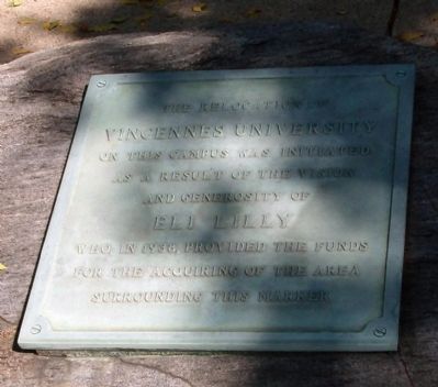
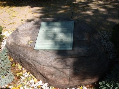
The Relocation of Vincennes University on this Campus was initiated as a result of the vision and generosity of ELI LILLY who in 1938 provided the funds for the acquiring of the area surrounding this marker.
Topics and series. This historical marker is listed in these topic lists: Education • Settlements & Settlers. In addition, it is included in the Former U.S. Presidents: #09 William Henry Harrison series list. A significant historical month for this entry is November 1804.
Location. 38° 41.157′ N, 87° 31.491′ W. Marker is in Vincennes, Indiana, in Knox County. Marker is at the intersection of Harrison Street and Park Street, on the right when traveling north on Harrison Street. located on Harrison Street past North 1st Street near "Indiana Territory Historic Site.". Touch for map. Marker is in this post office area: Vincennes IN 47591, United States of America. Touch for directions.
Other nearby markers. At least 8 other markers are within walking distance of this marker. Samuel Thornton Scott (1777 - 1827 ) (within shouting distance of this marker); William Henry Harrison & Lewis & Clark Expedition (within shouting distance of this marker); Sarah Knox Taylor (about 300 feet away, measured in a direct line); Millstones from Emison Mills (about 300 feet away); Revolutionary War Patriots (about 300 feet away); Indiana Territory (about 300 feet away); "Grouseland" (about 400 feet away); Tecumseh and Harrison (about 500 feet away). Touch for a list and map of all markers in Vincennes.
Photographed By Al Wolf, October 10, 2009
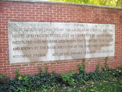
6. Inscription on Stone Work
It Reads: "" "Be it therefore enacted by the legislative Council and the House of Representatives, That an University be and is hereby instituted and Incorporated within this Territory. To be called and known by the name and style of the Vincennes University." November 29, 1806 Act of the Indiana Territory Legislature. ""
Credits. This page was last revised on June 16, 2016. It was originally submitted on October 14, 2009, by Al Wolf of Veedersburg, Indiana. This page has been viewed 960 times since then and 21 times this year. Photos: 1, 2, 3, 4, 5, 6. submitted on October 14, 2009, by Al Wolf of Veedersburg, Indiana. 7. submitted on April 25, 2015, by Pat Filippone of Stockton, California. • Bill Pfingsten was the editor who published this page.
