Jefferson Manor near Alexandria in Fairfax County, Virginia — The American South (Mid-Atlantic)
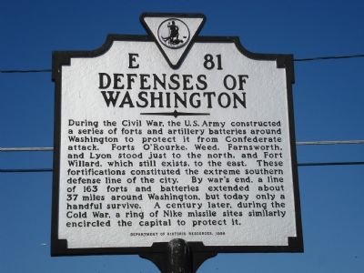
Defenses of Washington
Erected 1999 by Department of Historic Resources. (Marker Number E-81.)
Topics and series. This historical marker is listed in these topic lists: Forts and Castles • War, Cold • War, US Civil. In addition, it is included in the Defenses of Washington, and the Virginia Department of Historic Resources (DHR) series lists.
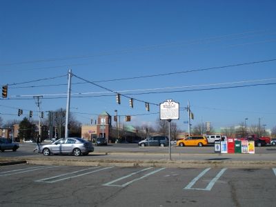
Location. 38° 46.879′ N, 77° 4.69′ W. Marker is near Alexandria, Virginia, in Fairfax County. It is in Jefferson Manor. Marker is at the intersection of Richmond Highway (Virginia Route 1) and Kings Highway (Virginia Route 633), on the right when traveling north on Richmond Highway . Marker is on the right side of a frontage road paralleling Route 1 when heading north. Touch for map. Marker is in this post office area: Alexandria VA 22306, United States of America. Touch for directions.
Other nearby markers. At least 8 other markers are within walking distance of this marker. Parapet and Gun Platforms (approx. 0.6 miles away); Mount Eagle Mansion (approx. 0.6 miles away); Fort Willard (approx. 0.7 miles away); a different marker also named Fort Willard (approx. 0.7 miles away); a different marker also named Defenses of Washington (approx. 0.7 miles away); Belle Haven Park (approx. ¾ mile away); Fort Lyon (approx. 0.8 miles away); Beacon Field Airport (approx. 0.8 miles away). Touch for a list and map of all markers in Alexandria.
More about this marker. This marker replaces a marker with the same name and title which was erected nearby in the late 1920s or early 1930s. Its inscription read, “Just to the north lie Forts O’Rorke, Weed, Farnsworth, and Lyon. To the east is Fort Willard. These fortifications constituted the extreme southern defense line of the city of Washington.”
Also see . . .
1. The Civil War Defenses of Washington, D.C. (Submitted on September 6, 2007, by Roger Dean Meyer of Yankton, South Dakota.)
2. Defenses Around Washington. (Submitted on September 6, 2007, by Roger Dean Meyer of Yankton, South Dakota.)
Credits. This page was last revised on January 27, 2023. It was originally submitted on September 6, 2007, by Roger Dean Meyer of Yankton, South Dakota. This page has been viewed 3,194 times since then and 44 times this year. Photos: 1, 2. submitted on September 6, 2007, by Roger Dean Meyer of Yankton, South Dakota. • J. J. Prats was the editor who published this page.

