Near Portage in Columbia County, Wisconsin — The American Midwest (Great Lakes)
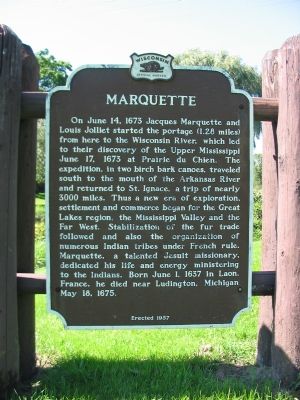
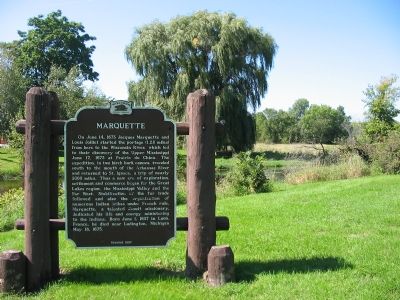
Marquette
Erected 1957 by the Wisconsin Historical Society. (Marker Number 63.)
Topics and series. This historical marker is listed in these topic lists: Churches & Religion • Colonial Era • Exploration • Native Americans • Waterways & Vessels. In addition, it is included in the Wisconsin Historical Society series list. A significant historical date for this entry is May 18, 1853.
Location. 43° 33.294′ N, 89° 26.073′ W. Marker is near Portage, Wisconsin, in Columbia County. Marker is on State Highway 33, 0.2 miles west of County Road F, on the left when traveling east. Marker is at a wayside next to the Fox River. Touch for map. Marker is in this post office area: Portage WI 53901, United States of America. Touch for directions.
Other nearby markers. At least 8 other markers are within 2 miles of this marker, measured as the crow flies. Fort Winnebago (a few steps from this marker); Site of Fort Winnebago (within shouting distance of this marker); Fort Winnebago Surgeons' Quarters (about 500 feet away, measured in a direct line); The Indian Agency House at Fort Winnebago (approx. 0.3 miles away); The Indian Agency House (approx. 0.3 miles away); Revolutionary War Veteran (approx. 0.4 miles away); Ketchum’s Point (approx. one mile away); Jacques Marquette and Louis Joliet (approx. 1½ miles away). Touch for a list and map of all markers in Portage.
Also see . . . Jacques Marquette. “Contact with the Native Americans of Illinois led Marquette to plan a mission among them, and he became interested in the reports of a great south-running river.” (Submitted on September 7, 2007, by Keith L of Wisconsin Rapids, Wisconsin.)
Credits. This page was last revised on December 28, 2019. It was originally submitted on September 6, 2007, by Keith L of Wisconsin Rapids, Wisconsin. This page has been viewed 2,229 times since then and 29 times this year. Photos: 1. submitted on September 6, 2007, by Keith L of Wisconsin Rapids, Wisconsin. 2. submitted on September 7, 2007, by Keith L of Wisconsin Rapids, Wisconsin. • J. J. Prats was the editor who published this page.

