Manassas, Virginia — The American South (Mid-Atlantic)
Mayfield Civil War Fort
A Civil War Redoubt
— The Manassas Museum System —
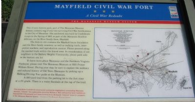
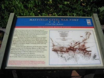
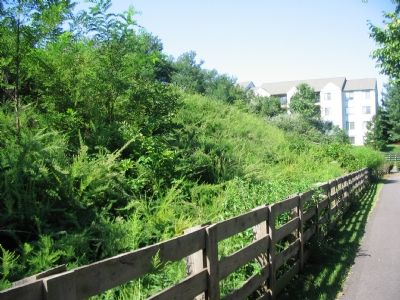
This 11-acre historic park, part of the Manassas Museum System, contains one of only two surviving Civil War fortifications in the City of Manassas. The earthwork was built by Confederate troops in the Spring of 1861 as part of the Manassas Junction defenses, on the Hooe family farm, Mayfield.
The historic site contains the Mayfield house foundation and the Hooe family cemetery, as well as walking trails, interpretive markers, and reproduction cannon. Please proceed along the marked trails within the fenced area. In consideration of our neighbors in the Battery Heights Community, please park only in the historic site lot.
To learn more about Manassas and the Northern Virginia Piedmont, please visit The Manassas Museum at 9101 Prince William Street. During your stay, be sure to explore the military and cultural history of Old Town Manassas by picking up a Walking/Driving Tour guide at the Museum.
A 300-yard trail from the parking lot to the fort rises at a 3% grade. There is a water fountain at the top of the trail.
Erected by Virginia Civil War Trails.
Topics and series. This historical marker is listed in these topic lists: Forts and Castles • War, US Civil. In addition, it is included in the Battlefield Trails - Civil War, and the Virginia Civil War Trails series lists. A significant historical year for this entry is 1861.
Location. This marker has been replaced by another marker nearby. It was located near 38° 45.292′ N, 77° 27.187′ W. Marker was in Manassas, Virginia. Marker could be reached from the intersection of Battery Heights Boulevard and Quarry Road, on the left when traveling south. At the east end of the parking lot for the Mayfield Fort Park. From Liberia Avenue (Route 776), turn west on Quarry Road, then make another left on Battery Heights Blvd. The parking lot is on the left. Touch for map. Marker was in this post office area: Manassas VA 20110, United States of America. Touch for directions.
Other nearby markers. At least 8 other markers are within walking distance of this location. Mayfield Fort (a few steps from this marker); Building Mayfield Fort (about 300 feet away, measured in a direct line); Building the Fort System (about 400 feet away); Why the Forts? (about 400 feet away); Role of Mayfield in Battle of First Manassas (about 400 feet away); Camps of Instruction (about 400 feet away); Battle of Bull Run Bridge (about 400 feet away); a different marker also named Battle of Bull Run Bridge (about 400 feet away). Touch for a list and map of all markers in Manassas.
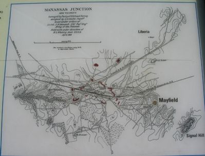
More about this marker. A map of fortifications around Manassas carries the caption: This map shows Confederate-constructed earthworks (highlighted) surrounding Manassas Junction. “Liberia” was a plantation owned by William J. Weir and used by both Confederate General P.G.T. Beauregard and Union General Irvin McDowell. “Liberia” house is a property of the Manassas Museum System.
Regarding Mayfield Civil War Fort. Additional interpretive markers in the park detail the fort, farm houses, and cemetery mentioned on this marker. To best appreciate the fortifications and the locations of the markers, use the “satellite” or “hybrid” viewing options in the HMDB Map. You may follow the trail on the related markers list.
Related marker. Click here for another marker that is related to this marker. This marker has been replaced with the linked marker.
Also see . . . Fortifications at Manassas Junction. Detailed discussion of the fortifications built around Manassas, based on analysis of maps and photographs. (Submitted on September 13, 2007, by Craig Swain of Leesburg, Virginia.)
Credits. This page was last revised on January 8, 2023. It was originally submitted on September 8, 2007, by Craig Swain of Leesburg, Virginia. This page has been viewed 2,943 times since then and 22 times this year. Photos: 1, 2. submitted on September 8, 2007, by Craig Swain of Leesburg, Virginia. 3. submitted on October 29, 2009, by Craig Swain of Leesburg, Virginia. 4, 5. submitted on September 8, 2007, by Craig Swain of Leesburg, Virginia. • J. J. Prats was the editor who published this page.


